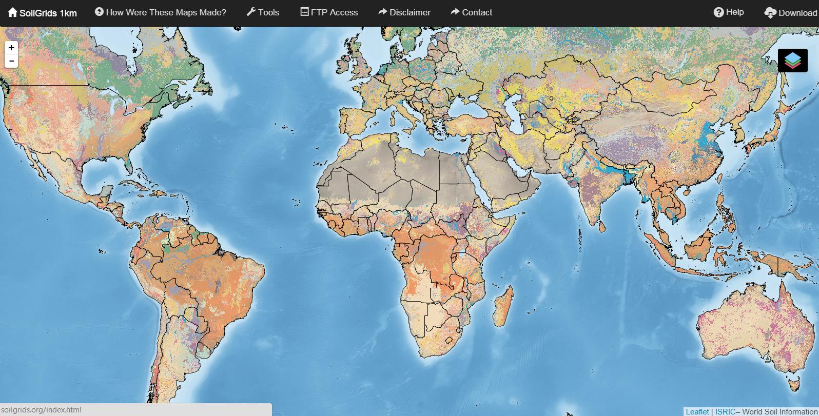
ISRIC SoilGrids1km visualisation and distribution website
▻http://soilgrids.org
I would like to introduce you the newly global coverage of soils grid at 1km ground resolution (online since August 29th 2014). See a list with all attributes at six standard depths of the dataset: soil organic carbon, soil pH, textur (sand, silt, clay in %), bulk density, cation-exchange capacity, coarse fragments, soil organic carbon stock, depth to bedrock, soil typ by WRB and USDA, Soil Taxanomy.
 http://www.digital-geography.com/wp-content/uploads/2014/10/Interface.jpg
  http://www.digital-geography.com/wp-content/uploads/2014/10/3.png
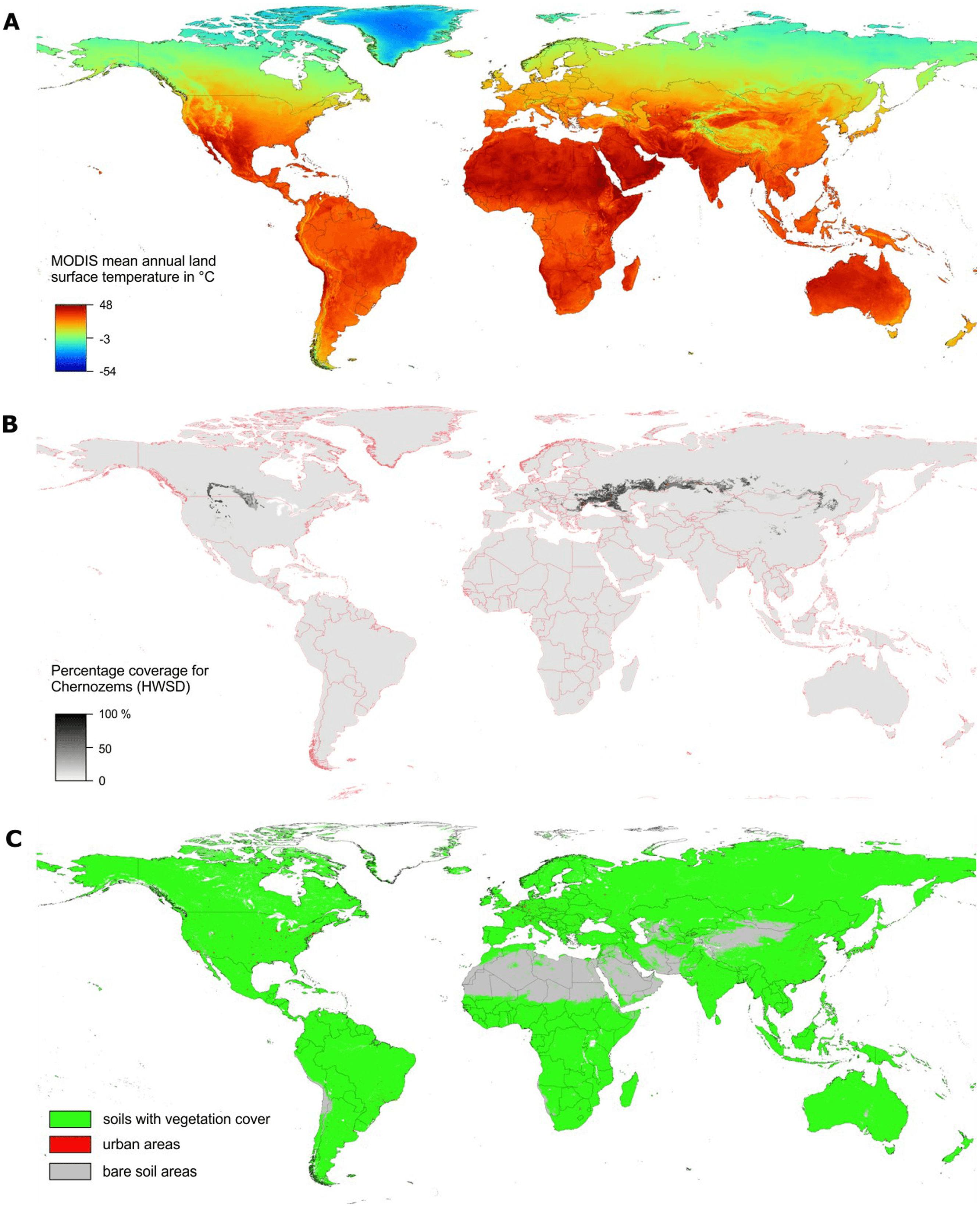
 via ▻http://www.digital-geography.com/free-global-soil-grids-1km-resolution