


From Cloud to GIS : Getting Weather Data.
In this post we are going to look at how to get weather forecast data and display it as a layer in a desktop geographical information system (GIS).
▻http://www.digital-geography.com/cloud-gis-getting-weather-data
Découverte de ce #plugin pour #qgis dans les commentaires de l’article :
▻http://www.lutraconsulting.co.uk/products/crayfish
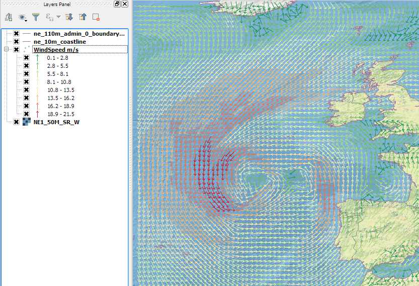
The Crayfish plugin aspires to be a time explorer for structured and unstructured mesh and vector datasets within QGIS. With Crayfish, users can load time varying mesh into QGIS. It currently supports several meteorology, hydrology and oceanography file formats.
ps : j’avais oublié le lien vers le premier article :p
Currently, Crayfish supports a number of file formats: NetCDF, GRIB, XMDF, Selafin files, SMS DAT and SWW. Examples of the software packages are: TUFLOW, AnuGA, BASEMENT, Flood Modeller 2D, HECRAS 2D, TELEMAC and Hydro_AS 2D.
Crayfish also allows user to view NetCDF and GRIB files directly in QGIS. In the example below, global temprature dataset (GRIB fromat) can be seen in QGIS.
