


“Vintage Maps Trace the Meandering Mississippi”
▻http://www.visualnews.com/2011/09/24/vintage-maps-trace-the-meandering-mississippi
 http://24.media.tumblr.com/6d0d68f234ae57c1693b87ae4ae362bb/tumblr_n54mw17NFF1qz6f9yo1_1280.jpg
  http://37.media.tumblr.com/fb392b8ed2edabbd2cca3eee67e800f6/tumblr_n54mw17NFF1qz6f9yo4_1280.jpg
  http://24.media.tumblr.com/2697c675afa0d17b6ec6edf5c57cace4/tumblr_n54mw17NFF1qz6f9yo3_1280.jpg
 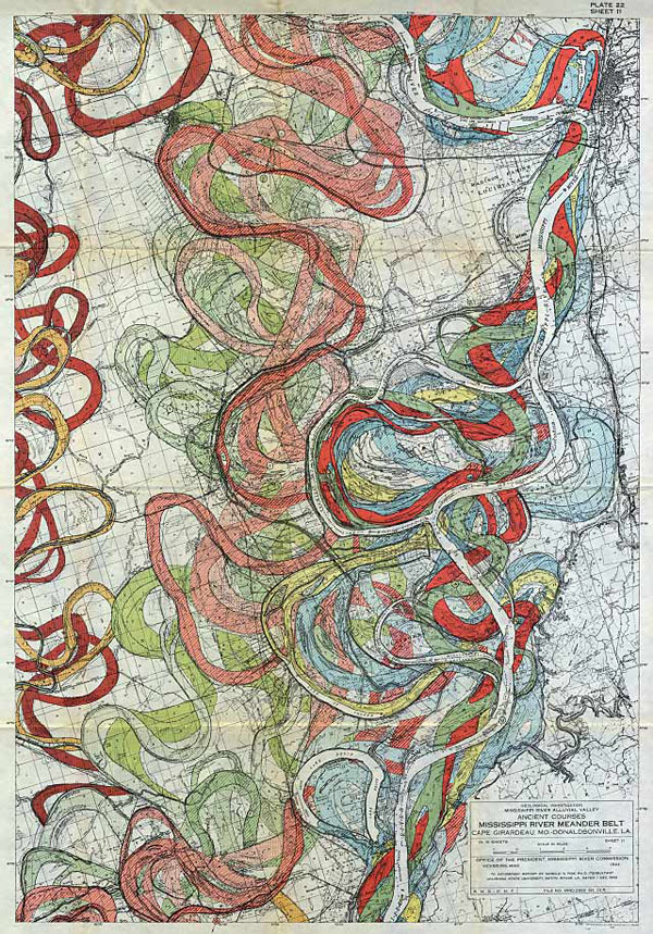 http://37.media.tumblr.com/e852da157ef810a5c830da8a1291e45e/tumblr_n54mw17NFF1qz6f9yo2_1280.jpg
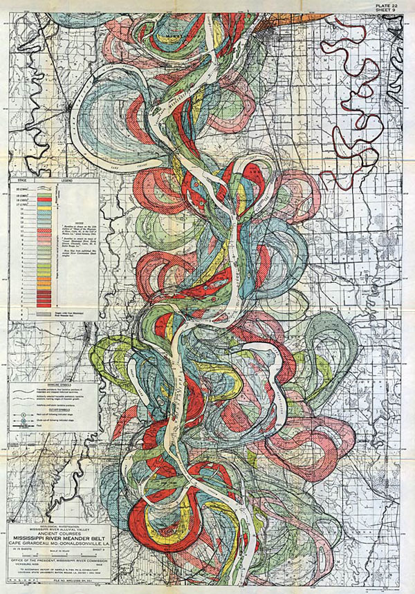
 For anyone obsessed with beautiful maps, these colorful and informative examples tracking the many paths of the lower Mississippi are a dream come true. The monumental collection was produced in 1944 by Harold N. Fisk, who drew in a rainbow of colors the path of past and current flows as the mighty river changed course and flooded over time.

