Cartographie d’Internet : La tuyauterie du net éclairée » OWNI, News, Augmented
Puisue nous venons de publier une carte d’Internet, j’ai fait quelque recherche sur le mot clé et retrouvé ce vieux post de 2011 d’OWNI (ça ne nous rajeunit pas... OWNI était une super idée)
▻http://owni.fr/2011/10/15/telegeography-entrailles-du-net-reseau-data/index.html
▻https://www.telegeography.com/telecom-resources/map-gallery/global-internet-map-2012/index.html
▻https://www.telegeography.com/telecom-resources/map-gallery/global-internet-map-2011/index.html
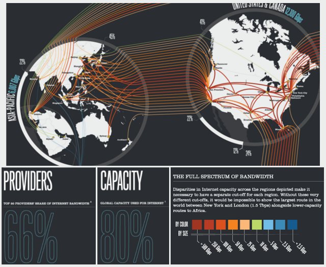
La société Telegeography récolte et analyse les données du marché des télécommunications pour donner une matérialité au réseau des réseaux. Expérience inédite. Esthétique et opérationnelle surtout. Bien dans son époque.
Visualiser le réseau, rendre matériel le prétendu virtuel. Bref, mettre les mains dans le cambouis d’Internet. C’est le fond de commerce de la firme Telegeography.
–—
Avec aussi ceci en cadeau bonus
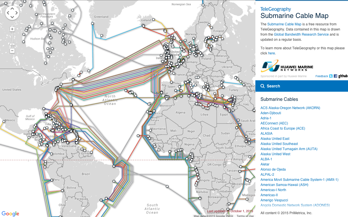
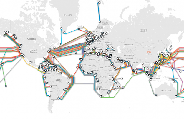
Submarine Cable Map
▻https://www.telegeography.com/index.html
►http://www.submarinecablemap.com
TeleGeography’s free interactive Submarine Cable Map is based on our authoritative Global Bandwidth research, and depicts active and planned submarine cable systems and their landing stations. Selecting a cable on the map projection or from the submarine cable list provides access to the cable’s profile, including the cable’s name, ready-for-service (RFS) date, length, owners, website, and landing points.
We added additional functionality to the map in September 2013, making it more comprehensive than ever. You can now:
View a list of all cables connected to a specific country—enter “Connected to” and the country name in the search box (for example, “Connected to Australia”).
View a list of all cables connected to a specific landing point—select the landing point on the map, or navigate to a cable’s profile and select one of its hyperlinked landing points.
View a list of all cables that came online in a specific year—enter “Ready for service in” and the year in the search box (for example, “Ready for service in 1999”), or navigate to a cable’s profile and select its hyperlinked RFS date.
Share data from the map. To share the URL of a cable’s profile, navigate to it and copy the URL from your browser. The URLs of country, landing point, and RFS searches are also shareable.
#internet #cartographie #réseaux #cables #helsinki