• Architekt Philipp Oswalt über Berlins Stadtschloss und rechte Spender : „Die Humboldt-Stiftung lügt“
    https://www.berliner-zeitung.de/kultur-vergnuegen/architekt-philipp-oswalt-berlin-stadtschloss-rechte-spender-humbold


    Der Architekt und Architekturprofessor Philipp Oswalt Foto Nadja Wohlleben

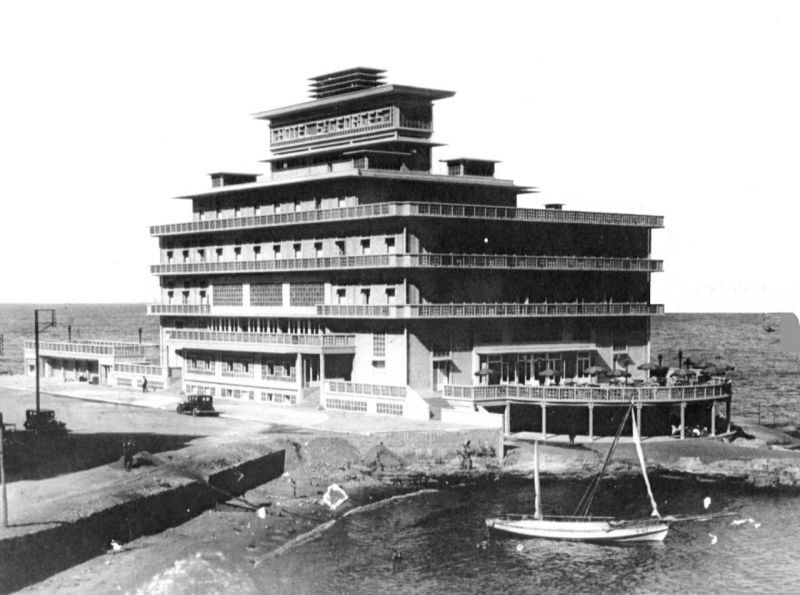
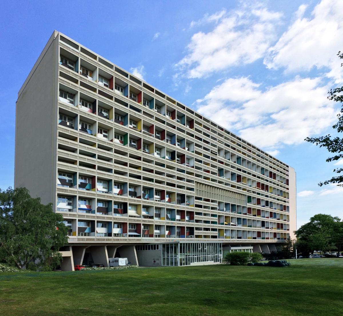
    A Berlin la réproduction en béton armé de du château des rois de Prusse est une affaire d’état et d’extrême droite. Le bâtiment sert la même idéologie nationaliste et réactionnaire comme l’église #Garnisonskirche à #Potsdam. Le nouveau bellicisme y rencontre le militarisme prusse et son siècle triomphal de 1813 à 1914.

    Cerise amtidemocatatique sur le gâteau au goût révanchiste - on y a déplacé les collections éthnologiques dont une partie consiste en objets volés et pillés dans le monde entier à l’époque de l’empire allemand. Ces collections ont été volées une deuxième fois, cette fois aux Berlinois, qui y avaient libre accès dans des bâtiments agréables et modernes à Berlin-Dahlem, afin de les enfermer dans un bâtiment consacré au discours justificateur du nouvel impérialisme woke nationaliste et transatlantique à la fois.

    17.4.2024 von Susanne Lenz - Der Architekt Philipp Oswalt über das Unbehagen, das ihm die Rekonstruktion der Schlossfassade bereitet, und die Verbindung des Fördervereins in rechtsradikale Milieus.

    Als verbissensten Gegner des Neubaus des Berliner Stadtschlosses hat jemand den Architekten Philipp Oswalt mal bezeichnet. Dabei kämpfte er vor allem gegen die historisierende Fassade und die Intransparenz hinsichtlich der Spender. Die Recherchen für sein neues Buch „Bauen am nationalen Haus“ haben erbracht, dass einige dem rechtsradikalen Milieu angehören und sie Einfluss auf die Gestaltung der Fassade genommen haben. Er empfängt uns in seiner Wohnung in Berlin-Schöneberg.

    Sie haben hier im Wohnzimmer ja Lampen aus dem Palast der Republik an der Decke. Wie sind Sie an die gekommen?

    Ich bin mit dem Künstler Fred Rubin befreundet, der einiges aus dem Palast der Republik gesichert hat. Die Lampen hat er umgestaltet. Es geht dabei nicht um Trophäen, sondern um kulturelle Transformation.

    Guten Morgen, Berlin Newsletter

    Vielen Dank für Ihre Anmeldung.
    Sie erhalten eine Bestätigung per E-Mail.

    Wo der Palast der Republik stand, steht heute das Stadtschloss. Sie haben kürzlich in Zusammenhang mit der Aufstellung der Prophetenfiguren an der Kuppel, Transparenz hinsichtlich der Spender gefordert. Warum halten Sie das für so wichtig?

    Ich muss vorausschicken, dass ich mich für den Erhalt des Palasts der Republik eingesetzt habe. Ich wollte, dass man ihn als Ort der deutschen Geschichte in eine Neugestaltung einbezieht. Das hat auch die Expertenkommission empfohlen. Ich lehne historische Rekonstruktionen nicht grundsätzlich ab, habe ja selbst in Dessau die Rekonstruktion der Bauhaus-Meisterhäuser mitverantwortet, aber ich bin gegen die Orthodoxie, mit der das in Berlin betrieben worden ist. Unbehagen bereitet mir auch das Geschichtsverständnis, das mit dieser Rekonstruktion einhergeht. Ich hatte aber nie den Verdacht, dass dahinter rechtslastige Interessen stehen könnten.

    Infobox image

    Nadja Wohlleben

    Zur Person

    Der Architekt Philipp Oswalt, geboren 1964 in Frankfurt am Main, ist Professor für Architekturtheorie an der Universität Kassel. Er war u.a. Leiter des Projektes „Schrumpfende Städte“ der Kulturstiftung des Bundes (2002–2008) und Direktor der Stiftung Bauhaus Dessau (2009–2014).
    Er ist Autor und Herausgeber zahlreicher Publikationen zur zeitgenössischen Architektur und Stadtentwicklung. Zuletzt ist von ihm „Bauen am nationalen Haus. Architektur als Identitätspolitik“ (Berenberg-Verlag 2023, 240 S. 22 Euro) erschienen.
    Meistgelesene Artikel

    Wie sind Sie dann darauf gekommen?

    Durch meine Auseinandersetzung mit der Garnisonkirche in Potsdam. Der Name des Großspenders Ehrhard Bödecker war mir daher bekannt. Als ich mir dann in der Deutschen Bibliothek in Leipzig seine Schriften angeguckt habe, war der Fall relativ klar. Nachdem seine antisemitischen Äußerungen bekannt geworden waren, forderte die Familie, dass seine Plakette im Schloss entfernt wird.

    In Ihrem neuen Buch „Bauen am nationalen Haus“ stellen Sie fest, dass es viele rechtslastige Spender gibt.

    Es gibt eine strukturelle Verbindung des Fördervereins in rechtsradikale Milieus. Nicht nur, was Spender betrifft, sondern auch einzelne Vereinsmitglieder und Funktionäre des Vereins. Dieter Lieberwirth aus der Partei der Republikaner war Gründungsvorstand und wirkt bis heute im Verein. Karl-Klaus Dittel engagierte sich im baden-württembergischen Zweig des Fördervereins, der fragwürdige Kampagnen für die AfD dort organisiert hat, Stichwort illegale Parteienfinanzierung.

    Berliner Schloss: Erste Propheten-Statuen an der Kuppel nach Streit um Spenden befestigt

    Burggraben vor dem Reichstag: Ein törichtes Projekt, das Angriffe heraufbeschwört

    Zieht ein solches Projekt rechtslastige Spender an, oder ist es nicht einfach normal, dass unter 40.000 Spendern auch politisch Rechtsstehende oder Rechtsradikale sind?

    Beides stimmt. Bei einem Symbolbau aus vordemokratischer Zeit, der als Identitätsanker propagiert und als nationales Symbol verstanden wird, gibt es eine Anschlussfähigkeit in rechtsradikale und rechtsextreme Milieus. Das wird zum Teil bestritten. Herr Boddien sagt, Preußen spiele in diesen Milieus keine Rolle. Der Förderverein hat aber den Kontakt nicht nur nicht vermieden, wie meine Recherchen zeigen. Er hat bereits 1993 in der Jungen Freiheit inseriert und sich bis heute nicht abgegrenzt.

    Sie behaupten, dass rechtslastige Spender Einfluss auf die Struktur der Fassade genommen haben, etwa was die Gestaltung der Kuppel angeht. Die Humboldt-Stiftung weist das zurück. Die Kuppel sei bereits Bestandteil von Frank Stellas Entwurf gewesen.

    Die Humboldt-Stiftung wirft Nebelkerzen und sie lügt. Das, was hier heute steht, ist etwas merklich anderes als das, was die Expertenkommission empfohlen und was der Bundestag 2002 beschlossen hat. Und der Förderverein hat diese Radikalisierung durchgesetzt. 2003 wurde der Abriss des Palasts beschlossen, damit war auch der Beschluss der Expertenkommission hinfällig, dass er teilweise in den Schlossneubau einbezogen wird. Der Entwurf der Wettbewerbsausschreibung für den Neubau wird durchgestochen, skandalisiert, Thierse mischt sich ein, ein Entwurf für die Kuppel wird zwingend, wobei der Bauherr, also der Bundestag, sich damals noch nicht festlegte, ob es eine historisch getreue oder eine Neuinterpretation sein soll. Dann kam der Wettbewerb, und mit dem Entwurf von Kuehn Malvezzi eine interessante Interpretation, die ein schwebendes Dach statt der Kuppel vorsah. Das wurde von der Jury als unzulässig erklärt: Es sei keine Kuppel. Mit der Entscheidung für Stellas Entwurf entschied man sich für die Rekonstruktion der Kuppel und auch die Innenseite der Portale.

    Philipp Oswalt: „Die Politik sah sich in der Pflicht, Spenderwünschen nachzukommen.“

    Philipp Oswalt: „Die Politik sah sich in der Pflicht, Spenderwünschen nachzukommen.“Nadja Wohlleben

    Wenn der Entwurf Stellas die Kuppel bereits vorsah, warum sagen Sie dann, die Humboldt-Stiftung werfe Nebelkerzen?

    Weil die Stiftung Stellas Entwurf und seine Überarbeitung zwei Jahre später in einen Topf wirft. In dem Wettbewerbsentwurf waren die Propheten nicht enthalten. Die Stiftung lügt, wenn sie sagt, dass es keinen Einfluss der Spender gegeben hat. Die zusätzlichen Rekonstruktionen waren nicht durch den Grundsatzbeschluss von 2002 abgedeckt, und deshalb auch nicht haushalterisch unterlegt. Das heißt, das musste durch Spenden finanziert werden. Das war allen Beteiligten klar. Die Politik sah sich dann in der Pflicht, Spenderwünschen nachzukommen. Und es ist ja auch eigentlich nicht problematisch, dass bei einem Projekt, bei dem es eine zivilgesellschaftliche Teilhabe gibt, eine Mitgestaltung erwünscht ist. Das wird nur deshalb heikel, weil dabei auch rechtsradikale Positionen eine Rolle gespielt haben. Auch beim Eosanderportal. Nehmen Sie die große Kartusche. Das ist eine Zutat von 1904, der Bundestag hat 2002 von einer Barockfassade gesprochen. Da ging es nicht um wilhelminische Elemente. Das hat man dem Förderverein überlassen und diesem ist alles bis 1918 heilig. Natürlich ohne die Schäden der Revolution.

    Warum macht die Stiftung das?

    Das ist schwer zu erklären. Der Förderverein geht ja mit der Stiftung nicht gerade zimperlich um. Hartmut Dorgerloh war teilweise schwer unter Beschuss. Trotzdem – nachdem der Anwalt Peter Raue dem Förderverein einen Persilschein hinsichtlich der rechten Spender ausgestellt hatte, erklärte die Stiftung 2022, nun sei alles in Ordnung, man arbeite gern wieder mit dem Förderverein zusammen. Doch das entbehrte jeder sachlichen Grundlage.

    Was meinen Sie?

    Raues Persilschein – abgesehen davon, dass er in dieser Angelegenheit befangen war, da er Anwalt des Fördervereins und der Familie Bödecker ist – lag dem Stiftungsrat gar nicht vor. Aber vor allem konnte Herr Raue von den 26 Millionen anonym eingegangener Gelder nur etwas über eine Million prüfen, da bei den übrigen 25 Millionen selbst dem Förderverein unbekannt ist, woher das Geld kommt. Da muss man sagen: Liebe Leute, das habt ihr gut verschwiegen und man hat es euch abgenommen. Auch das Gutachten des Instituts für Zeitgeschichte zu Bödecker lag dem Stiftungsrat nicht vor. Herr Dorgerloh hat das beschönigend dargestellt, indem er sagte, Bödecker sei weder rechtsextrem noch im rechtsradikalen Sinne antisemitisch. Es ist für mich offenkundig, dass die Stiftung kein ehrliches Aufklärungsinteresse hatte. Alle, auch die Bundestagsparteien, wollten Ruhe in die Debatte bringen und keine Angriffsfläche bieten. Aber die Spendenpraxis waren ein zentrales Legitimationsinstrument. Man konnte sagen, die Fassade kommt aus der Bevölkerung, es ist ihr Wunsch. Und wenn dies einen Makel bekommt, will man lieber den Deckel draufhalten.

    Philipp Oswalt: „Ist die Reproduktion eines Hohenzollernschlosses im 21. Jahrhundert die adäquate Setzung für die heutige deutsche Gesellschaft?“

    Philipp Oswalt: „Ist die Reproduktion eines Hohenzollernschlosses im 21. Jahrhundert die adäquate Setzung für die heutige deutsche Gesellschaft?“Nadja Wohlleben

    Eine der zentralen Thesen Ihres Buches ist, dass solche Repräsentationsbauten wie das Stadtschloss dazu dienen, gesellschaftliche Identität zu schaffen. Was für eine Identität soll das denn in diesem Fall sein?

    Das Schloss ist das wichtigste Bundesbauprojekt neben dem Reichstag seit 1990: Aber ist die Reproduktion eines Hohenzollernschlosses im 21. Jahrhundert die adäquate Setzung für die heutige deutsche Gesellschaft? Man hat versucht, das mit dem Inneren auszugleichen, mit den außereuropäischen Sammlungen. Das ist eine neokoloniale Instrumentalisierung dieser Kulturen, wenn man damit die preußische Fassade legitimieren und sich als weltoffen darstellen will. Und das Problem mit der Fassade wird man damit nicht los.

    Sie sprechen im Zusammenhang mit der Rekonstruktion von Deckerinnerung. Was ist das?

    Der Begriff kommt aus der Psychologie. Mit einer Erinnerung wird eine andere verdeckt. Der Ort, an dem das Schloss steht, stand für vieles: für Preußen, den Wilhelmismus, die Revolution, die Weimarer Republik, den Krieg, die deutsche Teilung, die friedliche Revolution von 1990. Aber die Geschichte ab 1918 wurde eliminiert. Wobei die stalinistisch motivierte Sprengung des Schlosses 1950 bereits die davorliegende Geschichte eliminiert hat. Immerhin hat man die Erinnerung an die Revolution von 1918 durch den Transfer des Schlossportals ins Staatsratsgebäude zu bewahren versucht. Das Stadtschloss hat die Gewaltgeschichte des 20. Jahrhunderts durch einen Rückgriff auf die Zeit vor 1918 verdrängt.

    Philipp Oswalt bewertet den Abriss des Palasts der Republik als „ikonoklastischen Rachefeldzug oder eine Art Exorzismus“.

    Philipp Oswalt bewertet den Abriss des Palasts der Republik als „ikonoklastischen Rachefeldzug oder eine Art Exorzismus“.Nadja Wohlleben

    In Teilen der ostdeutschen Öffentlichkeit wird der Abriss des Palasts als kolonialer Akt der BRD verstanden.

    Das halte ich für falsch. Es gab eine westdeutsche Kolonisierung, aber was geschichtspolitische Fragen angeht, ist das eher eine Generationenfrage. Es gab auch vehemente Kräfte aus dem Osten, die sich für den Abriss eingesetzt haben. Günter Nooke war einer der Antragsteller, es gab Wolfgang Thierse, Manfred Stolpe, Wolfgang Tiefensee, Vera Lengsfeld, die damals noch in der CDU-Fraktion war, Richard Schröder. In meiner Wahrnehmung ist es die Generation der durch den Mauerbau Traumatisierten in West und Ost, die sich auf einen ikonoklastischen Rachefeldzug begeben oder eine Art Exorzismus betrieben haben. Man will in der Geschichte auch hinsichtlich der baulichen Spuren obsiegen.

    Sie brauchen keine Rache, weil Sie einer anderen Generation angehören?

    Ich bin aus Westdeutschland, lebe seit 1984 in Berlin, und habe nach 1990 eine starke Bindung an ostdeutsche Akteure und Milieus gewonnen. Für mich ist klar, dass die DDR eine totalitäre Diktatur war, aber natürlich ist das eine wichtige Epoche deutscher Geschichte. Und es gab auch in der DDR interessante Entwicklungen, dissidentische und reformerische. Es ist irrsinnig, das in einen Giftschrank zu packen. Die jüngere Generation hat eine gelassenere Einstellung dazu, sie muss sich nicht am SED-Staat rächen. Für sie ist das eine abgeschlossene Periode, die man als Teil der deutschen Geschichte annehmen und einen Umgang damit finden kann. Keinen verherrlichenden Umgang, aber eben auch keinen eliminatorischen, sondern einen differenzierenden und in Teilen wertschätzenden.

    Sie schlagen gemeinsam mit Max Czollek, Agnieszka Pufelska und Jürgen Zimmerer vor, einen künstlerischen Wettbewerb auszuschreiben, mit dem Ziel, die Preußen-Fassade zu brechen. Wird das jemals passieren?

    Warum eigentlich nicht? Die Gründungsintendanz des Humboldt-Forums machte zum Beispiel den Vorschlag, die Skulptur „Zweifel“ von Lars Ramberg temporär auf das Schloss zu setzen. Diese Idee ist dann sang- und klanglos gestorben, denn in vielen Kreisen galt das als Sakrileg. Wenn Ramberg seine Skulptur auf das Louvre setzen würde oder auf die Tate, würde dann die französische oder britische Gesellschaft Sturm laufen? Die Stiftung Humboldt-Forum würde eine solche Aktion aus ihrem Gefängnis befreien. Warum ist man in Deutschland zumindest teilweise so verkrampft? Was soll schlimm daran sein, das Spruchband an der Kuppel zu überblenden oder dem Ort Spuren aus der Zeit zwischen 1918 und 2008 einzuschreiben? Warum soll ich nicht zum Beispiel markieren, was die kaiserlichen Truppen am Schloss kaputt geschossen haben, um die Revolutionsgarden zu schlagen. Das wäre doch interessant. Wen stört das? Müssen wir erst mal drei Generationen warten? Das Schloss ist ein Ort, mit dem sich viele nicht identifizieren können. Warum soll man das nicht öffnen?

    #Berlin #Mitte #Schloßplatz #architecture #histoire #Prusse #militarisme #extrême_droite #urbanisme

  • German colonial genocide in Namibia the #Hornkranz massacre

    Introduction

    On 12 April 1893, German colonial troops attacked the Nama settlement of ||Nâ‡gâs, known today as Hornkranz. Their intent was to destroy the settlement and its people, after its leader, Hendrik Witbooi, refused to sign so-called ‘protection’ treaties—tools of the German colonial administration for controlling sovereign indigenous nations and their lands. As their presence in what they declared in 1885 as ‘German Southwest Africa’ grew, the German regime was increasingly unwilling to tolerate the independence and agency exercised by Hendrik Witbooi and his clan in the face of the encroaching German empire.

    In their attack on Hornkranz, the Germans wanted to both make an example of the Witbooi clan and to punish them for their defiant rejection of German rule. Curt von Francois, who led the attack, made his objective clear: ‘to exterminate the Witbooi tribe’ (Bundesarchiv, R 1001/1483, p. 46). In this premeditated act of erasure, his troops massacred almost eighty women and children before capturing another hundred, burned what remained of the settlement to the ground, and established a garrison, rendering it impossible for survivors to return.

    Though the genocide of the Nama, Ovaherero and other peoples indigenous to what is now modern-day Namibia is widely recognised to have taken place between 1904 and 1908, the Nama people remember this massacre as the true first act in the genocide against them. This is substantiated not only by the clarity of the German objective to destroy the |Khowesin as a people, but also by the retrospective reading of Hornkranz as a clear precedent of the systemic tactics of dispossession and destruction that would be used by the Germans against the Nama, the Ovaherero, the San, and others in the years to come.

    Outside of the descendant communities, the events at Hornkranz have until now been overlooked and underrepresented, as has the cultural significance of the settlement itself within the dominant historiography, broadly based on the German visual and narrative record. The site of the former Witbooi settlement was expropriated and today constitutes a private farm, access to which is possible only with special permission from its owner. The descendants of Hornkranz are rarely able to visit their own cultural heritage sites and commemorate the struggle of their ancestors.

    The faint extant traces of the Witbooi settlement at Hornkranz can be identified today only with the guidance of the descendants and the historians that learned from them. Two plaques on the site are the only indications of the Nama presence on that land. One plaque was inaugurated by the community in 1997, the only occasion on which they were able to gather to commemorate the massacre at the site where it took place. The other plaque (date unknown) glorifies the German troops, even going so far as to include an offensive slur for the Nama; the massacre is described as a ‘battle’, conveying little of the atrocities perpetrated there.

    The descendants of Hornkranz and the wider Nama community continue to struggle for justice and for opportunities to correct the historical record and tell the story of Hornkranz on their own terms. In support of their efforts to resist this erasure, we worked with descendants, who have inherited knowledge of their community’s history through oral transmission over multiple generations, to reconstruct the lost settlement and produce a new body of visual evidence about the massacre and its aftermath. Led by their testimonies, we used modelling and mapping techniques along with our own field research and a very limited archival record to situate their accounts and rematerialize Hornkranz.

    Our reconstruction of the Witbooi settlement at Hornkranz aims to underscore the vitality of oral tradition in the act of reconstituting the colonial archive and testifies to the oral transmission of inherited knowledge as an ongoing act of resistance in itself.
    Background

    The |Khowesin (Witbooi) people, a semi-nomadic subtribe of the wider Nama peoples, settled around the perennial spring at Hornkranz in 1884-1885, the very period during which the Berlin Conference, formalising the fragmentation of Africa into colonies and protectorates, was taking place. The chief of the Witbooi clan, Hendrik Witbooi, later went on to become one of the most prominent figures of anti-colonial resistance in Southwest Africa, uniting all Nama clans and later forming a coalition with the Ovaherero to fight against the German colonial regime.

    Following the establishment of their settlement in Hornkranz, the Witbooi Nama lived relatively undisturbed until 1892, when first attempts to compel Hendrik Witbooi into signing a protection treaty began. Hendrik Witbooi, aware that the true objective of the so-called ‘protection treaties’ was nothing short of subjugation, was the last leader to refuse to comply:

    What are we being protected against? From what danger or difficulty, or suffering can one chief be protected by another? […] I see no truth or sense, in the suggestion that a chief who has surrendered may keep his autonomy and do as he likes.

    The German attempt to secure control over the peoples inhabiting the colony and their land is manifested in their mapping efforts. The first map we found featuring Hornkranz dates to 1892, the same year that the Germans began demanding the Witbooi sign such treaties. Despite Witbooi’s refusal to sign, Hornkranz is labelled in these German maps as ‘proposed Crown Land’ already six months before the attack—the very act of cartographic representation prefiguring the expulsion and massacre to follow less than a year later.

    After the Germans attacked Hornkranz, the Witboois were finally forced to concede and sign one of the protection treaties they had so long been resisting.

    A decade later, in 1904, the Nama joined the Ovaherero in an anti-colonial struggle against German rule. In response, the Germans issued an extermination order against the Ovaherero and later, another against the Nama. Hendrik Witbooi died in battle on 29 October 1905. Following his death, the Nama tribes surrendered. The extermination order against the Nama was never revoked.
    12 April 1893: The Attack and Aftermath

    The German troops approached the settlement in the early hours of 12 April, planning to attack under the cover of night without any warning. They then split into three contingents—a recounting of this strategy is recorded in the diary of Kurd Schwabe, one of the perpetrators of the attack. Von Francois led the attack from the northern side, entering the village first, while Schwabe approached from the east.

    Hendrik Witbooi, who was allegedly sitting outside of his house when he noticed the approaching troops, ordered all Nama fighters to retreat and take up defensive positions along the riverbed, where he expected the ensuing battle to take place. Instead, the German troops stopped when they reached the sleeping village and proceeded to target the defenceless population that had stayed behind. The brutality of the onslaught came as a shock to Hendrik Witbooi, who had not expected the Germans to unleash such ‘uncivilised’ tactics upon another sovereign nation.

    Sixteen thousand rounds of bullets were reportedly discharged by the Germans in the span of just thirty minutes. According to the testimony of descendants and corroborated by Schwabe’s diary, some victims were burned alive in their homes.

    The canisters recovered from the site during our fieldwork in September 2023 indicate where some exchange of fire may have taken place while the Witbooi fighters were retreating. While the found bullets were identified as those used by the Witbooi Nama, their location and distribution also corroborates written descriptions of the massacre unfolding in the inhabited area of the settlement, with stored ammunition exploding from inside the burning houses.

    The massacre yielded 88 victims: ten men, including one of Hendrik Witbooi’s sons, and 78 women and children.

    The following day, the German troops returned to raze what remained of the settlement to the ground. Promptly after, a garrison was established on the ashes of the Witbooi settlement, reinforcing the Germans’ clear intention to claim the land and prevent the Witboois from ever returning.

    Over the next year, the Witbooi Nama made several attempts to return to Hornkranz, resulting in four more skirmishes on the site. Eventually, they were forced to sign a protection treaty in Naukluft in August 1894, which cemented the dispossession of their land.

    The treaty meant that the Witbooi Nama were now obliged to assist the Schutztruppen in their battles against other tribes, most devastatingly at the Battle of Waterberg in August 1904 (see our Phase 1 investigation of this event). Once the Nama realised the true genocidal intent of the Schutztruppen, they united with the Ovaherero against colonial rule. The extermination order against the Nama was issued on 22 April 1905.

    After the genocidal war ended in 1908, Hornkranz was sold off to a private owner and a police station was established on its premises. Today, the police station building is the main farmhouse.

    Nama descendants are seeking to establish the 1893 massacre as the first act of genocide against the Nama, and 12 April as the official Genocide Remembrance Day in Namibia.

    This investigation—part of a larger collaboration between Forensic Architecture, Forensis, Nama Traditional Leaders Association (NTLA) and Ovaherero Traditional Authority (OTA)—seeks to support the community’s broader efforts to make the site accessible for commemoration and preservation.

    Methodology
    What Remains

    Little material evidence of Hornkranz survives today. This is in part due to the scale and totality of destruction by the Germans; but it is also a testament to the Witbooi’s steadfast resistance to being documented by the colonial regime, as well as to the light footprint the Nama exerted on the land through their semi-nomadic inhabitation and subsistence. The archival record about the Witbooi and Hornkranz is also sparse and skewed. Alongside an incomplete and biased colonial description of the massacre and the settlement, the only visual representation of Hornkranz on record is a soldier’s crude sketch showing its houses set alight by the German troops on the night of the massacre. The memory of Hornkranz as it was at the time of the attack lives on instead through the descendant communities who have inherited the testimonies of their forebearers about its material culture, rituals, life and environmental practices; our reconstruction and understanding of Hornkranz is possible only insofar as we are led by their testimonies.

    Around the rectangular patch where Hendrik Witbooi’s house once stood, Maboss Ortman and Lazarus Kairabeb, NTLA advisors, identified stones they said are the ruins of the house. Right next to it is the only stone foundation in the settlement, that of a church still under construction at the time of the German assault. These two traces anchored us spatially when we began the 3D reconstruction. We were told by Zak Dirkse, a Nama historian, that Hendrik Witbooi’s house was located higher up in the settlement, with the other houses further down toward the river.

    The other remains and known landmarks of the original Hornkranz settlement help us to navigate it and determine its approximate boundaries. During our visit to the site, the farm owner pointed us to a long strip of clustered stones he explained were the remains of the settlement’s defensive walls, some 300 metres north-west of the church ruins. To the south, by the river, the settlement’s former cemetery is marked by the spread of small rectangular cut stones marking each grave. Further along the river, Maboss and Lazarus showed us the remains of two defensive ramparts, guard outposts downhill from the settlement on its outer edges. They recounted that these ramparts were identifiable to the Witbooi from a distance by a white cornerstone that stands out among the brown stones the rest of the rampart is made of. The ramparts are placed along the hill leading down to the river and would have had a wide lookout view. A few steps to the west of one of the ramparts, we found what brought the Witbooi to this area, a rare perennial spring, which acted not only as a fresh water source for the village, but as a lifeline to the fauna and flora on which the Witbooi relied to survive. Since the early 20th century, this spring has been surrounded to its north by a concrete dam. By establishing this constellation of remains and landmarks, we were able to clarify the approximate outer edges of the settlement.

    Reconstruction

    To reconstruct the Hornkranz settlement, departing from the few architectural landmarks at our disposal, we replicated the architecture of each house and the elements of family life around it, estimated the area of inhabitation within the settlement, and constructed possible layouts of house distribution within the settlement. This reconstruction was led by the close guidance of descendants of the Witbooi we met with in Gibeon, the expertise of Nama historian Zak Dirkse, and the feedback of the Witbooi Royal House council, the representative body of the Witbooi Nama. Our model represents the most comprehensive visual reconstruction of the Witbooi settlement to date.

    Architecture of the Settlement

    Houses in Hornkranz consisted mostly of round domed huts, between four and five metres in diameter, and constructed with cladding made out of reed mat or a mix of animal dung and clay. Zak explained that these huts would have been constructed on a light foundation made up of the same dung and clay mixture spread on the ground. A central pole would act as the main structural pillar on which the reed mats would rest. According to members of the Witbooi descendants, alongside these huts there would have been other houses built of stone, like that of Hendrik Witbooi. Descendants also explained that houses typically had two entrances opposite one another and positioned on an east-west axis with the main entrance facing east.

    Working with the community descendants and Zak, we used 3D modelling software to reconstruct what a typical family home would have looked like. We were told that outside the houses, many families would have had a round kraal lined with a light wooden fence where they kept smaller livestock. Close to the main entrance, they would also have had a fireplace and a simple wooden rack to hang and dry meat. The main kraal of the settlement was near the chief’s house, where a separate storage hut also stood.

    The light environmental trace of the Nama, the German colonial army’s obliteration of the settlement, the failure of subsequent administrations to engage in preservation efforts, and the conversion of the land into a private farm all make it difficult to locate definitive traces of the layout and location of homes based on what little remains at the modern-day site. Nevertheless, by closely reading the texture of the ground, we found possible traces of cleared, round areas surrounded by larger rocks, and noted areas of sparse vegetation growth, a potential indicator of the impact of the huts’ clay-dung foundations. We marked five possible sites where Witbooi homes might have stood.

    Zak explained that a defensive wall would have flanked the settlement along its more vulnerable northern and eastern fronts. We studied the contours of the landscape to estimate, based on the presence of limited remains, how the wall might have cut through the landscape. We estimate that the eastern wall may have been constructed along the peak of the hill to the settlement’s east, given its optical reach and defensive position.

    Area of Inhabitation

    To estimate the area of inhabitation and the settlement’s population, we studied the remaining ruins of the settlement, the terrain of the landscape, and the land’s geological features.

    Houses, we were told, would have been built on flatter ground. We used a 12.5 metre resolution digital elevation model (DEM) to build the terrain in our 3D model and further analysed it in geographic information system (GIS) software. From the DEM, we extracted the contour lines of the landscape and conducted a slope analysis, which calculates the percentage of slope change in the settlement. Analysis of the contours and the areas of low slope help to define the curvature of the settlement’s inhabitation.
    Contour Analysis - 1 metre contours of the site of Hornkranz derived from a digital elevation model (DEM). (Forensic Architecture/Forensis)

    We then traced and excluded uninhabitable geological features from the area of potential inhabitation, including bodies of water and large embedded rock formations. Together, the land’s features, its topography, and our estimated location of the defensive wall help establish where people may have lived.

    Layout of Hornkranz

    Building on the traces of potential houses we previously identified within the landscape and the descendant’s description of the settlement, we were able to algorithmically model potential layouts of the settlement. We used the 3D procedural modelling software application Houdini to design an algorithm that would generate possible layouts of the settlement according to a set of rules, including our defined area of potential inhabitation and the approximate space each household would need for its family life (which we approximate to be a radius of 10 metres). The rules fed to the algorithm were that the houses had to be at least 20 metres apart, each house was approximately 5 metres in size, and there were sixty houses in total with a deviation of +/- ten houses.

    According to the Hornkranz descendants, there would have been around four to six people per household. With an average of five people per household, we estimate the population to be around 300 people per household.
    Number of inhabitants

    The exact population size of Hornkranz at the time of the attack is not known. Sources provide estimates ranging from 250 up to nearly one thousand inhabitants.

    In addition to the members of the |Khowesin Nama clan, Hendrik Witbooi also gathered followers from other clans at Hornkranz, including the ǀAixaǀaen (Afrikaner Oorlams), ǁKhauǀgoan (Swartbooi Nama), Khaiǁkhaun (Red Nation Nama) and ǂAonin (Topnaar Nama). Indeed, the various Nama subtribes were elastic social entities.

    We estimated the 1893 population of Hornkranz by referencing the reported number of individuals killed and captured. Hendrik Witbooi wrote in his diary that 88 people were killed by the Germans that day, 78 of them women and children and ten of them men, with one hundred women and children captured by German colonial forces. Other sources indicate a similar number of casualties: 85 women and children, and ten men (Missonary Olpp, cited in Steinmetz 2009). Descendant narratives also mention the successful escape of some women and children during the German assault. Assuming that before the attack, women and children totalled at least 178 (according to Hendrik Witbooi’s figures), and that women and children made up around three out of five family members in an average household, we estimate there could have been around sixty households and three hundred people in Hornkranz on the dawn of the German attack.

    https://forensic-architecture.org/investigation/restituting-evidence-genocide-and-reparations-in-german-colon

    #Allemagne #colonialisme #massacre #génocide #Namibie #architecture_forensique #histoire #histoire_coloniale #témoignage #Nama #Hendrik_Witbooi #Witbooi #Curt_von_Francois #Ovaherero #San

    ping @reka

  • Un mal qui répand la terreur
    http://carfree.fr/index.php/2024/04/04/un-mal-qui-repand-la-terreur

    Ce n’est pas de la peste qu’il s’agit, mais de l’automobile. On sait ce qu’elle prend de vies humaines en holocauste et l’on commence à réaliser ce que sa tyrannie Lire la suite...

    #Destruction_de_la_planète #Fin_de_l'automobile #archéologie #architecture #bordeaux #clamart #Colombes #courbevoie #histoire #Ivry #paris #parkings #paysage #société #suresnes #toulouse #urbanisme #ville

  • #Journal du #Regard : Mars 2024
    https://liminaire.fr/journal/article/journal-du-regard-mars-2024

    https://www.youtube.com/watch?v=264yMXt_VTA

    Chaque mois, un film regroupant l’ensemble des images prises au fil des jours, le mois précédent, et le texte qui s’écrit en creux. « Une sorte de palimpseste, dans lequel doivent transparaître les traces - ténues mais non déchiffrables - de l’écriture “préalable” ». Jorge Luis Borges, Fictions Nous ne faisons qu’apparaître dans un monde soumis comme nous au pouvoir du temps. Dans le silence qui suit la fin du signal de départ. Dans un seul et unique instant. Non pas suites sans principe de (...) #Journal, #Vidéo, #Architecture, #Art, #Écriture, #Voix, #Sons, #Paris, #Mémoire, #Paysage, #Ville, #Journal_du_regard, #Regard, #Dérive, #Paris, #Canal, #Jardin, #Seine (...)

  • Main Street to Miracle Mile : American Roadside Architecture
    https://libguides.unm.edu/c.php?g=454788&p=3106554

    Main Street to Miracle Mile: American Roadside Architecture was first published in 1985 and established the twentieth century roadside landscape as a subject for serious study. In the book Chester H. Liebs traces the transformation of commercial development as it moved from centralized main streets, out along the street car lines, to form the “miracle miles” and shopping malls of the late 20th century. After setting the special context for this development, he examines the evolution of what he call “Architecture for Speed Reading” followed by chapters on a variety of roadside commercial building types from auto showrooms and drive-in theaters to restaurants, motels and supermarkets. Today the work continues to be relevant as the United States reassesses the many challenges posed by decentralized suburban sprawl.

    #USA #voiture #transport #architecture

  • L’architecte Riken Yamamoto remporte le prix Pritzker 2024
    https://www.lemonde.fr/culture/article/2024/03/05/l-architecte-riken-yamamoto-remporte-le-prix-pritzker-2024_6220244_3246.html

    Université préfectorale, Saitama, Japon.

    En honorant Riken Yamamoto, le jury du Pritzker met en lumière la capacité de l’#architecture à répondre aux défis imposés par les changements de société, à rendre la vie meilleure, y compris quand les conditions économiques et sociologiques semblent souffler dans le sens contraire. Ce prix est aussi une adresse aux maîtres d’ouvrage, un appel à la responsabilité qui leur incombe vis-à-vis du bien commun, que la logique financière, devenue toute-puissante dans le secteur de la construction, tend aujourd’hui à escamoter sans vergogne.
    https://justpaste.it/fmw74

    La gauche du Monde.

  • Vers une société de réparation. L’exposition The Great Repair
    https://metropolitiques.eu/Vers-une-societe-de-reparation-L-exposition-The-Great-Repair.html

    L’exposition The Great Repair, conçue à #Berlin à partir de la restauration du bâtiment qui l’accueillait, présente une diversité d’expériences qui font valoir la nécessité d’une société de #réparation. En mars 2024, le Pavillon de l’Arsenal, à Paris, en accueille une version condensée. L’un de ses concepteurs nous a accordé un entretien. Entretien réalisé par Olivier Gaudin. Pourriez-vous présenter pour commencer le lieu d’origine de l’exposition, son bâtiment et son contexte ? L’Akademie der Künste est une #Entretiens

    / #architecture, #maintenance, réparation, #transition, #urbanisme, Berlin, #patrimoine, #Allemagne, #décolonisation, sobriété, (...)

    #sobriété #enseignement
    https://metropolitiques.eu/IMG/pdf/met_entretien_florent_hertweck.pdf

  • #Journal du #Regard : Février 2024
    https://liminaire.fr/journal/article/journal-du-regard-fevrier-2024

    https://youtu.be/28yB3hwxWpk?si=KfmRvnVBL24O8W9Y

    Chaque mois, un film regroupant l’ensemble des images prises au fil des jours, le mois précédent, et le texte qui s’écrit en creux. « Une sorte de palimpseste, dans lequel doivent transparaître les traces - ténues mais non déchiffrables - de l’écriture “préalable” ». Jorge Luis Borges, Fictions Nous ne faisons qu’apparaître dans un monde soumis comme nous au pouvoir du temps. Dans le silence qui suit la fin du signal de départ. Dans un seul et unique instant. Non pas suites sans principe de (...) #Journal, #Vidéo, #Architecture, #Art, #Écriture, #Voix, #Sons, #Paris, #Mémoire, #Paysage, #Ville, #Journal_du_regard, #Regard, #Dérive, #Paris, #Canal, #Louvre (...)

  • « De la Vendée à l’écriture »
    http://anarlivres.free.fr/pages/nouveau.html#expoRagon

    A l’occasion du centenaire de la naissance de Michel Ragon (1924-2020), le département de Vendée propose jusqu’au 5 avril une exposition (https://www.calameo.com/read/0021009784bb3fb7bec2) qui lui est consacré à l’hôtel du département, à La Roche-sur-Yon. Si l’aspect vendéen du romancier est privilégié, ses autres facettes ne semblent pas avoir été oubliées : l’écrivain prolétarien, le libertaire, le critique d’art et le spécialiste de l’architecture...

    #Ragon #expo #libertaire #littérature #architecture #art

  • Pour une ville « passante, poreuse et profonde »
    https://metropolitiques.eu/Pour-une-ville-passante-poreuse-et-profonde-une-attention-a-l-experi

    Issu d’une enquête sur les interactions entre espaces publics et espaces privés dans des villes des Suds comme des Nords, le livre richement illustré de David Mangin et Soraya Boudjenane plaide pour un #urbanisme attentif à l’expérience du piéton. Le sujet des #rez-de-chaussée et de leur rapport à l’espace public préoccupe aujourd’hui largement les métiers de l’urbain, autour de la revitalisation des centres-villes en déshérence, ou plus généralement de nouvelles interventions en faveur de rez-de-chaussée #Commentaires

    / #fabrique_de_la_ville, #architecture, #centre-ville, #commerce, urbanisme, #espace_public, (...)

    https://metropolitiques.eu/IMG/pdf/met_rottmann.pdf

  • #Homicide de #Bilal_M. : la #reconstitution 3D invalide la version policière
    https://www.youtube.com/watch?v=-tZ-8v0v9dU&embeds_referring_euri=https%3A%2F%2Fwww.index.ngo%2F&em

    Le 23 juin 2021, Bilal M., 34 ans, est tué par des policiers qui procèdent à son expulsion locative. Ces derniers ont plaidé la légitime défense, accusant Bilal M. de les avoir agressés avec un couteau. INDEX a mené une #contre-enquête et révèle des #incohérences majeures dans la version policière des faits.

    https://www.index.ngo/enquetes/homicide-de-bilal-m-la-reconstitution-3d-invalide-la-version-policiere
    #Bilal #reconstruction #police #violences_policières #France #architecture_forensique #INDEX

  • #Journal du #Regard : Janvier 2024
    https://liminaire.fr/journal/article/journal-du-regard-janvier-2024

    https://youtu.be/njVGfYegGSc?si=IkS9n1xmUiVWQgRh

    Chaque mois, un film regroupant l’ensemble des images prises au fil des jours, le mois précédent, et le texte qui s’écrit en creux. « Une sorte de palimpseste, dans lequel doivent transparaître les traces - ténues mais non déchiffrables - de l’écriture “préalable” ». Jorge Luis Borges, Fictions Nous ne faisons qu’apparaître dans un monde soumis comme nous au pouvoir du temps. Dans le silence qui suit la fin du signal de départ. Dans un seul et unique instant. Non pas suites sans principe de (...) #Journal, #Vidéo, #Architecture, #Art, #Écriture, #Voix, #Sons, #Paris, #Mémoire, #Paysage, #Ville, #Journal_du_regard, #Regard, #Dérive, #Paris, #Cimetière, #Musée (...)

  • #Journal du #Regard : Décembre 2023
    https://liminaire.fr/journal/article/journal-du-regard-decembre-2023

    https://www.youtube.com/watch?v=e2At_EIZv58&feature=youtu.be

    Chaque mois, un film regroupant l’ensemble des images prises au fil des jours, le mois précédent, et le texte qui s’écrit en creux. « Une sorte de palimpseste, dans lequel doivent transparaître les traces - ténues mais non déchiffrables - de l’écriture “préalable” ». Jorge Luis Borges, Fictions Nous ne faisons qu’apparaître dans un monde soumis comme nous au pouvoir du temps. Dans le silence qui suit la fin du signal de départ. Dans un seul et unique instant. Non pas suites sans principe de (...) #Journal, #Vidéo, #Architecture, #Art, #Écriture, #Voix, #Sons, #Paris, #Mémoire, #Paysage, #Ville, #Journal_du_regard, #Regard, #Dérive, #Paris (...)

  • Antoine Tabet et ses compagnons : portrait du Liban moderne - L’Orient-Le Jour
    https://www.lorientlejour.com/article/1363031/antoine-tabet-et-ses-compagnons-portrait-du-liban-moderne.html

    Aussi, Voyages à travers la culture, l’architecture et la politique avec Antoine Tabet et ses compagnons est, comme son titre l’indique, un ouvrage où l’architecture occupe une place centrale. Jad Tabet y relate les transformations fondamentales qui ont accompagné l’expansion de Beyrouth, ont imprégné significativement son paysage urbain et ont marqué les débuts de l’architecture moderne. Parmi les « architectes de la première génération », Jad Tabet cite Youssef Bey Aftimos, Bahjat Abdelnour et Mardiros Altounian. Mais alors que la production des architectes de la première génération se distinguait par son mélange de styles « ottoman et moderne », de nouvelles tendances sont apparues au début des années 30. Elles présentent la nécessité d’un langage architectural compatible avec les transformations majeures de l’époque. Joseph Najjar, Farid Trad et Antoine Tabet forment cette nouvelle génération d’ingénieurs qui, ayant travaillé à l’établissement d’une pratique de l’ingénierie moderne, jouera un rôle fondamental au cours des années 50 et 60. Jad Tabet montre aussi comment, chacun de ces trois pionniers, a incarné un modèle idéal du rapport de l’ingénieur à sa profession et à la société dans laquelle il vit. Du caractère officiel de la pratique de Joseph Najjar qui a occupé plusieurs postes ministériels de 1964 à 1968 et du modèle de l’ingénieur « libéral » qui est représenté par Farid Trad, Tabet distingue celui incarné par Antoine Tabet, son père, celui de l’ingénieur « engagé ». Comme les pionniers du modernisme en Occident, Antoine Tabet croyait que le projet moderniste en architecture était lié à un projet plus large visant à établir un monde plus juste dans lequel chacun jouissait d’une vie meilleure.

    Une des plus belles pages, s’il en est, de ce qui se donne aussi à lire comme un récit de filiation. Proposée dans les années 90 par Dominique Viart (« Filiations littéraires », in Écritures contemporaines 2), la notion couvre un type de récit qui se configure sur le mode de l’enquête, l’enjeu étant, pour le narrateur, de se situer dans l’histoire à la fois collective et familiale dont il est le produit. Le récit de l’autre – en l’occurrence le père – est le détour nécessaire pour parvenir à soi. Le récit de filiation devient ainsi prétexte à revisiter l’Histoire et se présente comme un travail de restitution écrit à partir d’archives, de documents, de traces diverses devenues précieuses. Cette restitution se pense à plus d’un niveau puisque « restituer », c’est aussi le fait de « rendre quelque chose à quelqu’un », rendre une dette ou rendre leur existence à ceux qui ne sont plus en restituant, d’une certaine manière, leur légitimité.

    C’est donc un opus qui tient à la fois du traité d’architecture, du livre d’histoire et de l’objet littéraire que nous livre Jad Tabet pour brosser la fresque d’une époque, de l’émergence d’un monde à son extinction – le récit débutant avec la découverte de la maison de Bhamdoun dans laquelle Antoine Tabet est né s’achève avec la mort de ce dernier.

    A propos du livre LubnĀn al-bidayĀt fi sirat mouthakaf hadĀthi. RahalĀt fi al-thakĀfa wal-handasa wal-siyĀsa ma‘ Antoine Tabet wa rifĀkihi (Le Liban des commencements dans la biographie d’un intellectuel moderne : voyages à travers la culture, l’architecture et la politique avec Antoine Tabet et ses compagnons) de Jad Tabet (préface d’Elias Khoury), éditions Riad El-Rayyes, 2023, 335 p.
    #Liban #architecture #engagement #modernisme

  • Périple autour du #vernaculaire américain
    https://metropolitiques.eu/Periple-autour-du-vernaculaire-americain.html

    Comment décrire, encore, les architectures et paysages américains ? Trois architectes françaises ont mené une exploration écrite et graphique de l’est des #États-Unis, dont rend compte l’ouvrage richement illustré What about vernacular ?. En 2023, est paru aux éditions Parenthèses What about vernacular ?, ouvrage de 384 pages dont les autrices sont les architectes Justine Lajus-Pueyo, Alexia Menec et Margot Rieublanc. D’emblée le titre What about vernacular ? positionne la proposition de Lajus-Pueyo, #Commentaires

    / #architecture, vernaculaire, États-Unis, #voyage, #photographie, #dessin, #paysage

  • The Planning of Palestine: Urban Planning under and as Occupation with #Dana_Erekat and #Eyal_Weizman

    This episode is about planning in Palestine, and especially Gaza. As you all know, this is a podcast about Latin American Cities. However, right now it seems difficult to talk or think about anything other than the genocide unfolding in Palestine. Many of those of us who think critically about Latin American cities find so many connections between our histories and struggles and the settler-colonial project of Israel and its occupation of Palestine. This is particularly true when we reflect on the role of planning and architecture in cementing the occupation, dispossession and violence upon Palestinian people, and particularly Gazans. This is the focus of today’s episode.

    To discuss this, it is truly my privilege to host cohost, Mekarem Eljamal and our two guests, Dana Erekat and Eyal Weizman.

    Dana is a Palestinian architect and planner, with a BA in architecture from UC Berkeley and an Masters in City Planing from MIT. The list of positions she has held is as impressive at it is long. Among these, she has worked with the UNDP, with the World Bank, the Kenyon Institute, and more. From 2013-2012, she was Head of Aid Management and Coordination Directorate/ Special Advisor to the Minister at the Palestinian Ministry of Planning and Administrative Development, during which she led the technical committee for the 2014 Gaza Reconstruction plan. She is currently the CEO of the data analytic company Whyise.

    Eyal Weizman is Professor of Spatial and Visual Cultures and founding director of the Centre for Research Architecture at Goldsmiths, University of London. He is perhaps most known as the founder and director of Forensic Architecture, a multidisciplinary research group based at Goldsmiths, University of London that uses architectural techniques and technologies to investigate cases of state violence and violations of human rights around the world.

    Mekarem Eljamal is a Doctoral Student in Urban Planning at Columbia GSAPP. Her current research looks into the political economy of “mixed cities” within Israel, with particular attention to how the discursive invocations and conceptualizations of the “mixed city” sit vis-à-vis the material realities of the city. Eljamal’s work draws heavily on settler colonial scholarship as she explores the ways in which the deployment of the mixed city classification intersects with questions of multiculturalism, right to the city, and citizenship.

    https://open.spotify.com/episode/5ADzbTjRf0prYjmUB5HnxO
    #urban_matter #Palestine #Israël #Gaza #villes #aménagement_territorial #urbanisme #architecture_forensique #dépossession #violence #occupation #à_écouter #à_lire #audio

  • 3D-printed sand wall created by Barry Wark at Museum of the Future
    https://www.dezeen.com/2023/12/12/3d-printed-sand-wall-barry-wark

    The wall was assembled from a series of 3D-printed “jigsaw panels”. These were produced using binder-jet printing, a process that involves adding a liquid binding agent into the thin layers of printed particles.

    Quel #sable ?
    Est-ce une voie pour utiliser le sable du désert, impropre à la construction béton ?
    #impression_3D #architecture

  • Une brève généalogie politique de la cabane - La Grappe
    https://lagrappe.info/?Une-breve-genealogie-politique-de-la-cabane-154

    Qu’elle soit synonyme de l’enfance, d’un retour à la nature ou bien de formes de précarité, la cabane est une jonction à de nombreux imaginaires. Sans chercher à en faire un objet d’étude scientifique et complet, cet article propose une divagation, concernant une généalogie politique de cette forme d’habitat. Si certaines personnes ont choisi de se retirer dans des cabanes pour mieux s’opposer à la société de leur époque, nous pouvons aussi remarquer que les grandes contestations de ces dernières années ont remis au goût du jour ce type de construction, afin de renforcer la lutte et la cohésion. De la Zad aux Gilets Jaunes, c’est une manière de prolonger l’élan collectif et d’ancrer un combat dans un lieu, dans le temps, mais aussi dans la vie quotidienne. Si bien qu’il est possible de retracer, au travers de ces constructions simplistes, une longue histoire d’une recherche d’harmonie avec la nature qui nous entoure, d’une vision critique de la société de consommation et de contrôle, ainsi que de l’espérance de rapports émancipés et libérés des chaînes qui nous contraignent au quotidien.

    Une construction de Le Corbusier pour lui

    Une construction de Le Corbusier pour les autres

    #cabane #architecture #histoire #nature #zad @chezsoi

  • « Obsolescence des ruines » de Bruce Bégout
    https://topophile.net/savoir/obsolescence-des-ruines-de-bruce-begout

    Dans Obsolescence des ruines. Essai philosophique sur les gravats, publié aux éditions Inculte en 2022, le philosophe et écrivain Bruce Bégout propose une réflexion riche et fouillée sur la production architecturale contemporaine. Appuyée sur un nombre considérable de références, de Robert Smithson à Günther Anders, en passant, entre autres, par Hannah Arendt et Rem Koolhaas,... Voir l’article

  • Le dessous des images. Derniers instants avant le naufrage

    Au large de la Grèce, une équipe de garde-côtes survole et capture cette scène depuis un hélicoptère. Des centaines de migrants appellent au secours depuis un chalutier. La plupart ne survivront pas au naufrage. Mais à quoi a servi cette image ? Présenté par Sonia Devillers, le magazine qui analyse les images de notre époque.

    Ce cliché du 13 juin 2023 est repris dans toute la presse internationale. Les autorités grecques ont photographié ce bateau de pêche qu’ils savent bondé et fragile, et dont les passagers sont affamés et déshydratés. Pourtant, ils ne seront pas capables de les secourir. La responsabilité des garde-côtes sera mise en cause par médias et ONG. Arthur Carpentier, journaliste au Monde et coauteur d’une enquête sur ce naufrage, nous explique en quoi les images ont permis de reconstituer le drame. Le chercheur suisse Charles Heller nous aide à comprendre l’impact médiatique, politique et symbolique des images de migrants et de naufrages en Méditerranée.

    https://www.arte.tv/fr/videos/110342-133-A/le-dessous-des-images

    Citation de #Charles_Heller :

    « Ces #images cristallisent toutes les #inégalités et les #conflits du monde dans lequel on vit. Elles nous disent aussi la #normalisation de la #violence des #frontières, sur la large acceptation de dizaines de milliers de #morts aux frontières européennes, et en #Méditerranée en particulier »

    #naufrage #migrations #réfugiés #mer #Méditerranée #mer_Méditerranée #Grèce #reconstruction #Pylos #géolocalisation #architecture_forensique #images #mourir_en_mer #morts_en_mer #garde-côtes #Frontex #reconstitution #SAR #mer_Egée #border_forensics #domination #imaginaire #invasion #3_octobre_2013 #émoi #émotions #normalisation_de_la_violence

    ping @reka

    • Frontex report into Greek shipwreck suggests more deaths could have been prevented

      A Frontex report suggesting that many of the deaths caused by the shipwreck off the Greek coast near Pylos last June could have been prevented was released by the Aegean Boat Report NGO on their X feed yesterday evening (January 31).

      Investigations into what happened to the Adriana, an overcrowded fishing vessel carrying some 750 people from Libya to Italy that sank off the coast of Greece on June 13, are ongoing.

      However, a report produced by the European Border Agency Frontex — marked “sensitive” and dated December 1, 2023 — was posted to X (formerly known as Twitter) late on January 31.

      The report was posted by Aegean Boat Report, an organization working with migrants in the eastern Mediterranean.

      In their post on X, they thank freelance Brussels-based journalist Eleonora Vasques for “making it available to the public.” Frontex told InfoMigrants in an email that they had released the report via their “Transparency Office.” They added that the “release wass part of a Public Access to Documents request, an important process that allows us to share information with the public.”

      Vasques writes regularly for the European news portal Euractiv. One of her latest reports looks into what happened in the Cutro shipwreck off Italy almost a year ago. The story was also sourced back to an internal Frontex report, which concluded that more lives could have potentially been saved if the response from Frontex and the Italian coast guard had been different.

      https://twitter.com/ABoatReport/status/1752800986664448090

      Long and detailed report

      The 17-page Pylos report from Frontex is redacted in parts and goes into great detail about what happened and which authorities and merchant ships were involved. It also compares timelines from various authorities, NGOs and media organizations.

      In the email to InfoMigrants, Frontex continued that they “strive to make such documents available in our Public Register of Documents as promptly as possible.” The Press Spokesperson Krzysztof Borowski wrote that the “Pylos tragedy is a stark reminder of the challenges and dangers faced at sea. We at Frontex share the profound concern and sadness of the public regarding this heartbreaking event.” He finished by saying: “Our thoughts are with all those affected by this tragedy, and we remain dedicated to our mission of safeguarding lives while ensuring border security.”
      Committment to ’assess cases more thoroughly

      Although the report finds that Frontex “followed applicable procedures”, it admitted that “going forward and based on a reviewed assessment methodology ... the team … should assess similar cases more thoroughly against the need to issue a Mayday alert.”

      A Mayday alert is a radio distress signal used at sea.

      The report appears to suggest that more could have been done on the day to prevent such a huge loss of life.

      According to the Frontex report posted on X, “in the hours following the sighting of Adriana, Frontex made three attempts to follow up on the case, by suggesting additional Frontex Surveillance Aircraft (FSA) sorties.”

      Frontex writes that “no reply was received by the Greek authorities to Frontex’ repeated offers until Adriana’s shipwreck.”

      Frontex made an initial statement on June 16 expressing “shock and sadness” at the events off Pylos.
      ’Greek authorities failed to timely declare a search and rescue situation’

      Although the investigating office at Frontex underlines that it is “not in a position to conclude what caused Adriana’s capsizing and shipwreck … it appears that the Greek authorities failed to timely declare a search and rescue and to deploy a sufficient number of appropriate assets in time to rescue the migrants.”

      The report stated that Frontex “regrets the lack of information provided by the Greek authorities to its enquiry but still expects to receive updates from the national investigations in progress.”

      According to Frontex’ timeline of the incident, the agency first learned about the existence of the fishing vessel carrying migrants on June 13 at around 10:12 UTC, or around 13:12 in Greek summer time. They spotted the vessel from their aerial surveillance plane Eagle 1. About four hours later, another update was sent to the fundamental rights monitor, but according to the report, nothing “out of the ordinary” was flagged regarding the vessel at this point.

      The next paragraph jumped to June 14 at 06.19 UTC, when the fundamental rights monitor received “another update … notifying that Adriana sank overnight and a SAR [Search and Rescue] was in progress.”
      ’Serious Incident Report’ launched by Frontex on June 26

      In the following days, the Office for Fundamental Rights at Frontex monitored the aftermath of the incident, states the report.

      They studied “Frontex’ own sightings of Adriana” along with “statements by Greek officials, and initial information reported in the media.”

      Frontex launched a “Serious Incident Report (SIR) on June 26, “to clarify the role of Frontex in the incident as well as the legality and fundamental rights compliance of the assistance to the boat in distress, and the coordination and conduct of rescue operation by national authorities.”

      According to a summary of that work, the first mention of the Adriana came from the Italian control authorities in Rome at 08:01 UTC on June 13.

      At that point, Rome’s search and rescue authorities contacted Greece’s authorities and Frontex about “a fishing vessel with approximately 750 migrants on board, known to be sailing within the Greek Search and Rescue Region at 06:51 UTC.” At that point, Rome had already alerted the authorities to “reports of two dead children on board.”

      After receiving this report, Frontex wrote that it directed its plane Eagle 1, which was already in the air, to fly over the fishing vessel “even though the vessel lay outside the normal patrolling route.”

      The report said the Eagle 1 spotted the “heavily overcrowded” vessel at 09:47 UTC and informed the Greek authorities. Ten minutes later, the plane left the area due to low fuel and returned to base.
      Italian authorities report Adriana ’adrift’ long before Greek authorities do

      By 13:18, Rome’s search and rescue authorities provided an update of the situation to Greek authorities and Frontex. At that point, they said the boat was “reported adrift” and had “seven people dead on board.”

      At 14:54, Frontex reportedly received an email from the NGO Watch The Med – Alarm Phone alerting Frontex, JRCC Piraeus, the Greek Ombudsman’s Office, UNHCR and others to the new location of the fishing boat. In that email, Alarm Phone stated there were “several very sick individuals, including babies” among the approximately 750 people on board and that the boat was “not able to sail.”

      About 30 minutes later, this email was forwarded by Frontex to the Greek National Coordination Center and JRCC Piraeus, and it was sent on to the Fundamental Rights Office.

      About an hour later, Frontex contacted the Greek authorities to request an update on the situation. Frontex also offered to deploy a surveillance aircraft to check on the ship’s current position, but reports it received no reply.

      Just under two and a half hours later, the Greek authorities did request that Frontex support them “in the detection of a migrant boat within the maritime area south of Crete, as part of another SAR operation.” This turned out to be a sailing boat with about 50 people on board.
      ’No reply was received’

      Later that evening, Frontex contacted the Greek authorities twice more and said no reply was received.

      At 23:20 UTC, Frontex redirected the plane that had been helping with the fishing boat off Crete to the last known position of the fishing vessel.

      The timeline moves to June 14. At 02:46 UTC, Frontex informs the Greek authorities that its plane was headed towards the last position of the fishing vessel. It says it received no reply from the Hellenic authorities.

      Over an hour passed before the plane, this time the Heron 2, reached the “operational area” where it spotted “nine maritime assets (eight merchant vessels and one Hellenic Coast Guard patrol vessel) and two helicopters involved in a large-scale SAR operation.” At that point, states Frontex in the report “no signs of the fishing vessel were spotted.”

      At 05:31, Frontex told the Greek authorities that its plane Heron 1 was about to leave the operation, but offered Eagle 1, which was already airborne, to help with the SAR operation. The Greek authorities replied over two hours later that “no further aerial surveillance support was needed for the time being.”
      No mention of dead bodies on board in Greek timeline

      The Frontex report then includes a similar timeline from the Greek authorities. In the Greek version, there is no initial mention of dead bodies on board. They say they established contact with those on board and “no request for assistance was addressed to the Greek authorities.”

      Although the Italians reported that the vessel was already adrift around 13:18 UTC, according to the Frontex report, in the Greek version, the vessel is “still sailing with a steady course and speed” at 15:00 UTC.

      Around that same time, a Maltese flagged commercial vessel approaches the fishing boat to supply them with food and water, as requested by the Greek authorities. According to the Greek report, the people on board were repeatedly asked if they were facing “any kind of danger” or were “in need of additional support.” Their answer, according to Greece, was “they just wanted to continue sailing towards Italy.”

      30 minutes later, again according to JRCC Piraeus, via satellite phone contact, those on board said they wanted to keep sailing.

      At 18:00, the boat was approached again. According to the report, the migrants “accepted water” from the Greek-flagged commercial vessel that approached them, but “threw the rest of the supplies into the sea.” This approach and refusal of assistance carried on into the evening.
      Adriana ’still holding a steady course and speed’

      At 19:40 UTC, according to the Greek report, a Greek coast guard vessel approached the fishing vessel and “remained at a close distance in order to observe it.” It was still holding a “steady course and speed, without any indications of sailing problems.”

      It was only at 22:40 UTC, according to the Greek report, that the fishing vessel “stopped moving and informed the Greek authorities that they had an engine failure.”

      A Greek coast guard vessel then immediately approached the vessel to assess the situation. Less than an hour later — at 23:04 UTC, but 02:04 local time on June 14 — the Greek report notes that the fishing vessel “took an inclination to the right side, then a sudden inclination to the left side and again a great inclination to the right side, and eventually capsized.”

      They said "people on the external deck fell in the sea and the vessel sunk within 10-15 minutes.” At that point, the Hellenic coast guard “initiated a SAR operation.”

      The Frontex report then notes “alleged discrepancies” between the various timelines and survivor statements given to the media.

      They say that many of the survivors reported that the Greek coast guard “tied ropes onto the fishing vessel in an effort to tow it,” which allegedly caused it to destabilize and capsize.

      In the past, the Greek coast guard have tied and towed vessels successfully towards safety.

      However, while the Greek coast guard acknowledged that one rope was attached around three hours before the boat sank to ascertain passengers’ conditions, there was “no attempt to tow it.”

      The rope, say the Greeks, was removed by the migrants on board just a few minutes later and the coast guard vessel moved a distance away to continue observation.
      Was Adriana stationary prior to capsizing or not?

      The BBC and several other media outlets also reported at the time that prior to capsizing and sinking, the fishing vessel had not moved for several hours.

      This is consistent with the Frontex timeline, which mentions the Italian authorities’ warnings that the boat was adrift the day before it eventually capsized.

      Later in the report, Frontex notes that many of the “alternative and complementary timelines” put together by international NGOs and journalists are “credible” as they quote “more than one source for each statement.”

      The Frontex report looks into the question of whether or not the Adriana was drifting for several hours before sinking.

      It concludes that the Faithful Warrior, one of the merchant tankers sent to assist, was tracked between 17:00 and 20:00 and was “likely stationary or moving at extremely slow speed (less than 1 knot),” indicating that the Adriana was probably not sailing normally until shortly before it capsized as the Greek report claimed.

      The report also consulted “maritime experts to gain insight into issues pertaining to stability when a trawler of Adriana’s type is overloaded with human cargo.” Although their consultations were not precise due to a lack technical data, the experts indicated that the amount of people on board could have destabilized the boat or affected its stability.
      Testimony from survivors

      A Frontex team took testimonies from survivors after the shipwreck. They said they were told there were between 125 and 150 Syrians on board, including five women and six children.

      Around 400-425 Pakistanis were on board, the report said, most of whom were placed on the lower decks. The access ladders had been removed, making it impossible for them to exit.

      There were also between 150 and 170 Egyptians and about 10 Palestinians on board. The alleged smugglers were all said to be Egyptians and enforced discipline with pocket knives.

      Numerous fights broke out on board, particularly after food ran out a few days into sailing. At some point, the captain allegedly suffered a heart attack and the boat was “drifting without engine for extended periods of time.” On day four, June 12, six people were reported to have died, and others had resorted to drinking urine or sea water.

      On day five, June 13, some migrants said they received supplies from two vessels and “at night … were approached by a small boat that they were asked to follow.”

      They said they could not do this because of their engine malfunction. Several of the migrants also allege that attempts were made to tow the vessel — presumably by the Hellenic coast guard, they said.

      Survivors also said that at one point, a boat tied a rope to the front of the Adriana and started “making turns”. This, they said, “caused the migrants to run to one side, their vessel started rocking, and eventually capsized within 15 minutes.”

      Only people on the upper decks were able to jump into the water.
      Greek authorities leave ’detailed questions answered’

      In July, Frontex said it approached the Greek authorities with a “detailed set of questions” but most of its questions were left unanswered.

      In conclusion, the Frontex Fundamental Rights Office concluded that although Frontex “upheld” all its “applicable procedures,” in the light of the information that had already been transmitted and similar situations in which Mayday alerts had been issued, the assessment could have been different and the process for issuing Mayday alerts in the future “needs to be reviewed.”

      The report admits that “at the time of the initial sighting [of the Adriana] by Eagle 1, there was reasonable certainty that persons aboard … were threatened by grave and imminent danger and required immediate assistance.”

      They also say the “resources mobilized by the [Greek] authorities during the day … were not sufficient for the objective of rescuing the migrants.”

      Frontex adds that the Greek authorities appear to have “delayed the declaration of SAR operation until the moment of the shipwreck when it was no longer possible to rescue all the people on board.”

      https://www.infomigrants.net/en/post/54928/frontex-report-into-greek-shipwreck-suggests-more-deaths-could-have-be

  • Le #village_sous_la_forêt, de #Heidi_GRUNEBAUM et #Mark_KAPLAN

    En #1948, #Lubya a été violemment détruit et vidé de ses habitants par les forces militaires israéliennes. 343 villages palestiniens ont subi le même sort. Aujourd’hui, de #Lubya, il ne reste plus que des vestiges, à peine visibles, recouverts d’une #forêt majestueuse nommée « Afrique du Sud ». Les vestiges ne restent pas silencieux pour autant.

    La chercheuse juive sud-africaine, #Heidi_Grunebaum se souvient qu’étant enfant elle versait de l’argent destiné officiellement à planter des arbres pour « reverdir le désert ».

    Elle interroge les acteurs et les victimes de cette tragédie, et révèle une politique d’effacement délibérée du #Fonds_national_Juif.

    « Le Fonds National Juif a planté 86 parcs et forêts de pins par-dessus les décombres des villages détruits. Beaucoup de ces forêts portent le nom des pays, ou des personnalités célèbres qui les ont financés. Ainsi il y a par exemple la Forêt Suisse, le Parc Canada, le Parc britannique, la Forêt d’Afrique du Sud et la Forêt Correta King ».

    https://www.villageunderforest.com

    Trailer :

    https://www.youtube.com/watch?v=ISmj31rJkGQ

    #israel #palestine #carte #Israël #afrique_du_sud #forêt #documentaire

    #film #documentaire #film_documentaire

    (copier-coller de ce post de 2014 : https://seenthis.net/messages/317236)

    • Documentary Space, Place, and Landscape

      In documentaries of the occupied West Bank, erasure is imaged in the wall that sunders families and communities, in the spaces filled with blackened tree stumps of former olive groves, now missing to ensure “security,” and in the cactus that still grows, demarcating cultivated land whose owners have been expelled.

      This materiality of the landscape becomes figural, such that Shehadeh writes, “[w]hen you are exiled from your land … you begin, like a pornographer, to think about it in symbols. You articulate your love for your land in its absence, and in the process transform it into something else.’’[x] The symbolization reifies and, in this process, something is lost, namely, a potential for thinking differently. But in these Palestinian films we encounter a documenting of the now of everyday living that unfixes such reification. This is a storytelling of vignettes, moments, digressions, stories within stories, and postponed endings. These are stories of interaction, of something happening, in a documenting of a being and doing now, while awaiting a future yet to be known, and at the same time asserting a past history to be remembered through these images and sounds. Through this there arises the accenting of these films, to draw on Hamid Naficy’s term, namely a specific tone of a past—the Nakba or catastrophe—as a continuing present, insofar as the conflict does not allow Palestinians to imagine themselves in a determinate future of place and landscape they can call their own, namely a state.[xi]

      In Hanna Musleh’s I’m a Little Angel (2000), we follow the children of families, both Muslim and Christian, in the area of Bethlehem affected by the 2000 Israeli armed forces attacks and occupation.[xii] One small boy, Nicola, suffered the loss of an arm when he was hit by a shell when walking to church with his mother. His kite, seen flying high in the sky, brings delighted shrieks from Nicola as he plays on the family terrace from which the town and its surrounding hills are visible in the distance. But the contrast between the freedom of the kite in this unlimited vista and his reduced capacity is palpable as he struggles to control it with his remaining hand. The containment of both Nicola and his community is figured in opposition to a possible freedom. What is also required of us is to think not of freedom from the constraints of disability, but of freedom with disability, in a future to be made after. The constraints introduced upon the landscape by the occupation, however, make the future of such living indeterminate and uncertain. Here is the “cinema of the lived,”[xiii] of multiple times of past and present, of possible and imagined future time, and the actualized present, each of which is encountered in the movement in a singular space of Nicola and his kite.


      http://mediafieldsjournal.squarespace.com/documentary-space-place-and-la/2011/7/18/documentary-space-place-and-landscape.html;jsessioni
      #cactus #paysage

    • Memory of the Cactus

      A 42 minute documentary film that combines the cactus and the memories it stands for. The film addresses the story of the destruction of the Palestinian villages of Latroun in the Occupied West Bank and the forcible transfer of their civilian population in 1967. Over 40 years later, the Israeli occupation continues, and villagers remain displaced. The film follows two separate but parallel journeys. Aisha Um Najeh takes us down the painful road that Palestinians have been forcefully pushed down, separating them in time and place from the land they nurtured; while Israelis walk freely through that land, enjoying its fruits. The stems of the cactus, however, take a few of them to discover the reality of the crime committed.

      https://www.youtube.com/watch?v=DQ_LjknRHVA

    • Aujourd’hui, j’ai re-regardé le film « Le village sous la forêt », car je vais le projeter à mes étudiant·es dans le cadre du cours de #géographie_culturelle la semaine prochaine.

      Voici donc quelques citations tirées du film :

      Sur une des boîtes de récolte d’argent pour planter des arbres en Palestine, c’est noté « make wilderness bloom » :

      Voici les panneaux de quelques parcs et forêts créés grâce aux fonds de la #diaspora_juive :

      Projet : « We will make it green, like a modern European country » (ce qui est en étroit lien avec un certaine idée de #développement, liée au #progrès).

      Témoignage d’une femme palestinienne :

      « Ils ont planté des arbres partout qui cachaient tout »

      Ilan Pappé, historien israëlien, Université d’Exter :

      « ça leur a pris entre 6 et 9 mois poru s’emparer de 80% de la Palestine, expulser la plupart des personnes qui y vivaient et reconstruire sur les villes et villages de ces personnes un nouvel Etat, une nouvelle #identité »

      https://socialsciences.exeter.ac.uk/iais/staff/pappe

      Témoignage d’un palestinien qui continue à retourner régulièrement à Lubya :

      « Si je n’aimais pas cet endroit, est-ce que je continuerais à revenir ici tout le temps sur mon tracteur ? Ils l’ont transformé en forêt afin d’affirmer qu’il n’y a pas eu de village ici. Mais on peut voir les #cactus qui prouvent que des arabes vivaient ici »

      Ilan Pappé :

      « Ces villages éaient arabes, tout comme le paysage alentour. C’était un message qui ne passait pas auprès du mouvement sioniste. Des personnes du mouvement ont écrit à ce propos, ils ont dit qu’ils n’aimaient vraiment pas, comme Ben Gurion l’a dit, que le pays ait toujours l’air arabe. (...) Même si les Arabes n’y vivent plus, ça a toujours l’air arabe. En ce qui concerne les zones rurales, il a été clair : les villages devaient être dévastés pour qu’il n’y ait pas de #souvenirs possibles. Ils ont commencé à les dévaster dès le mois d’août 1948. Ils ont rasé les maisons, la terre. Plus rien ne restait. Il y avait deux moyens pour eux d’en nier l’existence : le premier était de planter des forêts de pins européens sur les villages. Dans la plupart des cas, lorsque les villages étaient étendus et les terres assez vastes, on voit que les deux stratégies ont été mises en oeuvre : il y a un nouveau quartier juif et, juste à côté, une forêt. En effet, la deuxième méthode était de créer un quartier juif qui possédait presque le même nom que l’ancien village arabe, mais dans sa version en hébreu. L’objectif était double : il s’agissait d’abord de montrer que le lieu était originellement juif et revenait ainsi à son propriétaire. Ensuite, l’idée était de faire passer un message sinistre aux Palestiniens sur ce qui avait eu lieu ici. Le principal acteur de cette politique a été le FNJ. »

      #toponymie

      Heidi Grunebaum, la réalisatrice :

      « J’ai grandi au moment où le FNJ cultivait l’idée de créer une patrie juive grâce à la plantation d’arbres. Dans les 100 dernières années, 260 millions d’arbres ont été plantés. Je me rends compte à présent que la petite carte du grand Israël sur les boîtes bleues n’était pas juste un symbole. Etait ainsi affirmé que toutes ces terres étaient juives. Les #cartes ont été redessinées. Les noms arabes des lieux ont sombré dans l’oubli à cause du #Comité_de_Dénomination créé par le FNJ. 86 forêts du FNJ ont détruit des villages. Des villages comme Lubya ont cessé d’exister. Lubya est devenu Lavie. Une nouvelle histoire a été écrite, celle que j’ai apprise. »

      Le #Canada_park :

      Canada Park (Hebrew: פארק קנדה‎, Arabic: كندا حديقة‎, also Ayalon Park,) is an Israeli national park stretching over 7,000 dunams (700 hectares), and extending from No man’s land into the West Bank.
      The park is North of Highway 1 (Tel Aviv-Jerusalem), between the Latrun Interchange and Sha’ar HaGai, and contains a Hasmonean fort, Crusader fort, other archaeological remains and the ruins of 3 Palestinian villages razed by Israel in 1967 after their inhabitants were expelled. In addition it has picnic areas, springs and panoramic hilltop views, and is a popular Israeli tourist destination, drawing some 300,000 visitors annually.


      https://en.wikipedia.org/wiki/Canada_Park

      Heidi Grunebaum :

      « Chaque pièce de monnaie est devenue un arbre dans une forêt, chaque arbre, dont les racines étaient plantées dans la terre était pour nous, la diaspora. Les pièces changées en arbres devenaient des faits ancrés dans le sol. Le nouveau paysage arrangé par le FNJ à travers la plantation de forêts et les accords politiques est celui des #parcs_de_loisirs, des routes, des barrages et des infrastructures »

      Témoignage d’un Palestinien :

      « Celui qui ne possède de #pays_natal ne possède rien »

      Heidi Grunebaum :

      « Si personne ne demeure, la mémoire est oblitérée. Cependant, de génération en génération, le souvenir qu’ont les Palestiniens d’un endroit qui un jour fut le leur, persiste. »

      Témoignage d’un Palestinien :

      "Dès qu’on mange quelque chose chez nous, on dit qu’on mangeait ce plat à Lubya. Quelles que soient nos activités, on dit que nous avions les mêmes à Lubya. Lubya est constamment mentionnées, et avec un peu d’amertume.

      Témoignage d’un Palestinien :

      Lubya est ma fille précieuse que j’abriterai toujours dans les profondeurs de mon âme. Par les histoires racontées par mon père, mon grand-père, mes oncles et ma grande-mère, j’ai le sentiment de connaître très bien Lubya.

      Avi Shlaim, Université de Oxford :

      « Le mur dans la partie Ouest ne relève pas d’une mesure de sécurité, comme il a été dit. C’est un outil de #ségrégation des deux communautés et un moyen de s’approprier de larges portions de terres palestiniennes. C’est un moyen de poursuivre la politique d’#expansion_territoriale et d’avoir le plus grand Etat juif possible avec le moins de population d’arabes à l’intérieur. »

      https://www.sant.ox.ac.uk/people/avi-shlaim

      Heidi Grunebaum :

      « Les petites pièces de la diaspora n’ont pas seulement planté des arbres juifs et déraciné des arbres palestiniens, elles ont aussi créé une forêt d’un autre type. Une vaste forêt bureaucratique où la force de la loi est une arme. La règlementation règne, les procédures, permis, actions commandées par les lois, tout régulé le moindre espace de la vie quotidienne des Palestiniens qui sont petit à petit étouffés, repoussés aux marges de leurs terres. Entassés dans des ghettos, sans autorisation de construire, les Palestiniens n’ont plus qu’à regarder leurs maisons démolies »

      #Lubya #paysage #ruines #architecture_forensique #Afrique_du_Sud #profanation #cactus #South_african_forest #Galilée #Jewish_national_fund (#fonds_national_juif) #arbres #Palestine #Organisation_des_femmes_sionistes #Keren_Kayemeth #apartheid #résistance #occupation #Armée_de_libération_arabe #Hagana #nakba #exil #réfugiés_palestiniens #expulsion #identité #present_absentees #IDPs #déplacés_internes #Caesarea #oubli #déni #historicisation #diaspora #murs #barrières_frontalières #dépossession #privatisation_des_terres #terres #mémoire #commémoration #poésie #Canada_park

    • The Carmel wildfire is burning all illusions in Israel

      “When I look out my window today and see a tree standing there, that tree gives me a greater sense of beauty and personal delight than all the vast forests I have seen in Switzerland or Scandinavia. Because every tree here was planted by us.”

      – David Ben Gurion, Memoirs

      “Why are there so many Arabs here? Why didn’t you chase them away?”

      – David Ben Gurion during a visit to Nazareth, July 1948


      https://electronicintifada.net/content/carmel-wildfire-burning-all-illusions-israel/9130

      signalé par @sinehebdo que je remercie

    • Vu dans ce rapport, signalé par @palestine___________ , que je remercie (https://seenthis.net/messages/723321) :

      A method of enforcing the eradication of unrecognized Palestinian villages is to ensure their misrepresentation on maps. As part of this policy, these villages do not appear at all on Israeli maps, with the exception of army and hiking maps. Likewise, they do not appear on first sight on Google Maps or at all on Israeli maps, with the exception of army and hiking maps. They are labelled on NGO maps designed to increase their visibility. On Google Maps, the Bedouin villages are marked – in contrast to cities and other villages – under their Bedouin tribe and clan names (Bimkom) rather than with their village names and are only visible when zooming in very closely, but otherwise appear to be non-existent. This means that when looking at Google Maps, these villages appear to be not there, only when zooming on to a very high degree, do they appear with their tribe or clan names. At first (and second and third) sight, therefore, these villages are simply not there. Despite their small size, Israeli villages are displayed even when zoomed-out, while unrecognized Palestinian Bedouin villages, regardless of their size are only visible when zooming in very closely.


      http://7amleh.org/2018/09/18/google-maps-endangering-palestinian-human-rights
      Pour télécharger le rapport :
      http://www.7amleh.org/ms/Mapping%20Segregation%20Cover_WEB.pdf

    • signalé par @kassem :
      https://seenthis.net/messages/317236#message784258

      Israel lifted its military rule over the state’s Arab community in 1966 only after ascertaining that its members could not return to the villages they had fled or been expelled from, according to newly declassified archival documents.

      The documents both reveal the considerations behind the creation of the military government 18 years earlier, and the reasons for dismantling it and revoking the severe restrictions it imposed on Arab citizens in the north, the Negev and the so-called Triangle of Locales in central Israel.

      These records were made public as a result of a campaign launched against the state archives by the Akevot Institute, which researches the Israeli-Palestinian conflict.

      After the War of Independence in 1948, the state imposed military rule over Arabs living around the country, which applied to an estimated 85 percent of that community at the time, say researchers at the NGO. The Arabs in question were subject to the authority of a military commander who could limit their freedom of movement, declare areas to be closed zones, or demand that the inhabitants leave and enter certain locales only with his written permission.

      The newly revealed documents describe the ways Israel prevented Arabs from returning to villages they had left in 1948, even after the restrictions on them had been lifted. The main method: dense planting of trees within and surrounding these towns.

      At a meeting held in November 1965 at the office of Shmuel Toledano, the prime minister’s adviser on Arab affairs, there was a discussion about villages that had been left behind and that Israel did not want to be repopulated, according to one document. To ensure that, the state had the Jewish National Fund plant trees around and in them.

      Among other things, the document states that “the lands belonging to the above-mentioned villages were given to the custodian for absentee properties” and that “most were leased for work (cultivation of field crops and olive groves) by Jewish households.” Some of the properties, it adds, were subleased.

      In the meeting in Toledano’s office, it was explained that these lands had been declared closed military zones, and that once the structures on them had been razed, and the land had been parceled out, forested and subject to proper supervision – their definition as closed military zones could be lifted.

      On April 3, 1966, another discussion was held on the same subject, this time at the office of the defense minister, Levi Eshkol, who was also the serving prime minister; the minutes of this meeting were classified as top secret. Its participants included: Toledano; Isser Harel, in his capacity as special adviser to the prime minister; the military advocate general – Meir Shamgar, who would later become president of the Supreme Court; and representatives of the Shin Bet security service and Israel Police.

      The newly publicized record of that meeting shows that the Shin Bet was already prepared at that point to lift the military rule over the Arabs and that the police and army could do so within a short time.

      Regarding northern Israel, it was agreed that “all the areas declared at the time to be closed [military] zones... other than Sha’ab [east of Acre] would be opened after the usual conditions were fulfilled – razing of the buildings in the abandoned villages, forestation, establishment of nature reserves, fencing and guarding.” The dates of the reopening these areas would be determined by Israel Defense Forces Maj. Gen. Shamir, the minutes said. Regarding Sha’ab, Harel and Toledano were to discuss that subject with Shamir.

      However, as to Arab locales in central Israel and the Negev, it was agreed that the closed military zones would remain in effect for the time being, with a few exceptions.

      Even after military rule was lifted, some top IDF officers, including Chief of Staff Tzvi Tzur and Shamgar, opposed the move. In March 1963, Shamgar, then military advocate general, wrote a pamphlet about the legal basis of the military administration; only 30 copies were printed. (He signed it using his previous, un-Hebraized name, Sternberg.) Its purpose was to explain why Israel was imposing its military might over hundreds of thousands of citizens.

      Among other things, Shamgar wrote in the pamphlet that Regulation 125, allowing certain areas to be closed off, is intended “to prevent the entry and settlement of minorities in border areas,” and that “border areas populated by minorities serve as a natural, convenient point of departure for hostile elements beyond the border.” The fact that citizens must have permits in order to travel about helps to thwart infiltration into the rest of Israel, he wrote.

      Regulation 124, he noted, states that “it is essential to enable nighttime ambushes in populated areas when necessary, against infiltrators.” Blockage of roads to traffic is explained as being crucial for the purposes of “training, tests or maneuvers.” Moreover, censorship is a “crucial means for counter-intelligence.”

      Despite Shamgar’s opinion, later that year, Prime Minister Levi Eshkol canceled the requirement for personal travel permits as a general obligation. Two weeks after that decision, in November 1963, Chief of Staff Tzur wrote a top-secret letter about implementation of the new policy to the officers heading the various IDF commands and other top brass, including the head of Military Intelligence. Tzur ordered them to carry it out in nearly all Arab villages, with a few exceptions – among them Barta’a and Muqeible, in northern Israel.

      In December 1965, Haim Israeli, an adviser to Defense Minister Eshkol, reported to Eshkol’s other aides, Isser Harel and Aviad Yaffeh, and to the head of the Shin Bet, that then-Chief of Staff Yitzhak Rabin opposed legislation that would cancel military rule over the Arab villages. Rabin explained his position in a discussion with Eshkol, at which an effort to “soften” the bill was discussed. Rabin was advised that Harel would be making his own recommendations on this matter.

      At a meeting held on February 27, 1966, Harel issued orders to the IDF, the Shin Bet and the police concerning the prime minister’s decision to cancel military rule. The minutes of the discussion were top secret, and began with: “The mechanism of the military regime will be canceled. The IDF will ensure the necessary conditions for establishment of military rule during times of national emergency and war.” However, it was decided that the regulations governing Israel’s defense in general would remain in force, and at the behest of the prime minister and with his input, the justice minister would look into amending the relevant statutes in Israeli law, or replacing them.

      The historical documents cited here have only made public after a two-year campaign by the Akevot institute against the national archives, which preferred that they remain confidential, Akevot director Lior Yavne told Haaretz. The documents contain no information of a sensitive nature vis-a-vis Israel’s security, Yavne added, and even though they are now in the public domain, the archives has yet to upload them to its website to enable widespread access.

      “Hundreds of thousands of files which are crucial to understanding the recent history of the state and society in Israel remain closed in the government archive,” he said. “Akevot continues to fight to expand public access to archival documents – documents that are property of the public.”

    • Israel is turning an ancient Palestinian village into a national park for settlers

      The unbelievable story of a village outside Jerusalem: from its destruction in 1948 to the ticket issued last week by a parks ranger to a descendent of its refugees, who had the gall to harvest the fruits of his labor on his own land.

      Thus read the ticket issued last Wednesday, during the Sukkot holiday, by ranger Dayan Somekh of the Israel Nature and Parks Authority – Investigations Division, 3 Am Ve’olamo Street, Jerusalem, to farmer Nidal Abed Rabo, a resident of the Jerusalem-area village of Walaja, who had gone to harvest olives on his private land: “In accordance with Section 228 of the criminal code, to: Nidal Abed Rabo. Description of the facts constituting the offense: ‘picking, chopping and destroying an olive tree.’ Suspect’s response: ‘I just came to pick olives. I pick them and put them in a bucket.’ Fine prescribed by law: 730 shekels [$207].” And an accompanying document that reads: “I hereby confirm that I apprehended from Nidal Abed Rabo the following things: 1. A black bucket; 2. A burlap sack. Name of the apprehending officer: Dayan Somekh.”

      Ostensibly, an amusing parody about the occupation. An inspector fines a person for harvesting the fruits of his own labor on his own private land and then fills out a report about confiscating a bucket, because order must be preserved, after all. But no one actually found this report amusing – not the inspector who apparently wrote it in utter seriousness, nor the farmer who must now pay the fine.

      Indeed, the story of Walaja, where this absurdity took place, contains everything – except humor: the flight from and evacuation of the village in 1948; refugee-hood and the establishment of a new village adjacent to the original one; the bisection of the village between annexed Jerusalem and the occupied territories in 1967; the authorities’ refusal to issue blue Israeli IDs to residents, even though their homes are in Jerusalem; the demolition of many structures built without a permit in a locale that has no master construction plan; the appropriation of much of its land to build the Gilo neighborhood and the Har Gilo settlement; the construction of the separation barrier that turned the village into an enclave enclosed on all sides; the decision to turn villagers’ remaining lands into a national park for the benefit of Gilo’s residents and others in the area; and all the way to the ridiculous fine issued by Inspector Somekh.

      This week, a number of villagers again snuck onto their lands to try to pick their olives, in what looks like it could be their final harvest. As it was a holiday, they hoped the Border Police and the parks authority inspectors would leave them alone. By next year, they probably won’t be able to reach their groves at all, as the checkpoint will have been moved even closer to their property.

      Then there was also this incident, on Monday, the Jewish holiday of Simhat Torah. Three adults, a teenager and a horse arrived at the neglected groves on the mountainside below their village of Walaja. They had to take a long and circuitous route; they say the horse walked 25 kilometers to reach the olive trees that are right under their noses, beneath their homes. A dense barbed-wire fence and the separation barrier stand between these people and their lands. When the national park is built here and the checkpoint is moved further south – so that only Jews will be able to dip undisturbed in Ein Hanya, as Nir Hasson reported (“Jerusalem reopens natural spring, but not to Palestinians,” Oct. 15) – it will mean the end of Walaja’s olive orchards, which are planted on terraced land.

      The remaining 1,200 dunams (300 acres) belonging to the village, after most of its property was lost over the years, will also be disconnected from their owners, who probably won’t be able to access them again. An ancient Palestinian village, which numbered 100 registered households in 1596, in a spectacular part of the country, will continue its slow death, until it finally expires for good.

      Steep slopes and a deep green valley lie between Jerusalem and Bethlehem, filled with oak and pine trees, along with largely abandoned olive groves. “New” Walaja overlooks this expanse from the south, the Gilo neighborhood from the northeast, and the Cremisan Monastery from the east. To the west is where the original village was situated, between the moshavim of Aminadav and Ora, both constructed after the villagers fled – frightened off by the massacre in nearby Deir Yassin and in fear of bombardment.

      Aviv Tatarsky, a longtime political activist on behalf of Walaja and a researcher for the Ir Amim nonprofit organization, says the designated national park is supposed to ensure territorial contiguity between the Etzion Bloc and Jerusalem. “Since we are in the territory of Jerusalem, and building another settler neighborhood could cause a stir, they are building a national park, which will serve the same purpose,” he says. “The national park will Judaize the area once and for all. Gilo is five minutes away. If you live there, you will have a park right next door and feel like it’s yours.”

      As Tatarsky describes the blows suffered by the village over the years, brothers Walid and Mohammed al-‘Araj stand on a ladder below in the valley, in the shade of the olive trees, engrossed in the harvest.

      Walid, 52, and Mohammed, 58, both live in Walaja. Walid may be there legally, but his brother is there illegally, on land bequeathed to them by their uncle – thanks to yet another absurdity courtesy of the occupation. In 1995, Walid married a woman from Shoafat in East Jerusalem, and thus was able to obtain a blue Israeli ID card, so perhaps he is entitled to be on his land. His brother, who lives next door, however, is an illegal resident on his land: He has an orange ID, as a resident of the territories.

      A sewage line that comes out of Beit Jala and is under the responsibility of Jerusalem’s Gihon water company overflows every winter and floods the men’s olive grove with industrial waste that has seriously damaged their crop. And that’s in addition, of course, to the fact that most of the family is unable to go work the land. The whole area looks quite derelict, overgrown with weeds and brambles that could easily catch fire. In previous years, the farmers would receive an entry permit allowing them to harvest the olives for a period of just a few days; this year, even that permit has not yet been forthcoming.

      The olives are black and small; it’s been a bad year for them and for their owners.

      “We come here like thieves to our own land,” says Mohammed, the older brother, explaining that three days beforehand, a Border Police jeep had showed up and chased them away. “I told him: It’s my land. They said okay and left. Then a few minutes later, another Border Police jeep came and the officer said: Today there’s a general closure because of the holiday. I told him: Okay, just let me take my equipment. I’m on my land. He said: Don’t take anything. I left. And today I came back.”

      You’re not afraid? “No, I’m not afraid. I’m on my land. It’s registered in my name. I can’t be afraid on my land.”

      Walid says that a month ago the Border Police arrived and told him he wasn’t allowed to drive on the road that leads to the grove, because it’s a “security road.” He was forced to turn around and go home, despite the fact that he has a blue ID and it is not a security road. Right next to it, there is a residential building where a Palestinian family still lives.

      Some of Walaja’s residents gave up on their olive orchards long ago and no longer attempt to reach their lands. When the checkpoint is moved southward, in order to block access by Palestinians to the Ein Hanya spring, the situation will be even worse: The checkpoint will be closer to the orchards, meaning that the Palestinians won’t be permitted to visit them.

      “This place will be a park for people to visit,” says Walid, up on his ladder. “That’s it; that will be the end of our land. But we won’t give up our land, no matter what.” Earlier this month, one local farmer was detained for several hours and 10 olive trees were uprooted, on the grounds that he was prohibited from being here.

      Meanwhile, Walid and Mohammed are collecting their meager crop in a plastic bucket printed with a Hebrew ad for a paint company. The olives from this area, near Beit Jala, are highly prized; during a good year the oil made from them can fetch a price of 100 shekels per liter.

      A few hundred meters to the east are a father, a son and a horse. Khaled al-‘Araj, 51, and his son, Abed, 19, a business student. They too are taking advantage of the Jewish holiday to sneak onto their land. They have another horse, an original Arabian named Fatma, but this horse is nameless. It stands in the shade of the olive tree, resting from the long trek here. If a Border Police force shows up, it could confiscate the horse, as has happened to them before.

      Father and son are both Walaja residents, but do not have blue IDs. The father works in Jerusalem with a permit, but it does not allow him to access his land.

      “On Sunday,” says Khaled, “I picked olives here with my son. A Border Police officer arrived and asked: What are you doing here? He took pictures of our IDs. He asked: Whose land is this? I said: Mine. Where are the papers? At home. I have papers from my grandfather’s time; everything is in order. But he said: No, go to DCO [the Israeli District Coordination Office] and get a permit. At first I didn’t know what he meant. I have a son and a horse and they’ll make problems for me. So I left.”

      He continues: “We used to plow the land. Now look at the state it’s in. We have apricot and almond trees here, too. But I’m an illegal person on my own land. That is our situation. Today is the last day of your holiday, that’s why I came here. Maybe there won’t be any Border Police.”

      “Kumi Ori, ki ba orekh,” says a makeshift monument in memory of Ori Ansbacher, a young woman murdered here in February by a man from Hebron. Qasem Abed Rabo, a brother of Nidal, who received the fine from the park ranger for harvesting his olives, asks activist Tatarsky if he can find out whether the house he owns is considered to be located in Jerusalem or in the territories. He still doesn’t know.

      “Welcome to Nahal Refaim National Park,” says a sign next to the current Walaja checkpoint. Its successor is already being built but work on it was stopped for unknown reasons. If and when it is completed, Ein Hanya will become a spring for Jews only and the groves on the mountainside below the village of Walaja will be cut off from their owners for good. Making this year’s harvest Walaja’s last.

      https://www.haaretz.com/israel-news/.premium-israel-is-turning-an-ancient-palestinian-village-into-a-national-p
      https://seenthis.net/messages/807722

    • Sans mémoire des lieux ni lieux de mémoire. La Palestine invisible sous les forêts israéliennes

      Depuis la création de l’État d’Israël en 1948, près de 240 millions d’arbres ont été plantés sur l’ensemble du territoire israélien. Dans l’objectif de « faire fleurir le désert », les acteurs de l’afforestation en Israël se situent au cœur de nombreux enjeux du territoire, non seulement environnementaux mais également identitaires et culturels. La forêt en Israël représente en effet un espace de concurrence mémorielle, incarnant à la fois l’enracinement de l’identité israélienne mais également le rappel de l’exil et de l’impossible retour du peuple palestinien. Tandis que 86 villages palestiniens détruits en 1948 sont aujourd’hui recouverts par une forêt, les circuits touristiques et historiques officiels proposés dans les forêts israéliennes ne font jamais mention de cette présence palestinienne passée. Comment l’afforestation en Israël a-t-elle contribué à l’effacement du paysage et de la mémoire palestiniens ? Quelles initiatives existent en Israël et en Palestine pour lutter contre cet effacement spatial et mémoriel ?

      https://journals.openedition.org/bagf/6779

    • Septembre 2021, un feu de forêt ravage Jérusalem et dévoile les terrassements agricoles que les Palestinien·nes avaient construit...
      Voici une image :

      « La nature a parlé » : un feu de forêt attise les rêves de retour des Palestiniens

      Un gigantesque incendie près de Jérusalem a détruit les #pins_européens plantés par les sionistes, exposant ainsi les anciennes terrasses palestiniennes qu’ils avaient tenté de dissimuler.

      Au cours de la deuxième semaine d’août, quelque 20 000 dounams (m²) de terre ont été engloutis par les flammes dans les #montagnes de Jérusalem.

      C’est une véritable catastrophe naturelle. Cependant, personne n’aurait pu s’attendre à la vision qui est apparue après l’extinction de ces incendies. Ou plutôt, personne n’avait imaginé que les incendies dévoileraient ce qui allait suivre.

      Une fois les flammes éteintes, le #paysage était terrible pour l’œil humain en général, et pour l’œil palestinien en particulier. Car les incendies ont révélé les #vestiges d’anciens villages et terrasses agricoles palestiniens ; des terrasses construites par leurs ancêtres, décédés il y a longtemps, pour cultiver la terre et planter des oliviers et des vignes sur les #pentes des montagnes.

      À travers ces montagnes, qui constituent l’environnement naturel à l’ouest de Jérusalem, passait la route Jaffa-Jérusalem, qui reliait le port historique à la ville sainte. Cette route ondulant à travers les montagnes était utilisée par les pèlerins d’Europe et d’Afrique du Nord pour visiter les lieux saints chrétiens. Ils n’avaient d’autre choix que d’emprunter la route Jaffa-Jérusalem, à travers les vallées et les ravins, jusqu’au sommet des montagnes. Au fil des siècles, elle sera foulée par des centaines de milliers de pèlerins, de soldats, d’envahisseurs et de touristes.

      Les terrasses agricoles – ou #plates-formes – que les agriculteurs palestiniens ont construites ont un avantage : leur durabilité. Selon les estimations des archéologues, elles auraient jusqu’à 600 ans. Je crois pour ma part qu’elles sont encore plus vieilles que cela.

      Travailler en harmonie avec la nature

      Le travail acharné du fermier palestinien est clairement visible à la surface de la terre. De nombreuses études ont prouvé que les agriculteurs palestiniens avaient toujours investi dans la terre quelle que soit sa forme ; y compris les terres montagneuses, très difficiles à cultiver.

      Des photographies prises avant la Nakba (« catastrophe ») de 1948, lorsque les Palestiniens ont été expulsés par les milices juives, et même pendant la seconde moitié du XIXe siècle montrent que les oliviers et les vignes étaient les deux types de plantation les plus courants dans ces régions.

      Ces végétaux maintiennent l’humidité du sol et assurent la subsistance des populations locales. Les #oliviers, en particulier, aident à prévenir l’érosion des sols. Les oliviers et les #vignes peuvent également créer une barrière naturelle contre le feu car ils constituent une végétation feuillue qui retient l’humidité et est peu gourmande en eau. Dans le sud de la France, certaines routes forestières sont bordées de vignes pour faire office de #coupe-feu.

      Les agriculteurs palestiniens qui les ont plantés savaient travailler en harmonie avec la nature, la traiter avec sensibilité et respect. Cette relation s’était formée au cours des siècles.

      Or qu’a fait l’occupation sioniste ? Après la Nakba et l’expulsion forcée d’une grande partie de la population – notamment le nettoyage ethnique de chaque village et ville se trouvant sur l’itinéraire de la route Jaffa-Jérusalem –, les sionistes ont commencé à planter des #pins_européens particulièrement inflammables sur de vastes portions de ces montagnes pour couvrir et effacer ce que les mains des agriculteurs palestiniens avaient créé.

      Dans la région montagneuse de Jérusalem, en particulier, tout ce qui est palestinien – riche de 10 000 ans d’histoire – a été effacé au profit de tout ce qui évoque le #sionisme et la #judéité du lieu. Conformément à la mentalité coloniale européenne, le « milieu » européen a été transféré en Palestine, afin que les colons puissent se souvenir de ce qu’ils avaient laissé derrière eux.

      Le processus de dissimulation visait à nier l’existence des villages palestiniens. Et le processus d’effacement de leurs particularités visait à éliminer leur existence de l’histoire.

      Il convient de noter que les habitants des villages qui ont façonné la vie humaine dans les montagnes de Jérusalem, et qui ont été expulsés par l’armée israélienne, vivent désormais dans des camps et communautés proches de Jérusalem, comme les camps de réfugiés de Qalandiya et Shuafat.

      On trouve de telles forêts de pins ailleurs encore, dissimulant des villages et fermes palestiniens détruits par Israël en 1948. Des institutions internationales israéliennes et sionistes ont également planté des pins européens sur les terres des villages de #Maaloul, près de Nazareth, #Sohmata, près de la frontière palestino-libanaise, #Faridiya, #Kafr_Anan et #al-Samoui sur la route Akka-Safad, entre autres. Ils sont maintenant cachés et ne peuvent être vus à l’œil nu.

      Une importance considérable

      Même les #noms des villages n’ont pas été épargnés. Par exemple, le village de Suba est devenu « #Tsuba », tandis que #Beit_Mahsir est devenu « #Beit_Meir », #Kasla est devenu « #Ksalon », #Saris est devenu « #Shoresh », etc.

      Si les Palestiniens n’ont pas encore pu résoudre leur conflit avec l’occupant, la nature, elle, s’est désormais exprimée de la manière qu’elle jugeait opportune. Les incendies ont révélé un aspect flagrant des composantes bien planifiées et exécutées du projet sioniste.

      Pour les Palestiniens, la découverte de ces terrasses confirme leur version des faits : il y avait de la vie sur cette terre, le Palestinien était le plus actif dans cette vie, et l’Israélien l’a expulsé pour prendre sa place.

      Ne serait-ce que pour cette raison, ces terrasses revêtent une importance considérable. Elles affirment que la cause palestinienne n’est pas morte, que la terre attend le retour de ses enfants ; des personnes qui sauront la traiter correctement.

      https://www.middleeasteye.net/fr/opinion-fr/israel-jerusalem-incendies-villages-palestiniens-nakba-sionistes-reto

      –—

      An Israeli Forest to Erase the Ruins of Palestinian Agricultural Terraces

      “Our forest is growing over, well, over a ruined village,” A.B. Yehoshua wrote in his novella “Facing the Forests.” The massive wildfire in the Jerusalem Hills last week exposed the underpinning of the view through the trees. The agricultural terraces were revealed in their full glory, and also revealed a historic record that Israel has always sought to obscure and erase – traces of Palestinian life on this land.

      On my trips to the West Bank and the occupied territories, when I passed by the expansive areas of Palestinian farmland, I was always awed by the sight of the long chain of terraces, mustabat or mudrajat in Arabic. I thrilled at their grandeur and the precision of the work that attests to the connection between the Palestinian fellah and his land. I would wonder – Why doesn’t the same “phenomenon” exist in the hills of the Galilee?

      When I grew up, I learned a little in school about Israeli history. I didn’t learn that Israel erased Palestinian agriculture in the Galilee and that the Jewish National Fund buried it once and for all, but I did learn that “The Jews brought trees with them” and planted them in the Land of Israel. How sterile and green. Greta Thunberg would be proud of you.

      The Zionist movement knew that in the war for this land it was not enough to conquer the land and expel its inhabitants, you also had to build up a story and an ethos and a narrative, something that will fit with the myth of “a people without a land for a land without a people.” Therefore, after the conquest of the land and the expulsion, all trace of the people who once lived here had to be destroyed. This included trees that grew without human intervention and those that were planted by fellahin, who know this land as they do their children and as they do the terraces they built in the hills.

      This is how white foreigners who never in their lives were fellahin or worked the land for a living came up with the national forestation project on the ruins of Arab villages, which David Ben-Gurion decided to flatten, such as Ma’alul and Suhmata. The forestation project including the importation of cypress and pine trees that were alien to this land and belong to colder climes, so that the new inhabitants would feel more at home and less as if they were in somebody else’s home.

      The planting of combustible cypresses and pines, which are not suited to the weather in this land, is not just an act of national erasure of the Palestinian natives, but also an act of arrogance and patronage, characteristics typical of colonialist movements throughout the world. All because they did not understand the nature, in both senses of the word, of the countries they conquered.

      Forgive me, but a biblical-historical connection is not sufficient. Throughout the history of colonialism, the new settlers – whether they ultimately left or stayed – were unable to impose their imported identity on the new place and to completely erase the place’s native identity. It’s a little like the forests surrounding Jerusalem: When the fire comes and burns them, one small truth is revealed, after so much effort went into concealing it.

      https://www.haaretz.com/opinion/.premium-an-israeli-forest-to-erase-the-ruins-of-palestinian-agricultural-t

      et ici :
      https://seenthis.net/messages/928766

    • Planter un arbre en Israël : une forêt rédemptrice et mémorielle

      Tout au long du projet sioniste, le végétal a joué un rôle de médiateur entre la terre rêvée et la terre foulée, entre le texte biblique et la réalité. Le réinvestissement national s’est opéré à travers des plantes connues depuis la diaspora, réorganisées en scènes signifiantes pour la mémoire et l’histoire juive. Ce lien de filiation entre texte sacré et paysage débouche sur une pratique de plantation considérée comme un acte mystique de régénération du monde.

      https://journals.openedition.org/diasporas/258

  • #Journal du #Regard : Novembre 2023
    https://liminaire.fr/journal/article/journal-du-regard-novembre-2023

    https://www.youtube.com/watch?v=2W-8sR246ZU&ab_channel=PierreMenard

    Chaque mois, un film regroupant l’ensemble des images prises au fil des jours, le mois précédent, et le texte qui s’écrit en creux. « Une sorte de palimpseste, dans lequel doivent transparaître les traces - ténues mais non déchiffrables - de l’écriture “préalable” ». Jorge Luis Borges, Fictions Nous ne faisons qu’apparaître dans un monde soumis comme nous au pouvoir du temps. Dans le silence qui suit la fin du signal de départ. Dans un seul et unique instant. Non pas suites sans principe de (...) #Journal, #Vidéo, #Architecture, #Art, #Écriture, #Voix, #Sons, #Paris, #Mémoire, #Paysage, #Ville, #Journal_du_regard, #Regard, #Dérive, #Paris, #Voyage, #Nice (...)

  • Communiqué commun et publication d’une analyse préliminaire sur la mort de Roger ‘#Nzoy’ Wilhelm

    Depuis plusieurs mois, Border Forensics enquête sur la mort de Roger ‘Nzoy’ Wilhelm, un Suisse d’origine sud-africaine, tué par la #police à la gare de #Morges (Suisse) le 30 août 2021. Plus de deux ans après sa mort, alors que le déroulement exact des événements reste flou, le #Ministère_public du Canton de Vaud a récemment annoncé sa volonté de rendre une #ordonnance_de_classement et une #ordonnance_de_non-entrée_en_matière.

    Alors que notre enquête sur la mort de Roger ‘Nzoy’ Wilhelm est toujours en cours, et en contribution à la demande de vérité et de justice de la Commission d’enquête indépendante sur la mort de Roger Nzoy Wilhelm, aujourd’hui une analyse préliminaire produite par Border Forensics concernant une partie des événements a été soumise au Ministère public du Canton de Vaud. Cette analyse sera rendu public prochainement.

    –—

    Communiqué de presse : La Commission indépendante et Border Forensics critiquent le ministère public dans l’affaire de l’homicide de Roger Nzoy Wilhelm et publient des preuves ignorées

    Le Zurichois Roger Wilhelm, âgé de 38 ans, a été abattu par un policier le 30 août 2021 à la gare de Morges. Wilhelm a été laissé sur le ventre pendant six minutes et demie, sans que les autres policiers impliqués ne lui prodiguent les premiers soins. Malgré cela, le 10 octobre 2023, le Ministère public du canton de Vaud a annoncé qu’il ne poursuivrait ni l’#homicide ni l’#omission_de_prêter_secours.

    La Suisse ne dispose pas d’une institution indépendante pour enquêter sur les incidents de violence policière, c’est pourquoi un examen et une enquête indépendants de la société civile sur ce cas de décès s’avèrent urgents. Une commission indépendante composée de scientifiques issus des domaines de la médecine, de la psychologie, du droit et des sciences sociales ainsi que l’organisation de recherche scientifique Border Forensics examinent désormais le cas eux- mêmes. Les résultats provisoires de ces recherches ont été présentés aujourd’hui [vendredi 10.11.23] à Lausanne en présence d’Evelyn Wilhelm et de l’avocat Me Ludovic Tirelli, chargé de l’affaire. Ces travaux montrent que la décision du Ministère public doit être remise en question de toute urgence.

    Elio Panese, membre de l’équipe de recherche Border Forensics, a reconstitué à la seconde près le déroulement de l’#homicide à Morges au moyen d’un film. Ce film montre que Roger Wilhelm est resté au sol menotté pendant six minutes et demie alors qu’il avait une blessure par balle et qu’il n’a pas fait d’autres mouvements que de respirer. Cela prouve que les policières/policiers impliqué·es ont négligé de prendre les mesures de #sauvetage et de #réanimation vitales. Le Dr Martin Herrmann, qui fait partie des experts médicaux de la commission (spécialiste FMH en chirurgie générale et traumatologie), a confirmé dans son analyse que les mesures de #premiers_secours nécessaires n’avaient pas été prises, bien que Roger Wilhelm, allongé sur le ventre, ne représentait aucune menace pour les policières/policiers et qu’il effectuait encore des mouvements respiratoires. La question à clarifier devant le tribunal est la suivante : la vie de Roger Wilhelm aurait-elle pu être sauvée par des mesures de premiers secours immédiates prises par la police ?

    Udo Rauchfleisch, professeur émérite de psychologie clinique et membre de la commission, a rédigé un rapport basé sur des dossiers psychiatriques, des entretiens avec des proches, des déclarations de témoins et des séquences vidéo de l’homicide de Roger Wilhelm. Selon ce rapport, la police vaudoise a été appelée pour venir en aide à un homme Noir qui présentait des symptômes de psychose. Selon l’expertise du Prof. Rauchfleisch, Roger Wilhelm n’était en aucune manière et à aucun moment agressif, mais il était stressé et aurait eu besoin d’une #aide_psychologique. Au lieu d’apporter leur aide, les quatre policières/policiers ont accru le #stress_psychologique de Roger Wilhelm. Celui-ci a été considéré comme une menace et a finalement été abattu. C’est pourquoi une autre question décisive se pose, qui doit être clarifiée devant le tribunal : le comportement des policières/policiers était-il adéquat et l’utilisation d’#armes_à_feu était-elle nécessaire et conforme à la loi ?

    La mort de Roger Wilhelm doit être replacée dans le contexte d’autres homicides de personnes Noires par la police en Suisse. Dans le cas de #Mike_Ben_Peter, décédé le 28 février 2018 à la suite d’une intervention policière, le procureur chargé de l’enquête, qui gère également le cas de Roger Nzoy Wilhelm, a demandé à la surprise générale l’acquittement des policiers impliqués lors du procès. Me Brigitte Lembwadio Kanyama, membre du groupe juridique de la Commission, a sévèrement critiqué le traitement des décès survenus à la suite d’interventions policières dans le canton de Vaud. Dans tous les cas, les personnes tuées étaient des personnes Noires. L’avocat Me Philipp Stolkin, membre du groupe juridique de la Commission, a souligné que le #ministère_public devrait être en mesure de mener son enquête indépendamment de la #couleur_de_peau de la victime et du fait qu’une personne soupçonnée d’avoir commis une infraction soit employée par une entité de droit public.

    Selon un autre membre du groupe de la commission, le juriste David Mühlemann, du point de vue des #droits_humains, le ministère public est tenu d’enquêter de manière indépendante, efficace et complète sur de tels décès exceptionnels : « Ce qui est en jeu, ce n’est rien de moins que la confiance du public dans le monopole de la violence de l’État. » En voulant classer l’affaire, le ministère public empêche la possibilité d’une enquête conforme aux droits humains. C’est pourquoi la Commission demande instamment au Ministère public vaudois d’ouvrir une enquête sur l’affaire Roger Nzoy Wilhelm et de porter l’affaire devant le tribunal.

    Vous trouverez plus d’informations sur : https://nzoycommission.org

    https://www.borderforensics.org/fr/actualites/20231110-pr-roger-nzoy-wilhelm

    #border_forensics #architecture_forensique #violences_policières #Suisse #Roger_Wilhelm #justice #impunité

    • Commission d’enquête indépendante sur la mort de Roger Nzoy Wilhelm

      Roger Nzoy Wilhelm a été abattu le 30 août 2021 par un policier de la police régionale à la gare de Morges. Une commission indépendante s’est constituée le 31 mai 2023 pour faire la lumière sur les circonstances de sa mort.

      En Suisse, des agressions policières sont régulièrement commises contre des personnes de couleur, des migrants et des personnes socialement défavorisées. Certaines de ces agressions ont une issue fatale, comme dans le cas de Roger Nzoy Wilhelm. La commission estime qu’il est urgent de faire toute la lumière sur ces décès et de mettre en place un contrôle de l’action de la police par la société civile. C’est pourquoi nous avons décidé de commencer à travailler sur les points suivants :

      - l’élucidation complète des circonstances qui ont conduit à la mort de Roger Nzoy Wilhelm à la gare de Morges le 30 août 2021.
      – l’examen complet de la procédure juridique et policière, des dossiers d’enquête et de l’administration des preuves par la justice. Il s’agit d’examiner si l’enquête a satisfait aux exigences de la procédure pénale en matière d’enquête sur les décès ou dans quelle mesure l’enquête a été déficiente : Comment la scène de crime a-t-elle été sécurisée ? Les témoins ont-ils été correctement interrogés ou ont-ils subi des pressions ? Comment s’est déroulé l’examen médico-légal ?
      - Il s’agit d’examiner si les enquêtes menées dans le cas de Roger Nzoy répondent aux exigences des droits de l’homme en matière d’enquête efficace et indépendante en cas de décès exceptionnel et quels sont les obstacles structurels à l’élucidation des violences policières.
      - la mise en perspective des circonstances qui ont conduit à la mort de Roger Nzoy Wilhelm dans le contexte historique et social en Suisse.

      https://www.nzoycommission.org/fr