naturalfeature:pacific ocean

  • Inside the Close Naval Encounters in the South China Sea - Bloomberg

    On notera que la seule chose que confient les officiers interrogés sur ce navire amiral est que le comportement des navires qui les ont pistés à de multiples reprises à toujours été extrêmement sûr. Ils ne disent pas a toujours été extrêmement professionnel, car cela contredirait trop ouvertement les déclarations officielles.

    https://www.bloomberg.com/news/articles/2019-05-13/south-china-sea-naval-encounters


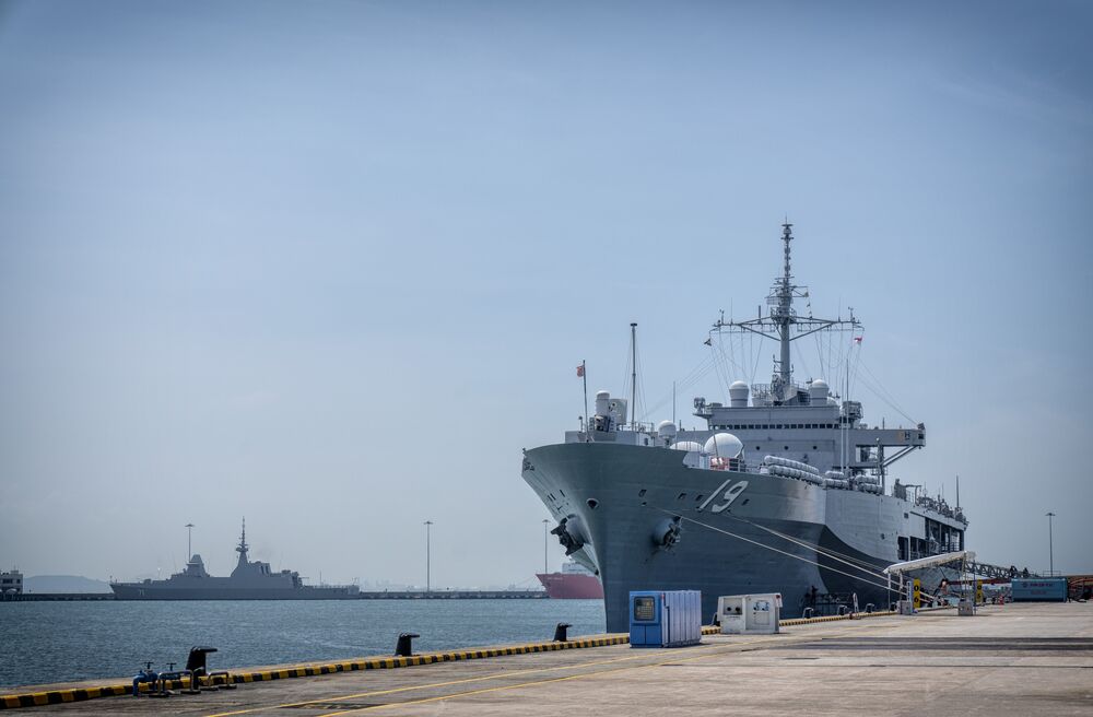
    The U.S. Navy’s USS Blue Ridge in Singapore on May 9.
    Photographer : Bryan van der Beek/Bloomberg

    The voice on the radio in the middle of the South China Sea follows a familiar script for Captain Eric Anduze, who helms the USS Blue Ridge. It’s China on the phone.

    They’ll contact us and they’ll go — ‘U.S. government vessel, this is Chinese Navy vessel’ number whatever — ‘we will maintain five miles from you and escort you as you make your transit,”’ Anduze said, describing the English-speaking voice from a rival Chinese warship.

    The U.S. response is short: “Chinese vessel, this is government vessel 1 9, copy, out.” From there on, silence, as the vessels of the world’s rival powers steam onward together.

    The ship-to-ship interactions are a regular potential flash point for the world’s two biggest militaries in contested waters. In September, a Chinese destroyer sailed within a football field’s distance of the USS Decatur in what the U.S. said was an “unsafe and unprofessional” maneuver. That hasn’t deterred future sailings — the U.S. sent two guided-missile destroyers within 12 nautical miles of disputed islands earlier this month.

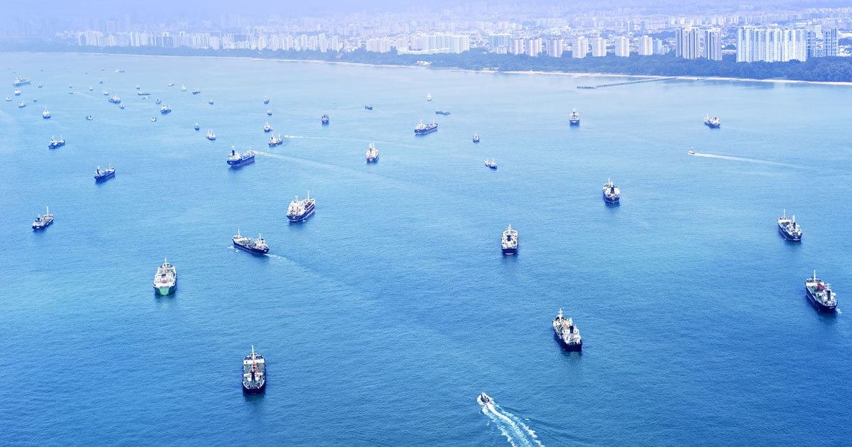
    Based in Japan, the Blue Ridge is a frequent traveler through the South China Sea, which Beijing considers its waters against an international community increasingly concerned by its encroachment. The area is home to key shipping lanes and fisheries that have sparked dispute between China and its neighbors.
    […]
    The U.S. Navy allowed media outlets, including Bloomberg, an inside look at the sort of ship it’s using to sail through the disputed waters. The oldest operational warship in the American Navy, the Blue Ridge is the flagship of the 7th Fleet, and docked in Singapore as part of a tour of southeast Asian port cities.

    The Blue Ridge is billed as one of the most technologically advanced ships in the world. It operates as a central information node for a fleet whose range stretches from the Indian-Pakistan border to the International Date Line in the Pacific Ocean. Through its several computers flow a database the Navy says gives it a “complete tactical picture of air, surface and subsurface contacts.” That’s what it does: it sails and it knows things.

    The ship is a small floating town of more than 1,000 sailors at any given time. There are beds and cafeterias, fitness centers and a post office. A miniature hospital has sick beds and an operating room, along with a dentist who can fill a cavity or pull a tooth — unless the waves get too rough. Up on deck, sailors can jog around a makeshift track around the ship, at about seven laps to a mile.

    Since February, Captain Anduze said the Blue Ridge has been escorted by Chinese vessels about six times in an almost unremarkable and now routine manner.

    In Washington, the view is that China uses “coercive tactics” including its naval and paramilitary vessels to enforce claims in the South China Sea, the Pentagon said last week in its annual report on China’s military power. Those are targeted “in ways calculated to be below the threshold of provoking conflict,” though have escalated into near-misses with U.S. warships.

    Naval officials on the Blue Ridge declined to comment in detail on those more aggressive encounters, except to say nothing similar had happened with them as they passed through the South China Sea’s shipping lanes.

    We have had ships that come about three to four miles away and then just navigate with us throughout the area,” Anduze said. Those interactions have been “very safe.

  • Marines seize an airfield and small island while testing tactics for fight against China
    https://www.marinecorpstimes.com/news/your-marine-corps/2019/03/21/marines-seize-an-airfield-and-small-island-alongside-special-opera


    Marines with Charlie Company, Battalion Landing Team, 1st Battalion, 4th Marines, run toward security positions during a live-fire range as part of the 31st Marine Expeditionary Unit’s simulated Expeditionary Advanced Base Operations, Camp Schwab, Okinawa, Japan, March 13, 2019.
    Gunnery Sgt. T. T. Parish/Marine Corps

    Marines with the 31st Marine Expeditionary Unit, or MEU, seized a small island and airfield with elite special operations airmen and soldiers as part of a test of its future fighting concept.

    That fighting concept, known as expeditionary advanced base operations, or EABO, will see Marines spread thinly across the vastness of the Pacific Ocean, operating from small bases — a tactic that will help Marines stay alive in a high-end fight with China.

    EABO is still in the early stages of experimentation. The concept recently was signed off by Commandant of the Marine Corps Gen. Robert B. Neller, but still awaits the signature of Chief of Naval Operations Adm. John Richardson.

    It’s a fight that will require assistance from the other services and the recent exercise that spanned March 11–14 included participation by U.S. Air Force 353rd Special Operations Group and soldiers with 1st Battalion, 1st Special Forces Group, according to details in a command release.
    […]
    The exercise kicked off with the insertion of Marine reconnaissance via a military free-fall jump over Ie Shima Training Facility on Ie Jima Island, which is located off the coast of Okinawa, Japan, according to details in a command release.

    Grunts with 1st Battalion, 4th Marines then carried out a long-range raid to seize the island’s airfield, moving nearly 600 miles by MV-22 Ospreys supported by KC-130 air refuelers, the command release detailed.

    • vu par RT.com qui souligne l’absence quasi complète d’écho médiatique.

      The US just ‘invaded’ an island in the East China Sea & no one noticed — RT Op-ed
      https://www.rt.com/op-ed/455053-souch-china-sea-invade-us


      FILE PHOTO An MV-22B Osprey tiltrotor aircraft flies over U.S. Marines on their way to checkpoint during a vertical assault on Ie Shima Island, Japan, March 24, 2017
      © Global Look Press / ZUMAPRESS.com/Charles Plouffe/U.S. Marines

      Just recently, the US military launched a full-on invasion of an island in the East China Sea to send a strong message to China, and yet barely any mainstream media outlet has covered the story or its massive implications.
      […]
      Media blackout
      No one will come right out and say it, but it certainly seems as though the US military is actively preparing for a third world war. If this media blackout on the implications of these recent developments wasn’t bad enough; even more bizarre is the complete silence from the media on the enormous geopolitical activity itself.

      A brief search of Google News reveals that only a handful of media outlets even covered the event, many of which are not typically regarded as internationally mainstream sources. A ProQuest search for media coverage of the story in fact returned zero results. The most prominent western outlet that covered the story is Business Insider, as well as a number of military sites.

      I cannot find any mention of this story on any of the major news sites, whether it’s CNN, MSNBC, the Guardian, BBC, the New York Times – take your pick. Remember that the adversarial, independent and free media who is entrusted with informing you and keeping you up to date barely even mentions geopolitical manoeuvres that could lead to a global conflict.

  • Dick Dale, the Inventor of Surf Rock, Was a Lebanese-American Kid from Boston
    https://www.newyorker.com/culture/postscript/dick-dale-the-inventor-of-surf-rock-was-a-lebanese-american-kid-from-bost

    Dale died on Saturday, at age eighty-one. It’s perhaps curious, at first glance, that a Lebanese-American kid from Boston invented a genre known as surf rock, but such is Dale’s story. He was born Richard Monsour in 1937; several decades earlier, his paternal grandparents had immigrated to the U.S. from Beirut.

    [...]

    Dale’s work was directly and mightily informed by the Arabic music that he listened to as a child. “My music comes from the rhythm of Arab songs,” Dale told the journalist George Baramki Azar, in 1998. “The darbukkah, along with the wailing style of Arab singing, especially the way they use the throat, creates a very powerful force.”

    • Puisque semi #Paywall :

      Dick Dale, the Inventor of Surf Rock, Was a Lebanese-American Kid from Boston
      Amanda Petrusich, The New-Yorker, le 18 mars 2019

      Like a lot of people in my generation, I heard Dick Dale’s “Misirlou” for the first time in the opening credits of Quentin Tarantino’s “Pulp Fiction.” It was 1994, I was fourteen, and my friend Bobby, who had both a license and a car, had driven us to the fancy movie theatre, the one with the un-ripped seats and slightly artier films. We were aspiring aesthetes who dreamed of one day being described as pretentious; by Thanksgiving, we had made half a dozen trips to see “Pulp Fiction.” Each time “Miserlou” played—and Tarantino lets it roll on, uninterrupted, for over a minute—I gripped my cardboard tub of popcorn a little tighter. I simply could not imagine a cooler way to start a movie. “Misirlou” is only two minutes and fifteen seconds long, all told, but it communicates an extraordinary amount of menace. Dale yelps periodically, as if he’s being hotly pursued. One is left only with the sense that something terrible and great is about to occur.

      Dale died on Saturday, at age eighty-one. It’s perhaps curious, at first glance, that a Lebanese-American kid from Boston invented a genre known as surf rock, but such is Dale’s story. He was born Richard Monsour in 1937; several decades earlier, his paternal grandparents had immigrated to the U.S. from Beirut. Dale bought his first guitar used, for eight dollars, and paid it off twenty-five or fifty cents at a time. He liked Hank Williams’s spare and searching cowboy songs—his stage name is a winking homage to the cheekiness of the country-music circuit—but he was particularly taken by the effervescent and indefatigable drumming of Gene Krupa. His guitar style is rhythmic, prickly, biting: “That’s why I play now with that heavy staccato style like I’m playing drums,” he told the Miami New Times, in 2018. “I actually started playing on soup cans and flower pots while listening to big band.” When he was a senior in high school, his family moved from Massachusetts to El Segundo, California, so that his father, a machinist, could take a job at Howard Hughes’s aerospace company. That’s when Dale started surfing.

      As far as subgenres go, surf rock is fairly specialized: the term refers to instrumental rock music made in the first half of the nineteen-sixties, in southern California, in which reverb-laden guitars approximate, in some vague way, the sound of a crashing wave. Though it is tempting to fold in bands like the Beach Boys, who often sang about surfing, surf rock was wet and gnarly and unconcerned with romance or sweetness. The important part was successfully evincing the sensation of riding atop a rushing crest of water and to capture something about that experience, which was both tense and glorious: man versus sea, man versus himself, man versus the banality and ugliness of life on land. Its biggest question was: How do we make this thing sound the way that thing feels? Surfing is an alluring sport in part because it combines recklessness with grace. Dale’s music did similar work. It was as audacious as it was beautiful.

      For six months, beginning on July 1, 1961, Dale set up at the Rendezvous Ballroom, an old dance hall on the Balboa Peninsula, in Newport Beach, and tried to bring the wildness of the Pacific Ocean inside. His song “Let’s Go Trippin’,” which he started playing that summer, is now widely considered the very first surf-rock song. He recorded it in September, and it reached No. 60 on the Hot 100. His shows at the Rendezvous were often referred to as stomps, and they routinely sold out. It is hard not to wonder now what it must have felt like in that room: the briny air, a bit of sand in everyone’s hair, Dale shredding so loud and so hard that the windows rattled. He was messing around with reverb and non-Western scales, ideas that had not yet infiltrated rock music in any meaningful way. Maybe you took a beer outside and let his guitar fade into the sound of the surf. Maybe you stood up close, near a speaker, and felt every bone in your body clack together.

      Dale’s work was directly and mightily informed by the Arabic music that he listened to as a child. “My music comes from the rhythm of Arab songs,” Dale told the journalist George Baramki Azar, in 1998. “The darbukkah, along with the wailing style of Arab singing, especially the way they use the throat, creates a very powerful force.”

      Dale was left-handed, and he preferred to play a custom-made Fender Stratocaster guitar at an indecent volume. (After he exploded enough amplifiers, Fender also made him a custom amplifier—the Dick Dale Dual Showman.) His version of “Misirlou” is gorgeously belligerent. Though it feels deeply American—it is so heavy with the energy of teen-agers, hot rods, and wide suburban boulevards—“Misirlou” is in fact an eastern Mediterranean folk song. The earliest recorded version is Greek, from 1927, and it was performed in a style known as rebetiko, itself a complex mélange of Orthodox chanting, indigenous Greek music, and the Ottoman songs that took root in Greek cities during the occupation. (A few years back, I spent some time travelling through Greece for a Times Magazine story about indigenous-Greek folk music; when I heard “Misirlou” playing from a 78-r.p.m. record on a gramophone on the outskirts of Athens—a later, slower version, recorded by an extraordinary oud player named Anton Abdelahad—I nearly choked on my cup of wine.)

      That a song written at least a century before and thousands of miles away could leave me quaking in a movie theatre in suburban New York City in 1994 is so plainly miraculous and wonderful—how do we not toast Dale for being the momentary keeper of such a thing? He eventually released nine studio albums, beginning in 1962 and ending in 2001. (In 2019, he was still touring regularly and had new dates scheduled for this spring and summer.) There’s some footage of Dale playing “Misirlou” on “Later…with Jools Holland,” in 1996, when he was nearly sixty years old. His hair has thinned, and he’s wearing a sweatband across his forehead. A feathery earring hangs from one ear. The dude is going for it in a big way. It feels like a plume of smoke is about to start rising from the strings of his guitar. His fingers never stop moving. It’s hard to see the faces of the audience members, but I like to think that their eyes were wide, and they were thinking of the sea.

      Amanda Petrusich is a staff writer at The New Yorker and the author of, most recently, “Do Not Sell at Any Price: The Wild, Obsessive Hunt for the World’s Rarest 78rpm Records.”

    • Dale’s work was directly and mightily informed by the Arabic music that he listened to as a child. “My music comes from the rhythm of Arab songs,” Dale told the journalist George Baramki Azar, in 1998. “The darbukkah, along with the wailing style of Arab singing, especially the way they use the throat, creates a very powerful force.”

  • China Military Threat: Seeking New Islands to Conquer - James Stavridis - Bloomberg
    https://www.bloomberg.com/opinion/articles/2019-02-21/china-military-threat-seeking-new-islands-to-conquer

    The constant refrain was simple: The West is becoming a less reliable partner. These allies are dismayed by a U.S. administration that has repeatedly criticized its closest partners and accused them of freeloading on defense. They are also worried about weakness and distraction of a Europe facing Brexit. This is compounded as they watch China increase pressure on Taiwan to accept a “one nation, two systems” deal a la Hong Kong and militarize the #South_China_Sea by constructing artificial islands.
    […]
    There is also a less-noticed but extremely worrisome aspect to China’s increasing boldness: It seems to be building its naval capability to dominate farther into the Pacific — as far as what Western analysts call the “second island chain.

    When thinking in a geo-strategic sense about China, the island-chain formulation is helpful. Since the 1950s, U.S. planners have delineated a first island chain, running from the Japanese islands through the Philippines, and down to the tip of Southeast Asia. Dominating inside that line has been the goal of China’s recent buildup in naval and missile capabilities. But U.S. officials warn that Chinese strategists are becoming more ambitious, set on gaining influence running to the second island chain — running from Japan through the Micronesian islands to the tip of Indonesia. As with its initial forays into the South China Sea, Beijing is using “scientific” missions and hydrographic surveying ships as the tip of the spear.

    Japan and Singapore are essentially anchors at the north and south ends the island chains. They have been integrating their defense capabilities with the U.S. through training, exercises and arms purchases. They are exploring better relations with India as the Pacific and Indian Oceans are increasingly viewed as a single strategic entity. This is a crucial element in the U.S. strategy for the region. But there are changes coming.

    First, there are expectations that China will eye the third island chain, encompassing Hawaii and the Alaskan coast before dropping south down to New Zealand. This has long been regarded as the final line of strategic demarcation between the U.S. and China. Second, some analysts are beginning to talk about a fourth and even fifth island chain, both in the Indian Ocean, an increasingly crucial zone of competition between the U.S. and China.

    Two obvious Indian Ocean chains exist. The first would run from southern Pakistan (where China has created a deep-water port at Gwador) down past Diego Garcia, the lonely atoll controlled by the U.K. from which the U.S. runs enormous logistical movements into Central Asia. As a junior officer on a Navy cruiser in the 1980s, I visited Diego Garcia when it was essentially a fuel stop with a quaint palm-thatched bar. The base has expanded enormously, becoming critical to supporting U.S. and British combat efforts in the Horn of Africa and Middle East.

    The fifth and final island chain could be considered to run from the Horn of Africa – where the U.S. and China now maintain significant military bases – down to the coast of South Africa. Little wonder the U.S. military has renamed its former Pacific Command as the Indo-Pacific Command.

    #Mer_de_Chine_méridionale

  • Le porte container Yantian Express (Hapag-Lloyd ) en feu avec ses 7500 containers à 1000 Km de la cote est du Canada

    https://gcaptain.com/hapag-lloyd-containership-yantian-express-on-fire-off-east-coast-of-canada
    https://www.hapag-lloyd.com/en/press/releases/2019/01/containers-caught-fire-on-board-the-yantian-express.html

    A fire has broke out aboard a Hapag-Lloyd containership in the North Atlantic off the east coast of Canada.

    In a statement posted to its website, Hapag-Lloyd said the fire started January 3 in one container on the deck of the Yantian Express and has spread to additional containers.

    Efforts to extinguish the fire were launched immediately but were suspended due to a significant deterioration of weather conditions.

    At the time of the update, the ship was located approximately 650 nautical miles off the coast of Canada.

    The crew of 8 officers and 15 seafarers are unharmed, Hapag-Lloyd said.

    The ship was sailing from Colombo, Sri Lanka to Halifax, via the Suez Canal, where it was expected to arrive on January 4, according to AIS ship tracking data. 

    The U.S. Coast Guard said Friday afternoon that it is coordinating the response efforts to ensure the safety of the crew.

    Another commercial vessel, Happy Ranger, was just 20 miles from the position of the Yantian Express and has diverted to provide assistance. A commercial tugboat is also en route.

    The Coast Guard said it is monitoring the situation. 

    The 7,510 TEU vessel 320-meters-long and is flagged in German flag. The ship operates in the East Coast Loop 5 (EC5) service. It was built in 2002.

    “It is still too early to make a precise estimate of any damage to the vessel or its cargo. Hapag-Lloyd is closely cooperating with all relevant authorities,” Hapag-Lloyd said.

    Both the Yantian Express and Happy Ranger are participating in the Automated Mutual-Assistance Vessel Rescue System (AMVER) program. 

    “Thanks to the participation of mariners in the AMVER system, we were able to coordinate a quick response,” said Petty Officer 1st Class Kelly Badal, operations unit watchstander at the Fifth District command center. “This system is crucial to coordinating nearby vessels to provide assistance when an emergency arises far from Coast Guard assets.”

    No pollution or injuries have been reported. 

    • The incident adds to a busy start to the year in terms of maritime accidents.
      On December 31, the car carrier Sincerity Ace suffered a fire with five fatalities in the Pacific Ocean between Japan and Hawaii. This ship is now abandoned, adrift and the fire continues on board.
      On January 1, the mega containership MSC ZOE lost an estimated 270 containers overboard in heavy weather in the North Sea. No injuries were reported. 
      On January 2, a 308-foot Chinese-flagged fish carrier, named Ou Ya Leng No. 6, ran aground on an uninhabited atoll in the Marshall Islands. Currently the crew of 24 remain on board the vessel. 

    • Yantian Express Abandoned in North Atlantic Due to Ongoing Container Fire – gCaptain
      https://gcaptain.com/yantian-express-abandoned-in-north-atlantic-due-to-ongoing-container-fire


      MV Yantian Express, sous son nom précédent _MV Shanghai Express, navire sous pavillon allemand

      The crew of the containership Yantian Express has been evacuated as the container fire continues to burn on board the ship in the North Atlantica, Hapag-Lloyd said in an update on Sunday.

      The fire started in one container on January 3rd and has since spread to other containers.

      Due to bad weather conditions, the fire has not been successfully contained and has significantly increased in intensity at times, according to Hapag-Lloyd. The salvage tug Smit Nicobar is on scene fighting the fire but as of the latest update, the fire had not been extinguished.

      The crew of the Yantian Express, comprised of 8 officers and 16 crew, has now been evacuated to the Smit Nicobar. All are unharmed, the company reported.

      The ship was last reported to be approximately 800 nautical miles off the coast of Canada (Nova Scotia).

      Further developments of the situation on the Yantian Express are being monitored closely, and the firefighting efforts with the salvage tug are ongoing,” Hapag-Lloyd said in its update.

      The company added that it could not make a precise estimate of any damage to the ship or its cargo.

  • AIS Animation Shows Commercial Response to Sincerity Ace Incident in Pacific Ocean – gCaptain
    https://gcaptain.com/ais-animation-shows-commercial-response-to-sincerity-ace-incident-in-pacif
    https://www.youtube.com/watch?v=eRZkXfl1Q4c

    We have obtained satellite AIS data showing the car carrier Sincerity Ace and the commercial response that followed after the vessel suffered a major fire during a voyage across the Pacific Ocean on New Year’s Eve.

    The satellite data is provided by exactEarth with the animation by Genscape Vesseltracker

    As we have reported, the fire broke out onboard the Panamanian-flagged MV Sincerity Ace on New Year’s Eve as it was approximately half way between Japan and Hawaii.

    Due to the remoteness of the location, about 2,000 miles northwest of Hawaii, crews of commercial vessels participating in the Automated Mutual-Assistance Vessel Rescue System (AMVER) we first to respond to the scene and helped rescue 16 of the 21 crew members on board.

    As of Wednesday, the search was continuing for two missing crew members. Three crew members were located in the water but could not be recovered as they were unresponsive.
    […]
    The Automated Mutual-Assistance Vessel Rescue System, or #AMVER, is a worldwide voluntary reporting system sponsored by the United States Coast Guard. It is a computer-based global ship reporting system used worldwide by search and rescue authorities to arrange for assistance to persons in distress at sea.

  • How to walk to LaGuardia Airport in New York City - Curbed NY
    https://ny.curbed.com/2018/12/6/18128031/how-to-walk-to-laguardia-airport-queens

    n a crisp and sunny autumn day, not long ago, I walked to LaGuardia Airport. I wasn’t one of those people you’ve seen on the news who get so panicked by gridlock on the Grand Central Parkway that they abandon their taxis and drag their wheelies across eight lanes of traffic and up the exit ramps to their terminals. I wasn’t even in a hurry. I didn’t have a plane to catch.

    I wasn’t going anywhere except the airport.

    Accompanied by Stanley Greenberg, a photographer whose primary interest is urban infrastructure, I walked to the airport simply to see if it could be done. It was an expedition, like Magellan circumnavigating the earth or Lewis and Clark trekking to the Pacific Ocean

    #photographie #aéroports un autre angle du #DFS

  • Macron at Sea Shows U.S.-France Ties Run Deeper Than Trump Spat - Bloomberg
    https://www.bloomberg.com/news/articles/2018-11-14/macron-at-sea-shows-u-s-france-ties-run-deeper-than-trump-spat

    France’s Emmanuel Macron is heading to sea on his biggest warship a day after he suffered a tirade of abuse from Donald Trump. The trip, planned for weeks, will show France’s alliance with the U.S. goes beyond any temporary disagreement between the presidents.

    France’s sole aircraft carrier, the Charles-de-Gaulle, the world’s most powerful vessel outside the U.S. navy, puts to sea Wednesday and will sail to the Indian Ocean early next year. It is starting a joint mission with the U.S. and an American frigate will escort it on the voyage, according the Elysee presidential palace.
    […]
    The French aircraft carrier will be part of what Macron has called an “Indo-Pacific Axis” — a strategy to expand France’s participation with a group of nations that includes Japan, Australia, India and the U.S.

    The countries, which are linked by military partnerships, are working to contain China’s maritime claims, keep shipping lines open and secure for trade in a region from Somalia to the Midway Atoll in the middle of the Pacific Ocean.

  • Russia detects missile launches from French frigate off Syria’s coast in Mediterranean — RT World News
    https://www.rt.com/news/438676-french-frigate-mediterranean-missiles


    © French Navy

    Russian airspace control systems registered missile launches from a French frigate in the Mediterranean on Monday, the Russian Defense Ministry reported.
    The French Navy’s newest frigate, FS Auvergne, fired rockets at around 8pm GMT on Monday, the Russian military said. “Airspace control has recorded rocket launches from the French frigate ’Auvergne,’” the ministry’s statement read. The ’Auvergne’ is deployed in the Mediterranean Sea, off the coast of Syria.

    Paris denied “any involvement in [the] attack,” a French army spokesman said, as cited by AFP.

    It is a ’European multi-purpose frigate’ (FREMM) which entered the service of the French Navy in February this year. Prior to its official commissioning, the Aquitaine-class warship underwent deployment across the globe, including the Mediterranean Sea, the Indian Ocean, the Persian Gulf, the South China Sea and the Pacific Ocean.

    The launch was detected at around the same time that air traffic controllers at Khmeimim Airbase “lost contact” with a military Il-20 aircraft during an attack by Israeli F-16 fighters on Latakia. Some 14 people were on board the plane at the time of the disappearance. A search and rescue mission is underway.

    The IDF has refused to comment on the report. Despite the fact that Israel rarely acknowledges striking specific targets inside Syria, earlier this month the IDF admitted hitting at least 202 “Iranian targets” in the country.

    As tensions over Idlib rise, Turkey and Russia on Monday agreed to establish a “demilitarized zone” between militants and government troops as part of an effort to clear the remaining jihadists from Syria.

  • Russia Is Hunting For Its Crashed Nuclear-Powered Cruise Missile And The U.S. Might Be Too - The Drive
    http://www.thedrive.com/the-war-zone/23058/russia-is-hunting-for-its-crashed-nuclear-powered-cruise-missile-and-the-u


    (je reprends ici l’intégralité de l’article, non accessible en France)

    Russia is reportedly set to launch an operation to recover a prototype of its Burevestnik nuclear-powered and nuclear-armed cruise missile that came down in the Barents Sea in 2017. At the same time, the wreckage presents a prime opportunity for other countries, particularly the United States, to gain major insights into its design and true capabilities.

    CNBC was first to report the Russian expedition, citing unnamed U.S. government sources with knowledge of an American intelligence report on the matter, on Aug. 21, 2018. These individuals said that the Kremlin would dispatch three unspecified ships, including one specially configured to recover the missile’s nuclear reactor, but said there was no set timeline for when the operation would begin or how long it might last. 
    Russia test-fired four Burevestniks in total between November 2017 and February 2018, according to the new information. The longest test flight reportedly lasted over two minutes and saw the weapon travel a total of 22 miles, while the shortest experiment saw the missile fail within seconds, but it still managed to cover a distance of five miles. The missile reportedly uses a nuclear reactor to power its propulsion system, giving it theoretically unlimited range.

    The Russians have otherwise been very tight-lipped about the design, which read more about here. So, it’s not surprising that they would want to recover any wrecks both to prevent foreign intelligence services from getting their hands on it and to gather more information for their test program.

    The official video below offers the best views of the Burevestnik cruise missile available to date.
    https://www.youtube.com/watch?v=IuwMsJlM-pg

    Though CNBC did not say which Russian ships might be heading out on the recovery mission, it is very possible that the Yantar might be among them. Officially an “oceanographic research vessel,” this spy ship has specialized equipment that can reportedly tap or cut submarine cables and investigate and retrieve objects from depths of up to 18,000 feet.

    In 2017, the vessel reportedly sailed off the coast of Syria to recover the remnants of two fighter jets, a Su-33 and a Mig-29KR, that crashed into the Mediterranean Sea during operations from Russia’s aircraft carrier Kuznetsov. In that case, the goal was also, at least in part, to make sure other countries could not retrieve the wrecks for their own purposes.

    In June 2018, the U.K.’s Royal Navy escorted Yantar through the English Channel as it headed into the North Sea. Pictures showed a Saab SeaEye Tiger deep-sea robot on the ship’s deck. Russia acquired this piece of equipment after the Kursk submarine disaster. The Tiger can reach depths of 3,280 feet and private companies have previously used them to do work at sites with heavy radioactive contamination.


    The Russian spy ship Yantar.

    It’s not clear what state the missile wreckage, or the weapon’s reactor, might be in. We at The War Zone have previously explored in detail what might happen if these weapons came down on land or over water after reports that they were crashing first emerged earlier in 2018. It’s also worth noting that these apparent failures might have been successes depending on the actual test points and would have provided Russia important information for further development of the Burevestnik regardless.

    Of course, if the weapon is at all salvageable, the race may be on for the Russians to get it off the bottom of the Barents Sea before anyone else does. The United States has already reportedly been keeping a close eye on the tests and could have a good idea of where the missiles have landed. 

    If they spread any substantial amount of radioactive material when they came down, it might make them even easier to locate. In February 2017, well before the reported test flights, a U.S. Air Force WC-135 atmospheric reconnaissance aircraft was flying around the Barents Sea on what the service has insisted was a routine mission. This coincided with reports of increased radioactivity in the region, but that might have been linked to leaking Russian nuclear waste facilities.

    That U.S. Navy has its own deep sea intelligence gathering and salvage capabilities, notably the super-secret Seawolf-class submarine the USS Jimmy Carter. In September 2017, again before Russia reportedly began firing Burevestniks, that boat returned to its homeport at Naval Base Kitsap-Bangor in Washington State flying a Jolly Roger flag, a symbol representing the completion of a particularly successful mission.


    USN
    The secretive USS Jimmy Carter flying a Jolly Roger flag as it returns to port in September 2017.

    The U.S. government has a long history of trying to steal sensitive Russian equipment from the bottom of the ocean, as well. In the 1970s, the Central Intelligence Agency famously used the Hughes Glomar Explorer to pull a portion of the Soviet Golf II-class ballistic missile submarine K-129 up from the depths of the Pacific Ocean.

    Getting ahold of or even examining pieces of a #Burevestnik, one of six super weapons Russian President Vladimir Putin highlighted in a speech in March 2018, would be a major coup for American intelligence agencies and the U.S. government’s foreign partners. NATO as a whole is also becoming more concerned with Russia’s aggressive policies and various advanced weapons developments, amid threatening training exercises, electronic warfare attacks, and deceptive information operations.

    All told, it might be worth keeping an eye on Yantar’s movements to see if she heads out into the waters above the Arctic Circle any time soon.

    Update: 5:20pm EST
    Canadian analyst Steffan Watkins has found that Russia’s Akademik Primakov, a seismic research vessel has been recently sailing a very deliberate pattern in the Kara Sea, which is to the east of the Novaya Zemlya archipelago. To the west of Novaya Zemlya is the Barents Sea and the area was home to Soviet nuclear weapon testing.


    @steffanwatkins
    Russian seismic research vessel Akademik Primakov (MMSI:273392760) is certainly looking for something in the Kara Sea at 5kn. (Before you get too excited, it could be mapping the Arctic shelf, to aid in Russian claims to it.)

    It is possible that the initial report of where the missile went down was inaccurate and that it instead crashed into the Kara Sea. However, as Watkins notes, the Akademik Primakov is more likely mapping the region. The Russian company JSC Sevmorneftegeofizika acquired the ship in June 2017 specifically to conduct geological exploration activities in the Arctic Shelf.

  • The Myth of Russia’s Arctic Rule
    https://mailchi.mp/9cdcff7c73de/taming-bureaucratic-beasts-in-china-1650757?e=752ba5eff2

    It’s clearly visible from this bird’s-eye view of the Arctic region.
     
    You can see here that Russia’s vast holdings of Arctic territory do not mitigate its lack of access to the world’s other oceans.
     
    Russian ships cannot get to the Pacific Ocean without passing the Chukchi Sea and the Bering Strait – both of which are off the coast of Alaska and thus securely under U.S. control.
     
    While the U.S. has only two icebreakers, it could shut down this shipping lane at will because it’s easily the world’s pre-eminent naval power.
     
    It’s more of the same for Russia with access to the Atlantic Ocean. To get to the Atlantic from the Arctic, Russian ships have to traverse waters between Iceland and Greenland, or between Iceland and the United Kingdom.
     
    Either way, it’s the same story – they are still susceptible to blockades from anti-Russian forces.
     
    These uncomfortable geopolitical realities make Russia’s position in the Arctic something of a trap. To make matters worse, with the accelerating Arctic ice melt, Russia’s geopolitical strategy in Europe is melting right along with it.
     
    The core of that strategy has been to establish buffer zones between Moscow and the North European Plain. This strategy is based in part on the idea that Russia has never had to worry about a potential threat to its Arctic coastline, as the Arctic Ocean has always been impossible for its enemies to traverse.
     
    But if Arctic ice melts enough to allow trade in the Arctic Ocean year round – as appears inevitable – that also means enemy navies would have much more room to operate.
     
    This explains why Russia has assumed a defensive posture when it comes to the Arctic.
     
    It also explains why Russia has been relatively cooperative in the region diplomatically.

    #arctique #Russie

    • La question est celle d’une route commerciale maritime. Sur l’axe majeur reliant l’Asie orientale à l’Europe (occidentale). De ce point de vue, les deux extrémités posent problème, les débouchés étant :
      • le détroit de Danemark dont il suffit de rappeler la bataille qui porte ce nom en 1941,…
      • la ligne GIUK et sa matérialisation physique par le SOSUS,
      • la mer du Nord comme sortie de la mer de Norvège, bordée de nations de l’OTAN
      pour l’autre côté, la mer des Tchouktches et la mer de Béring sont effectivement verrouillées comme indiqué dans l’extrait que tu pointes. Quant au reste de la façade orientale, située hors de la route maritime d’ailleurs,
      • la mer d’Okhotsk n’est pas libre de glaces en hiver (pour le moment…)


      • la mer du Japon (Vladivostok) est particulièrement fermée (Tsushima, 1905,…)

      Enfin, on parle ici de périphérie et, de ce point de vue, la facade « ouverte » de la mer de Béring est une périphérie particulièrement extrême. Petropavlosk-Kamtchatski, base des sous-marins russes est un bout du monde absolu. Tout doit y être acheminé d’une distance de plusieurs milliers de kilomètres.

      Voir à ce sujet, les effectifs engagés de part et d’autre dans la (très méconnue) bataille de Pétropavlosk en 1854
      https://fr.wikipedia.org/wiki/Si%C3%A8ge_de_Petropavlovsk
      (comme d’hab’, plus de détail sur WP[en]).

      De même pour les Aléoutiennes, campagne périphérique et manœuvre de diversion pendant la guerre du Pacifique.
      https://fr.wikipedia.org/wiki/Campagne_des_%C3%AEles_Al%C3%A9outiennes

      Quant à la vente de l’Alaska en 1867, on peut rêver – comme pour la Louisiane en 1803, mais on voit mal comment l’un et l’autre auraient pu résister au rouleau compresseur des jeunes États-Unis déferlant à la conquête de l’ouest. De ce point de vue, Alexandre II, comme Napoléon avant lui, a réussi à tirer un peu d’argent d’un territoire dont l’avenir sous son pavillon initial était plutôt désespéré. Imagine les péripéties d’un hypothétique Alaska russe en 1905, en 1917-1921, et après…

  • Exclusive: U.S. sorghum armada U-turns at sea after China tariffs
    https://www.reuters.com/article/us-usa-trade-china-sorghum-exclusive/exclusive-u-s-sorghum-armada-u-turns-at-sea-after-china-tariffs-idUSKBN1HR0

    Sorghum is a niche animal feed and a tiny slice of the billions of dollars in exports at stake in the trade dispute between the world’s two largest economies, which threatens to disrupt the flow of everything from steel to electronics.

    The supply-chain pain felt by sorghum suppliers on the Pacific, Atlantic and Indian oceans underscores how quickly the mounting trade tensions between the U.S. and China can impact the global agricultural sector, which has been reeling from low commodity prices amid a global grains glut.

    Twenty ships carrying over 1.2 million tonnes of U.S. sorghum are on the water, according to export inspections data from the USDA’s Federal Grain Inspection Service. Of the armada, valued at more than $216 million, at least five changed course within hours of China’s announcing tariffs on U.S. sorghum imports on Tuesday, Reuters shipping data showed.

    #sorgo #guerre_commerciale

    • China-bound U.S. sorghum diverted to Saudi Arabia, Japan | Agricultural Commodities | Reuters
      https://af.reuters.com/article/commoditiesNews/idAFL3N1S126K

      Four U.S. sorghum shipments initially bound for China have been diverted to other countries after Beijing’s move last week to impose hefty anti-dumping deposits on imports of the grain from the United States, according to trade sources and Reuters shipping data.

      Three of the cargoes are now sailing for Saudi Arabia after being sold to a private buyer, a U.S. trader and a Middle East-based trading source with knowledge of the matter said Tuesday. A fourth ship is heading to Japan, according to Reuters shipping data.
      […]
      Saudi Arabia is not a big sorghum importer, but it is the world’s 10th-largest buyer of corn. Some of the sorghum is expected to replace corn in animal feed rations.

      Japan is the second-largest market for U.S. sorghum, well behind top importer China which normally buys about 90 percent of all sorghum exported from the United States.

  • Japanese island’s mud could alter global economy: Study | Business Standard News
    http://www.business-standard.com/article/news-ians/japanese-island-s-mud-could-alter-global-economy-study-1180417002

    An estimated 16 million tonnes of mud containing massive, “semi-infinite” stores of valuable rare earth minerals, found in a small Japanese island in the Pacific Ocean could alter global economy, a new study has revealed.

    According to the study published by a team of Japanese researchers, this huge patch of mineral-rich deep sea mud lies near #Minamitori Island, 1,200 km off the coast of Japan, reports CNN.

    Rare earth minerals contain rare earth elements that are used in high-tech devices like smartphones, missile systems, radar devices and hybrid vehicles.

    For instance, #yttrium, one of the metals included in this recent discovery, can be used to make camera lenses, superconductors and cell phone screens.

    The 16 million tonnes of materials could contain 780 years worth of yttrium, 620 years worth of #europium, 420 years worth of #terbium and 730 years worth of #dysprosium.

    In other words, it “has the potential to supply these materials on a semi-infinite basis to the world”, the study said.

    According to the US Geological Survey, while the minerals are relatively abundant, they have “much less tendency to become concentrated in exploitable ore deposits”, making a find of this scale even more important.

    Most of the world’s supply of (#rare_earth_elements) comes from only a handful of sources,” CNN quoted a USGS report as saying.

    China currently holds a tight grip on the rare earth minerals — controlling about 95 per cent of global rare earths production as of 2015. Because of this, Japan and other countries rely on China to set prices and availability.

    However, Japan has complete economic control over the new supply, and the study said all indications are the new resource “could be exploited in the near future”.

    Even though Minamitori Island is more than a thousand miles away from the Japanese capital, it is still technically a part of Tokyo, in the village of Ogasawara, and falls within Japan’s economic borders.

    #terres_rares #Marcus_Island

  • Ex-U.S. Navy officers face negligent homicide charges over ship collisions
    https://www.reuters.com/article/us-usa-navy-collisions/u-s-navy-officers-face-possible-homicide-charges-over-ship-collisions-idUSK

    The commanding officers of two U.S. Navy destroyers involved in deadly collisions last year in the Pacific Ocean face courts-martial and military criminal charges including negligent homicide, the U.S. Navy said in a statement on Tuesday.

    Filing charges against the officers marks the Navy’s latest effort to address the problems that led to collisions involving its warships in Asia, in which 17 sailors were killed.

    The Navy has already dismissed several senior officers, including the commander of the Seventh Fleet, as a result of the collisions.

    Evidence supporting the charges against the commanders and several lower-ranking officers who served on the ships will be reviewed soon in investigative hearings, according to the Navy’s statement.

    The announcement of an Article 32 hearing and referral to a court-martial is not intended to and does not reflect a determination of guilt or innocence related to any offenses,” the statement added.

    The commanding officer of the USS John S. McCain guided missile destroyer, which collided with a merchant ship near Singapore in August, faces charges of dereliction of duty, hazarding a vessel and negligent homicide, the statement said.

    The commanding officer and three other officers on the USS Fitzgerald guided missile destroyer, which collided with a Philippine container ship in June, face charges including dereliction of duty, hazarding a vessel and negligent homicide, the Navy said.

  • How much trade transits the South China Sea? | ChinaPower Project

    https://chinapower.csis.org/much-trade-transits-south-china-sea

    The United Nations Conference on Trade and Development (UNCTAD) estimates that roughly 80 percent of global trade by volume and 70 percent by value is transported by sea. Of that volume, 60 percent of maritime trade passes through Asia, with the South China Sea carrying an estimated one-third of global shipping.1 Its waters are particularly critical for China, Taiwan, Japan, and South Korea, all of which rely on the Strait of Malacca, which connects the South China Sea and, by extension, the Pacific Ocean with the Indian Ocean. As the second-largest economy in the world with over 60 percent of its trade in value traveling by sea, China’s economic security is closely tied to the South China Sea.

    #chine #transport #transport_maritime #commerce_mondial

  • 99% of Australian Green Sea Turtles Studied Turning Female From Climate Change
    https://news.nationalgeographic.com/2018/01/australia-green-sea-turtles-turning-female-climate-change-r

    Since the sex of a sea turtle is determined by the heat of sand incubating their eggs, scientists had suspected they might see slightly more females. Climate change, after all, has driven air and sea temperatures higher, which, in these creatures, favors female offspring. But instead, they found female sea turtles from the Pacific Ocean’s largest and most important green sea turtle rookery now outnumber males by at least 116 to 1.

    #climat #épigénétique #tortues

  • Homeland Security Goes Abroad. Not Everyone Is Grateful. - The New York Times
    https://www.nytimes.com/2017/12/26/world/americas/homeland-security-customs-border-patrol.html

    An estimated 2,000 Homeland Security employees — from Immigration and Customs Enforcement special agents to Transportation Security Administration officials — now are deployed to more than 70 countries around the world.

    Hundreds more are either at sea for weeks at a time aboard Coast Guard ships, or patrolling the skies in surveillance planes above the eastern Pacific Ocean and the Caribbean Sea.

    The expansion has created tensions with some European countries who say that the United States is trying to export its immigration laws to their territory. But other allies agree with the United States’ argument that its longer reach strengthens international security while preventing a terrorist attack, drug shipment, or human smuggling ring from reaching American soil.

    “Many threats to the homeland begin overseas, and that’s where we need to be,” said James Nealon, the department’s assistant secretary for international engagement.

    #Etats-unis

  • Floating Guantanamos:
    The US Coast Guard is operating floating prisons in the Pacific Ocean, outside US legal protections | Public Radio International
    https://www.pri.org/stories/2017-11-24/us-coast-guard-operating-floating-prisons-pacific-ocean-outside-us-legal
    https://cdn1.pri.org/sites/default/files/styles/original_image/public/USCG_National_Security_Cutter_BERTHOLF_%28WMSL-750%29.jpeg?itok=j0savHeM

    Now, it turns out, there’s a secret US detention system in the War on Drugs, too — and this one is aboard US Coast Guard cutters sailing in the Pacific Ocean.

  • U.S. Has Three Aircraft Carriers in West Pacific for First Time in a Decade - Bloomberg
    https://www.bloomberg.com/news/articles/2017-10-26/u-s-has-three-carriers-in-west-pacific-for-first-time-since-07

    The U.S. Navy has three aircraft carriers and their assorted missile-carrying vessels deployed to the western Pacific Ocean for the first time in a decade as tensions with North Korea remain high and President Donald Trump prepares to depart for Asia next week.

    The milestone was reached Wednesday when the USS Nimitz and its strike group entered the Western Pacific region after operating in the Middle East, according to a Navy press release. The USS Theodore Roosevelt strike group, including a cruiser and three destroyers, entered the region Oct. 23, joining the USS Ronald Reagan.

    The high-profile deployments are part of a larger build-up. In addition to the aircraft carrier strike groups, capable of launching Tomahawk cruise missiles, the Navy announced Oct. 13 that the USS Michigan — one the service’s four specialized submarines for carrying as many as 66 Navy SEAL commandos and 154 Tomahawks — arrived in Busan, South Korea.

  • Tsunami carried a million sea creatures from Japan to US west coast | World news | The Guardian
    https://www.theguardian.com/world/2017/sep/29/tsunami-carried-million-sea-creatures-from-japan-to-us-west-coast?CMP=f

    The deadly tsunami that struck north-east Japan in 2011 has carried almost 300 species of sea life thousands of miles across the Pacific Ocean to the west coast of the United States.

    In what experts are calling the longest maritime migration ever recorded, an estimated one million creatures – including crustaceans, sea slugs and sea worms – made the 4,800-mile (7,725km) journey on a flotilla of tsunami debris.

    “This has turned out to be one of the biggest unplanned natural experiments in marine biology – perhaps in history,” said John Chapman, an expert at Oregon State University who co-authored a study of the creatures published this week in the journal Science.

    The towering tsunami, triggered by a 9.0 magnitude earthquake on the afternoon of 11 March 2011, generated five million tonnes of debris from the three prefectures of Iwate, Miyagi and Fukushima.

    About 70% sank quickly to the ocean floor, according to experts, but countless buoys, docks, boats and other items with buoyancy were swept out to sea.

    Between June 2012 and February this year 289 Japanese species attached to 600 pieces of debris washed up on beaches in the states of Washington, Oregon, California, Alaska and Hawaii, as well as in the Canadian province of British Columbia, according to the study.

    #tsunami #biologie_marine

    Comment le tsunami a provoqué une migration marine massive
    https://www.courrierinternational.com/article/environnement-comment-le-tsunami-provoque-une-migration-marin

  • Why Modern Cartographers Are So Impressed With This 16th-Century Map - Atlas Obscura

    http://www.atlasobscura.com/articles/tlacotapla-map-cartography-accuracy

    Merci à Thierry Joliveau pour le signalement.

    In February 1580, Francisco Gali was headed across Mexico to the Pacific Ocean. A mariner and cartographer who’d crossed the Pacific more than once, he had been living in “New Spain,” as Europeans called that part of the world, and was likely on another official mission that would take him to Asia. To sail out, first he had to make his way down the country’s Atlantic coast to manage a narrower crossing to the Pacific. On his journey, he passed through the coastal towns of the east, where the mayors had a special request of him. Make us a map, they asked.

    #cartographie #cartes_anciennes

  • #SpaceX va envoyer un super-ordinateur dans l’espace
    http://www.latribune.fr/technos-medias/spacex-va-envoyer-un-super-ordinateur-dans-l-espace-747010.html

    La société américaine SpaceX a prévu d’envoyer lundi 14 août sur la Station spatiale internationale (ISS) une cargaison comprenant un super-ordinateur, afin de tester sa capacité à fonctionner dans l’espace pendant un an, dans des conditions extrêmes.

    Le décollage du lanceur #Falcon_9, transportant la capsule Dragon, est prévu à 12h31 (16h31 GMT) depuis la base de Cap Canaveral, en Floride et les conditions météorologiques sont favorables 70%. La capsule Dragon transporte 2,9 tonnes de marchandises, dont un supercalculateur conçu par la société informatique américaine Hewlett Packard Enterprise (HPE).

    Le but de cette mission est de voir si l’ordinateur peut fonctionner dans des conditions extrêmes dans l’espace pendant un an, la durée qu’il faudrait à des astronautes pour atteindre Mars.

    Plus les astronautes parcourent de longues distances, plus le délai de transmission des communications devient important. Il faudrait au moins 20 minutes pour que des messages envoyés depuis Mars atteignent la Terre et autant de temps dans l’autre sens.

    « Un tel délai de communication rendrait toute exploration sur le terrain compliquée et potentiellement dangereuse si les astronautes sont confrontés à des scénarios de mission cruciaux qu’ils ne seraient pas en mesure de résoudre par eux-mêmes », explique le vice-président de HPE, Alain Andreoli, dans un communiqué.

    • SpaceX’s Dragon capsule successfully attached to ISS | TechCrunch
      https://techcrunch.com/2017/08/16/spacexs-dragon-capsule-successfully-attached-to-iss

      SpaceX’s latest International Space Station Resupply mission has completed its latest step, with the Dragon capsule launched on Monday loaded with over 6,400 pounds of supplies successfully docked. Dragon met up with the ISS early Wednesday morning, roughly 36 hours after launching from Kennedy Space Center aboard a Falcon 9 rocket.

      The Dragon capsule, whose payload includes experiments including a novel software-hardened HP supercomputer designed for eventual use in a Mars mission, was captured by the ISS’s robotic Canadarm appendage after matching orbit with the ISS as planned. The capsule will now remain docked at the ISS for roughly a month, as astronauts work to unload its cargo of supplies and experiments.

      Dragon will also be reloaded with 3,000 pounds of cargo destined for a return to Earth, including experimental results being ferried back for examination by researchers and scientists on the ground. The capsule will de-orbit and then splash down in the Pacific Ocean for recovery if all goes as planned.

      This is the last new Dragon capsule SpaceX will use for ISS resupply, if all goes to the private space company’s plan: from here out, SpaceX hopes to use only refurbished, reused Dragons it has flown and recovered before to run CRS missions for NASA.

    • SpaceX lands another one of its Falcon 9 rockets on solid ground - The Verge
      https://www.theverge.com/2017/8/14/16143306/spacex-falcon-9-rocket-launch-ground-landing-nasa-iss

      SpaceX has landed yet another one of its Falcon 9 rockets after launching the vehicle into space this afternoon. The rocket took off from Cape Canaveral, Florida, at 12:31PM ET, bound for the International Space Station. Around eight minutes after takeoff, the majority of the vehicle landed back on solid ground off the Florida coast. It marks the 14th successful rocket landing for SpaceX, and the sixth time a Falcon 9 has successfully touched on solid ground post-launch.

      In fact, SpaceX has yet to lose a rocket during a ground landing. The company has lost a few vehicles during ocean landings, when the rockets attempted to touch down on autonomous drone ships at sea. But all six Falcon 9s that have landed on solid ground have touched down just fine at SpaceX’s Landing Zone 1 — a ground-based landing site at Cape Canaveral.

  • Climate change causes glacial river in Yukon to change direction - Technology & Science - CBC News
    http://www.cbc.ca/news/technology/climate-change-yukon-river-piracy-1.4070153?cmp=rss

    Climate change has caused the massive Kaskawulsh Glacier in the Yukon to retreat so much that its meltwater abruptly switched direction, in the first documented case of “river piracy” in modern times.

    Instead of flowing into the Slims River and then north to the Bering Sea, the water has changed course and now flows south toward the Kaskawulsh River, the Gulf of Alaska and the Pacific Ocean, scientists have found.

    Also known as stream capture, river piracy is a term used to describe a geologic phenomenon where a stream or river is diverted toward another body of water. It’s usually caused by a dramatic tectonic event, such as a landslide or glacial dam collapse.

    #climat #rivière

  • The geology of the Beagle voyage | Darwin Correspondence Project
    https://www.darwinproject.ac.uk/commentary/geology/geology-beagle-voyage

    Via Phil Taylor‏ @ScienceAndMaps sur Twitter

    The primary concern that linked much of Darwin’s geological work in the Beagle years was to understand the changing relation between the levels of land and sea. In this he followed the example of the Scottish geologist Charles Lyell, whose three-volume Principles of Geology Darwin read during the voyage. Lyell argued that the history of movements in the earth’s crust should be (and could be) explained as the result of earthquakes, volcanoes, erosion, and other processes operating at the same intensity in the past as they did in the present. The earth had existed for long enough, Lyell claimed, that an accumulation of small changes could have enormous effects, even the raising of new continents from the ocean. As Darwin studied the shores of South America and discovered shells inland at thousands of feet above sea level, he became convinced that the continent had been uplifted in just such a gradual manner. His conviction was strengthened in February 1835, when he was witness to an earthquake that raised the harbour at Concepcion, Chile, several feet out of the Pacific Ocean.

    #cartographie #esquisses