# PALESTINE /// Cartographic Representation of the Bombings’ “Atmospheric” Impact in Gaza | The Funambulist
▻http://thefunambulist.net/2014/08/15/palestine-cartographic-representation-of-the-bombings-atmospheric-im
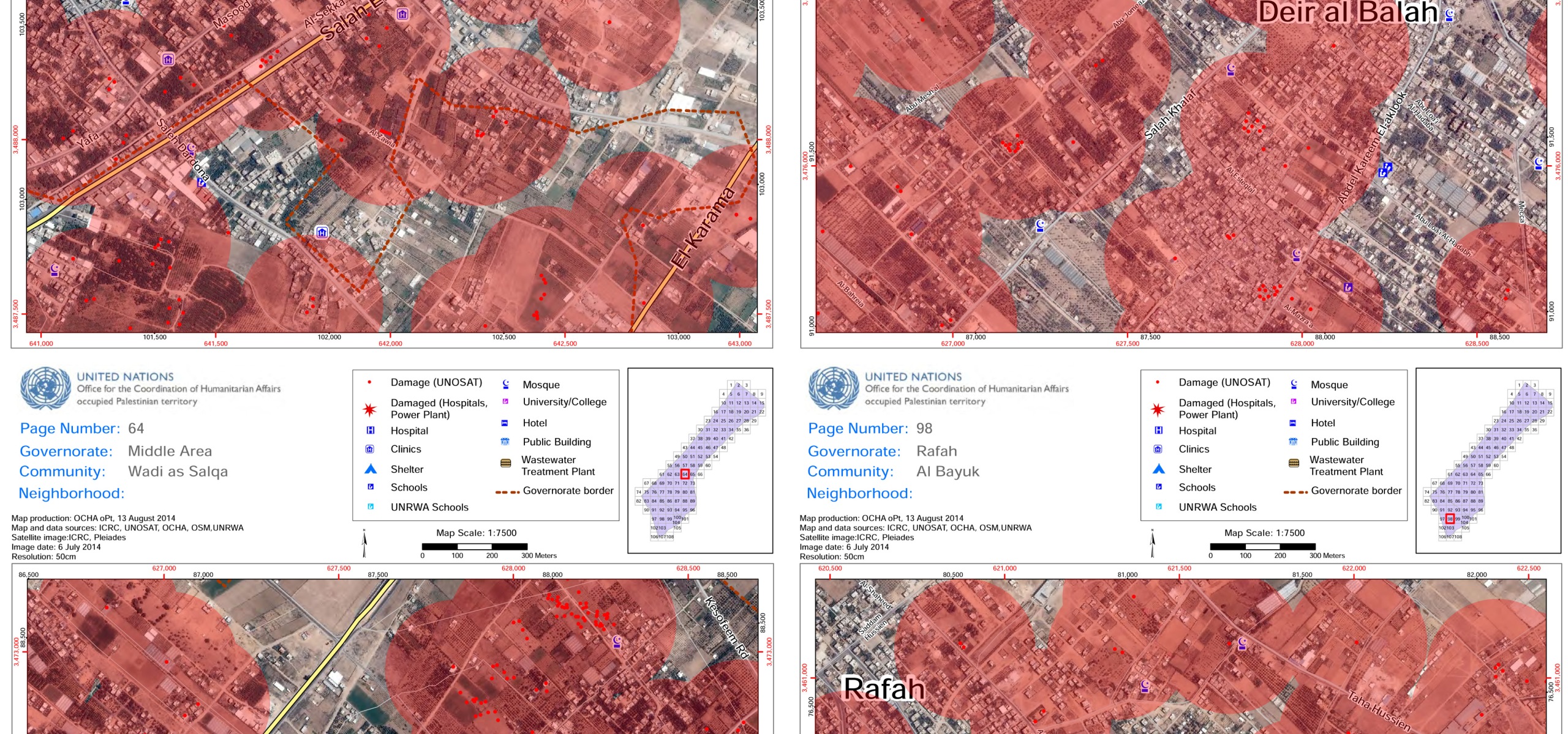
When it comes to the Israeli enforced organization of space in the West Bank and Gaza, one can always turns towards the UN Office for Coordination of Human Affairs in the Occupied Palestinian territories and the regularly updated maps they provide coupled with a multitude of important data. OCHA just released a 120-page “Gaza Crisis Atlas” that superimposes recent satellite photographs of the Gaza strip and their analyses in terms of damage imposed by the Israeli army bombing/shelling of this last month. Each red dot on these documents represents a destroyed structure, and it does not take much time to realize the amplitude of the bombings’ impact on the ground as red dots populate each page of the ‘atlas.’