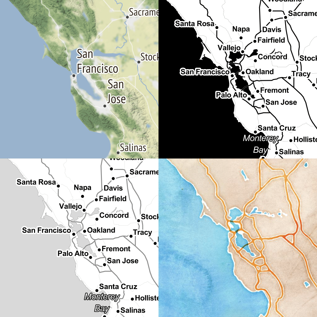
Seenthis
•
 
Identifiants personnels
  • [mot de passe oublié ?]

 
  • #t
  • #ti
RSS: #tiles

#tiles

  • #tilestache
  • b_b @b_b 22/05/2013 13:12
    1
    @fil
    1
    @fil

    Creating .#mbtiles DB for iOS MapBox from hi-res #map image
    http://martinsikora.com/creating-mbtiles-db-for-ios-mapbox-from-hi-res-map-image

    So, I made a simple bash script that takes all sizes you specify and first scales the original picture and then splits it into smaller pieces 256x256 each... With that in mind I made another Python script that takes our #tiles and puts them into one SQLite database.

    De quoi générer un fichier mbtiles à partir d’une grande image comme l’a fait @fil dernièrement.

    b_b @b_b
    Écrire un commentaire

  • b_b @b_b 17/05/2013 21:36
    5
    @rastapopoulos
    @fil
    @baroug
    @7h36
    @oeil_de_chat
    5

    Inkscape and MapBox for Interactive, Illustrated maps | MapBox
    http://www.mapbox.com/blog/the-making-of-our-infrastructure-map

    I ran this shell script, which automatically assembled the PNG tiles into an #mbtiles file.

    Intéressant ce script pour générer un fichier mbtiles à partir d’une sérié d’#images.

    #map #mapserver #tilestache

    b_b @b_b
    • RastaPopoulos @rastapopoulos CC BY-NC 17/05/2013 22:34

      Ces gens sont assez géniaux.

      RastaPopoulos @rastapopoulos CC BY-NC
    • Fil ☂ @fil 17/05/2013 23:36

      hé ho moi aussi j’ai fait un shell script pour http://madmeg.org/delizie
      #jaloux

      Fil ☂ @fil
    • b_b @b_b 18/05/2013 11:57
      @fil

      héhé @fil je pensais justement à un truc dans le style :

      ton script + le script cité ici + tilestache + http://tiles.kupaia.fr = de la boulette

      #truc_de_fourbe

      b_b @b_b
    • RastaPopoulos @rastapopoulos CC BY-NC 18/05/2013 13:17

      Ouais, j’ai pensé exactement à la même chose, les gens.

      RastaPopoulos @rastapopoulos CC BY-NC
    • Fil ☂ @fil 21/05/2013 22:05

      ok je viens de lire la doc de mbtiles (http://www.mapbox.com/developers/mbtiles), et je vois que ça va m’aider à résoudre un autre problème, celui de l’internationalisation du dessin ; là j’ai traité le dessin en trois langues déjà, et on en projette plein d’autres… pour l’instant ça me fait 4000 images par langue, alors que la plupart des zones sont inchangées (les légendes à traduire sont sur 1% de la surface)…

      • #mobile devices
      Fil ☂ @fil
    • Fil ☂ @fil 21/05/2013 23:23

      bon voilà j’ai fait un fichier .mbtiles à partir de #mbutil.py, que j’ai dû forker pour le faire « compresser »…
      https://github.com/Fil/mbutil/commit/a0b04d1315466fb68125028171621142757efa23

      (A noter, la compression de l’image ne me gagne que 0,3% d’espace. Mais quand je mettrai dans une même base toutes les langues, ça devrait augmenter très peu à chaque langue.)

      Fil ☂ @fil
    Écrire un commentaire

  • b_b @b_b 28/03/2013 10:02
    2
    @fil
    @rastapopoulos
    2

    stamen design | Announcing here.stamen.com
    http://content.stamen.com/here.stamen.com

    “The exercise started with some code that our friend and former colleague Mike Migurski started playing with about a year ago to extract HERE data from their 3D tiles.”

    On s’amuse chez stamen...

    http://content.stamen.com/files/here.stamen.com/nyc_downtown.jpg

    http://content.stamen.com/files/here.stamen.com/nyc_nypl.jpg

    http://content.stamen.com/files/here.stamen.com/sf_downtown_watercolor.jpg

    #map #tiles #3d #design

    • #San Francisco
    • #London
    • #New York
    • #Berlin
    b_b @b_b
    • RastaPopoulos @rastapopoulos CC BY-NC 28/03/2013 11:03

      Impressionnant les trucs en photos 3D.

      RastaPopoulos @rastapopoulos CC BY-NC
    Écrire un commentaire

  • b_b @b_b 22/03/2013 14:23

    DATA.SHOM.FR
    http://data.shom.fr

    Un outil du SHOM qui permet de visualiser pas mal de données carto maritimes (reste à voir quelles couches sont dispos en open pour jouer avec dans nos cartes). Dommage d’utiliser un truc en flash pour ça par contre...

    #map #data #tiles

    b_b @b_b
    Écrire un commentaire

  • b_b @b_b 16/03/2013 11:36

    the liberty of postgreslessness: tiled vectors in mapnik (tecznotes)
    http://mike.teczno.com/notes/postgreslessness-mapnik-vectiles.html

    Data is one of OpenStreetMap’s biggest pain points. The latest planet file is 27GB, and getting OSM into the Postgres database can be a long and winding road. Vectored tiles offer a way forward, and Mapnik is growing features to support them. I’m also thinking about how vectors could be used with Mapnik directly to render bitmaps without needing direct access to a spatial data base. MVT (Mapnik Vector Tiles) is my first attempt at a sensible file format.

    http://mike.teczno.com/img/mvt-renders/map-z15.png

    #map #mapserver #tilestache #geojson

    • #MVT
    b_b @b_b
    Écrire un commentaire

  • Fil ☂ @fil 12/03/2013 17:02
    4
    @rastapopoulos
    @reka
    @b_b
    @oeil_de_chat
    4

    Scaled Data Value Design in TileMill | MapBox
    http://mapbox.com/blog/scaled-data-value-design-in-tilemill

    Scaled data values can ensure that a user’s eyes are drawn to important data points rather than geographical anomalies associated with many choropleth maps,

    http://farm9.staticflickr.com/8101/8552086506_89764d9c8d_o.png

    #cartographie #mapbox #tilemill

    • #United States Department of Agriculture
    Fil ☂ @fil
    • b_b @b_b 23/03/2013 11:28

      #map #tiles

      b_b @b_b
    Écrire un commentaire

  • Fil ☂ @fil 12/12/2012 10:08
    1
    @b_b
    1
    @mad_meg

    #ImageMagick convert -crop
    http://www.imagemagick.org/Usage/crop/#crop_tile

    convert rose: -crop 20x20 \
    -set filename:tile „%[fx:page.x/20+1]%[fx:page.y/20+1]” \
    +repage +adjoin „rose_tile
    %[filename:tile].gif”

    #leaflet #cartographie #images pour un projet artistique de @mad_meg
    https://dl.dropbox.com/s/lg4vbkmvax4ba97/tile_18_17.png

    • #Facebook
    Fil ☂ @fil
    • mad meg @mad_meg CC BY 13/12/2012 23:00

      Il porte bien son nom ce #ImageMagick

      mad meg @mad_meg CC BY
    • b_b @b_b 14/02/2013 12:42

      #map #tiles

      b_b @b_b
    Écrire un commentaire

  • b_b @b_b 3/11/2012 14:11
    2
    @fil
    @magik
    2
    @fil

    HUGEpic
    http://hugepic.io

    When you want to upload HUGE pictures that you can zoom in on like a map.

    Un service en ligne pour afficher une grande image sous forme de tuiles dans une carte leaflet. Bon, on sais déjà le faire à la mano avec Maptiler et u peu de bidouille, mais là ça semble bien plus simple pour tester. Ça devrait intéresser @fil ;)

    #map #images #leaflet #tiles

    b_b @b_b
    • Fil ☂ @fil 3/11/2012 15:14

      le code (en python) est sur github https://github.com/peterbe/tiler

      Fil ☂ @fil
    • grommeleur @grommeleur 4/11/2012 22:54

      A subway map for the history of science
      http://hugepic.io/8e2fc2cd5
      Pour aller de James Watt à Ada Lovelace, changer à Joseph Fourier ou à Joseph-Louis Lagrange.

      grommeleur @grommeleur
    Écrire un commentaire

  • b_b @b_b 28/09/2012 20:16
    1
    @baroug
    1

    Largest photographs in the world - Wikipedia, the free encyclopedia
    http://en.wikipedia.org/wiki/Largest_photographs_in_the_world

    Une page qui recense des grandes images, on cause en gigapixels là :p

    Au passage on y apprend que la plus grande photographie réalisée est un sténopé de 34mx10m !

    #images #large #tiles

    • #California
    b_b @b_b
    Écrire un commentaire

  • b_b @b_b 27/08/2012 21:51
    2
    @fil
    @stephane
    2

    Mapping Mars with Open Planetary Data | MapBox
    ►http://mapbox.com/blog/2012-08-26-mapping-mars

    “Inspired by the Mars Curiosity rover, I set out to map Mars using all open source tools (like QGIS and TileMill) and open data. The results of these tools and awesome data are stunning. The first shows Mars as “the red planet,” and the second map uses a more divergent color ramp to show Mars’ topographical variation.”

    Toujours à fond chez #mapbox, cette fois ils nous pondent des cartes de Mars.

    #map #mars #tiles #gdal #tilemill #topography

    • #open source tools
    • #Mars Science Laboratory
    b_b @b_b
    • Fil @fil 27/08/2012 22:57

      http://farm9.staticflickr.com/8446/7860373568_c1c67aa448_c.jpg
      #espace #cartographie

      Fil @fil
    Écrire un commentaire

  • b_b @b_b 20/08/2012 13:08
    3
    @kent1
    @fil
    @dchionne
    3

    Images as Maps - macwright.org
    http://macwright.org/2012/08/13/images-as-maps.html

    “This is a Python script: download it as a raw file, name it togeo.py. You’ll need GDAL for it to work – not necessarily the ‘python bindings’, but make sure that, in your terminal, gdal_translate and gdalinfo are present.”

    Un script python pour convertir une image jpeg au format GeoTIFF afin de pouvoir l’utiliser comme fond de carte.

    #map #python #images #tiles

    • #Python
    • #jpeg
    b_b @b_b
    • (⊙.⊙)☂ @fil 20/08/2012 13:49

      #cartographie

      (⊙.⊙)☂ @fil
    Écrire un commentaire

  • b_b @b_b 25/07/2012 12:11
    1
    @fil
    1

    Maps – JOSM
    http://josm.openstreetmap.de/wiki/Maps

    “This wiki page provides imagery sources for JOSM. You can add more WMS and TMS servers to the list below, but make sure, they can be used for OpenStreetMap.” Des tuiles à la pelle...

    #map #leaflet #gis #tiles

    b_b @b_b
    Écrire un commentaire

  • b_b @b_b 29/06/2012 10:06
    1
    @fil
    1

    Code : Flickr Developer Blog » The great map update of 2012
    http://code.flickr.com/blog/2012/06/29/the-great-map-update-of-2012

    Flickr design ses propres tuiles basées sur les données OSM dans Tilemill et devrait bientôt switcher vers Leaflet, plein de bonnes choses à venir.

    Today we are launching Buenos Aires and Santiago in a new style. We will be launching more cities in this new style in the near future. They are built from more recent OSM data and they will also have an entirely new style which we call Pandonia. Our new style was designed in TileMill from the osm-bright template, both created by the rad team at MapBox.

    https://github.com/flickr/Pandonia

    To host all of these new tiles we needed to find a flexible javascript api. Cloudmade’s Leaflet is a simple and open source tile serving javascript library... We have a fork on GitHub which we plan to contribute to as time goes on. We’ll keep you posted.

    https://github.com/flickr/Leaflet

    #map #tiles #leaflet #tilemill

    • #JavaScript
    • #Buenos Aires
    • #Santiago
    • #API
    b_b @b_b
    Écrire un commentaire

  • b_b @b_b 3/05/2012 12:03
    2
    @fil
    @rastapopoulos
    2

    Ça faisait un moment que je voulais tester la mise en place d’un serveur de tuiles. Après avoir lu pas mal de pages à ce sujet j’ai choisi d’utiliser TileStache (développé par les gens de Stamen).

    Ma collection de liens et commentaires en vrac sont ici : http://labo.eliaz.fr/spip.php?article97

    Et comme je suis sympa, je vous ai rédigé un petit tutoriel pour installer TileStache sur votre serveur : http://www.weblog.eliaz.fr/article115.html

    #map #mapserver #tilestache

    • #TileStache
    b_b @b_b
    • b_b @b_b 4/05/2012 17:04
      @seenthis

      what the fuck @seenthis c’est quoi ce favicon attribué autofoireusement à mon site ? ^^

      b_b @b_b
    Écrire un commentaire

  • b_b @b_b 20/04/2012 16:38
    2
    @fil
    @rastapopoulos
    2

    Interview : Mike Migurski - Paul Smith
    http://pauladamsmith.com/blog/2012/03/migurski.html

    Interview de Mike Migurski auteur de TilesTache et de la fameuse carte en watercolor qui a fait du bruit dernièrement. L’article comporte un lien vers une autre page ou le procédé de génération de la carte watercolor est détaillé.

    #mapserver #map #tilestache

    • #Mike Migurski
    • #Paul Smith Interview de Mike
    • #Stamen
    • #Python
    b_b @b_b
    • Fil ☂ @fil 20/04/2012 18:03

      #art et #cartographie, aussi

      Fil ☂ @fil
    • Fil ☂ @fil 22/04/2012 01:13

      avec des liens explicatifs ici
      http://otherthings.com/blog/2012/03/stamens-watercolor-maps

      et ici
      http://content.stamen.com/watercolor_process

      http://content.stamen.com/files/london-sample-12.jpg

      • #London
      Fil ☂ @fil
    • Fil ☂ @fil 23/04/2012 14:25

      et comment ils ont produit les textures
      http://content.stamen.com/watercolor_textures

      • #final product
      Fil ☂ @fil
    Écrire un commentaire

  • b_b @b_b 22/02/2012 18:32

    Vizzuality/cartodb - GitHub
    https://github.com/Vizzuality/cartodb

    With CartoDB, you can upload your geospatial data (Shapefiles, GeoJSON, etc) using a web form and then make it public or private. After it is uploaded, you can visualize it in a table or on a map, search it using SQL, and apply map styles using CartoCSS. You can even access it using the CartoDB Maps API and SQL API, or export it to a file.

    Un truc qui fait penser à Tilemill. Un jour j’aurai le temps de m’intéresser à tout ça en détail, un jour...

    #map #tiles #server #opensource #gis

    • #Github
    • #CartoDB Gallery
    • #web form
    • #SQL
    • #CartoDB Maps
    • #Mac OS X
    • #Ubuntu
    b_b @b_b
    Écrire un commentaire

  • b_b @b_b 23/11/2011 13:51

    fortiusone/acetate - GitHub
    https://github.com/fortiusone/acetate

    Enfin des tiles qui ont de la gueule pour OSM ! Et hop on branche geodiversité là dessus :)

    Acetate is a set of stylesheets that are designed specifically for geographic data visualization. It includes several layers: topographic basemap, hillshading, roads, placenames. These layers can be used individually in combination in layering with thematic data, or composited together into a single image.

    #map #openlayers #osm #tiles

    • #Github
    b_b @b_b
    Écrire un commentaire

Thèmes liés

  • #cartographie
  • #gis
  • Company: Github
  • #imagemagick
  • #images
  • #leaflet
  • #map
  • #mapbox
  • #mapserver
  • #mbtiles
  • #tilemill
  • #tilestache