NASA releases images of dramatic deforestation in Cambodia
▻https://news.mongabay.com/2017/01/nasa-releases-images-of-dramatic-cambodia-deforestation
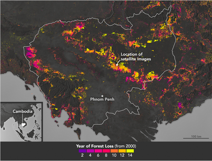
Cambodia has one of the world’s highest rates of deforestation, losing a Connecticut-size area of tree cover in just 14 years. This week, NASA released before-and-after satellite images of plantation expansion in central Cambodia that provide a dramatic example of the Southeast Asian country’s fast-paced land cover changes.
Ringed by Thailand, Laos, and Vietnam, Cambodia was once covered in lush rainforests. In them lived now-Endangered animals like Indochinese tigers (Panthera tigris corbetti), wild cattle called banteng (Bos javanicus), and two species of colorful monkeys called doucs, as well as many other kinds of plants and animals.
However, forest conversion for agriculture and other purposes has reduced wildlife habitat significantly, and tigers are now regarded as functionally extinct in Cambodia. According to the UN’s Food and Agriculture Organization (FAO), just 3 percent of Cambodia’s forests were primary as of 2015. And data from the University of Maryland (UMD) visualized on the forest monitoring platform Global Forest Watch shows tree cover loss skyrocketed over the past decade, from around 28,500 hectares lost in 2001 to nearly 238,000 hectares lost in 2010. In total, the data indicate Cambodia lost around 1.59 million hectares from 2001 through 2014 – an area a little larger than the U.S. state of Connecticut, including 38 percent of its intact forest landscapes. Only one intact forest landscape (IFL) remains in the country; IFLs are areas of original land cover that are large and undisturbed enough to retain all their native biodiversity.