


OSM first to honour plate tectonics | OpenStreetMap Blog
▻https://blog.openstreetmap.org/2017/04/01/osm-plate-tectonics
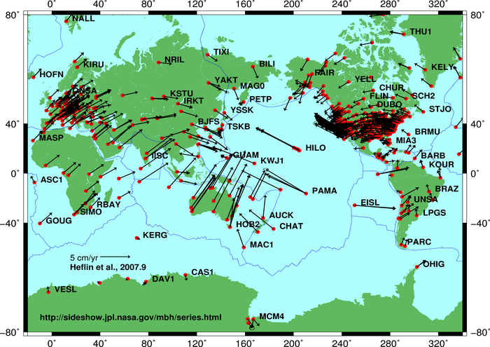
This movement can amount to up to 10 centimetres per year. Luckily, models exist that tell us just how much the earth is moving at any given location. And of course our data model provides us not only with the latitude and longitude of a point, but also with the time when it was entered. Assuming the data was correct at the time of entering OpenStreetMap, we can compute exactly how much that particular point has moved in the time since it was entered, and we can update the coordinates accordingly.
