


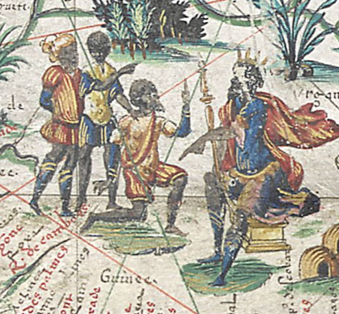
Map of the known world comissioned by Henry II of France in 1550
The British Library MS Viewer
▻http://www.bl.uk/manuscripts/Viewer.aspx?ref=add_ms_24065_f001r
 https://dl.dropbox.com/s/gmoryszvooc30vr/Capture%20d%E2%80%99%C3%A9cran%202017-06-29%20%C3%A0%2010.35.51.png?dl=0
  https://dl.dropbox.com/s/8zp3pbls6hltk75/Capture%20d%E2%80%99%C3%A9cran%202017-06-29%20%C3%A0%2010.35.32.png?dl=0
 1550, Map of the known world comissioned by Henry II of France (r. 1547–59) or the Duc de Montmorency. One of the earliest maps to show Canada and Australia (‘Terre Australle’). Includes twenty-six long descriptive texts, for which no other source is known.Decoration:Hand-painted illustrations of cities, kings, exotic peoples, animals, ships, and sea-monsters. Arms of King Henry II of France (lower left corner of the map) and the Duc de Montmorency (lower right).
1550, Map of the known world comissioned by Henry II of France (r. 1547–59) or the Duc de Montmorency. One of the earliest maps to show Canada and Australia (‘Terre Australle’). Includes twenty-six long descriptive texts, for which no other source is known.Decoration:Hand-painted illustrations of cities, kings, exotic peoples, animals, ships, and sea-monsters. Arms of King Henry II of France (lower left corner of the map) and the Duc de Montmorency (lower right).
#cartographie #cartes_anciennes #cartographie_anciennes #cartographie_historique