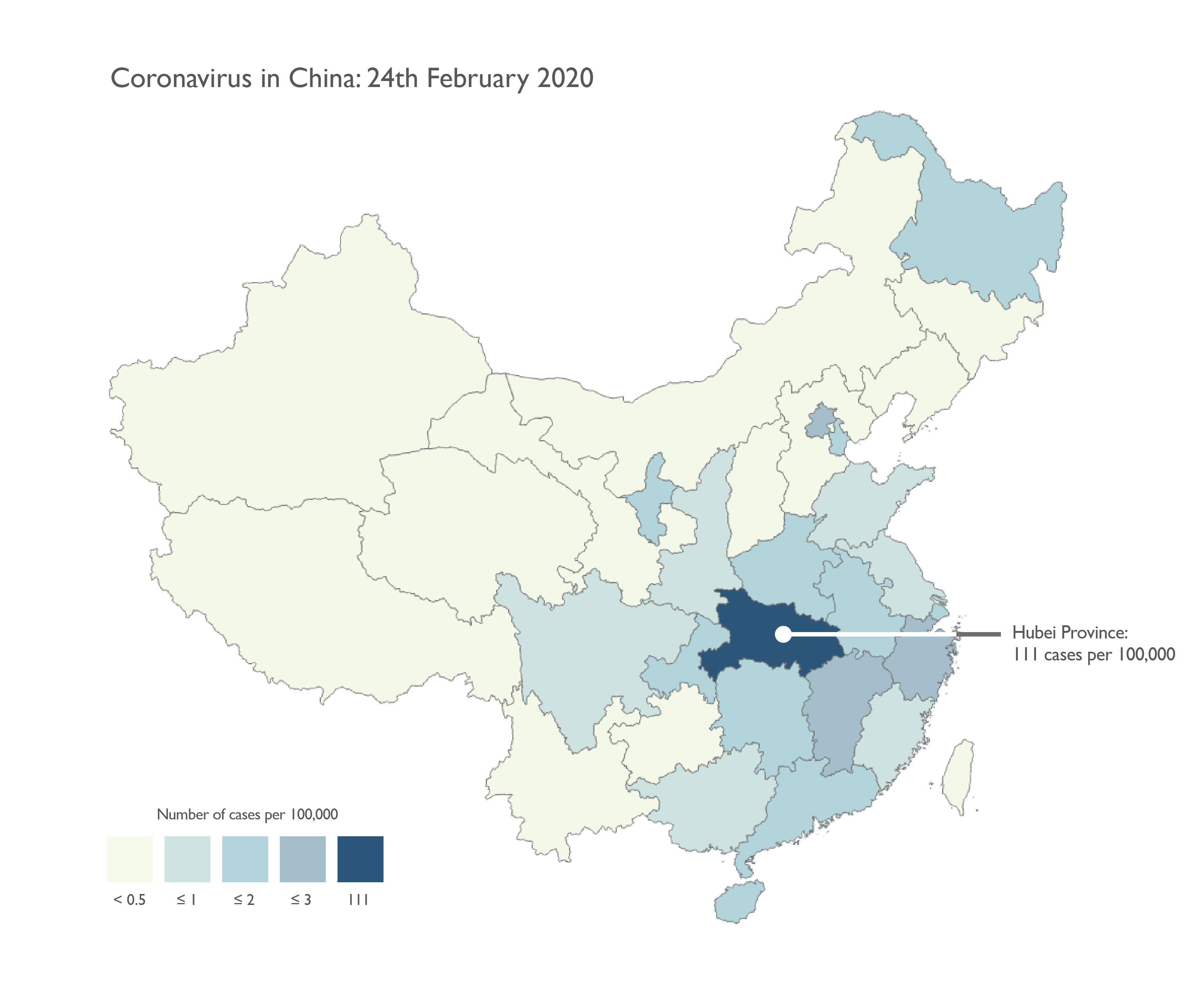
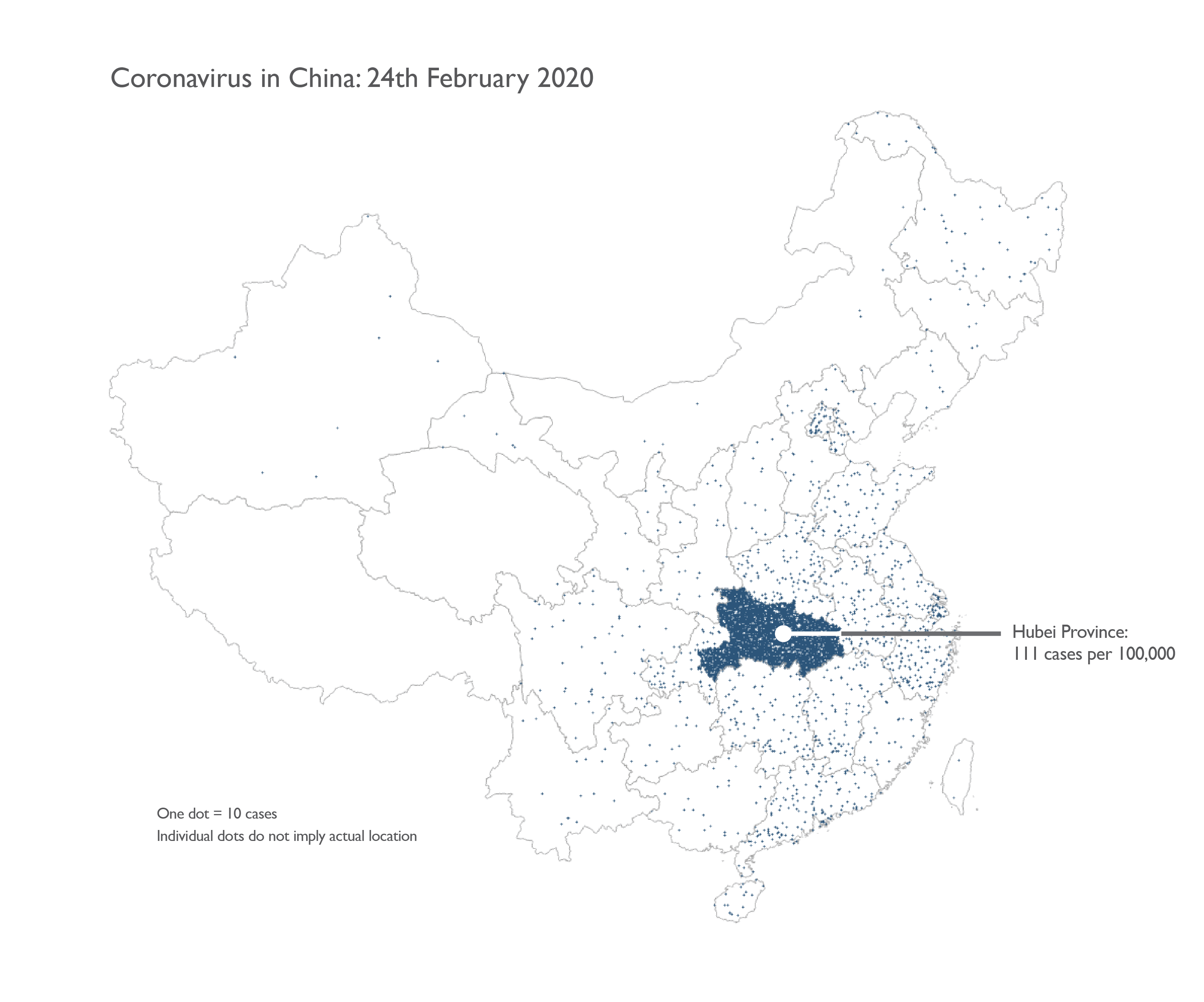
Mapping coronavirus, responsibly
Media outlets all rush to provide their audience with fast, visible content. Social media drives sharing of these maps at a breathtaking pace. When you throw in a developing human health story the ingredients are ripe for maps to take centre stage, as they have become with the ongoing coronavirus outbreak. Let’s take a look at how maps can help shape the narrative and, as concern (fear?) grows, how to map the data responsibly.
▻https://www.esri.com/arcgis-blog/products/product/mapping/mapping-coronavirus-responsibly