It’s an issue that has been highlighted by researchers using open-source, publicly available information - including mapping data - to locate attacks and document the destruction.
“The fact that we don’t get high-resolution satellite images from Israel and Palestinian territories sets us back,” says Samir, an open-source investigator.
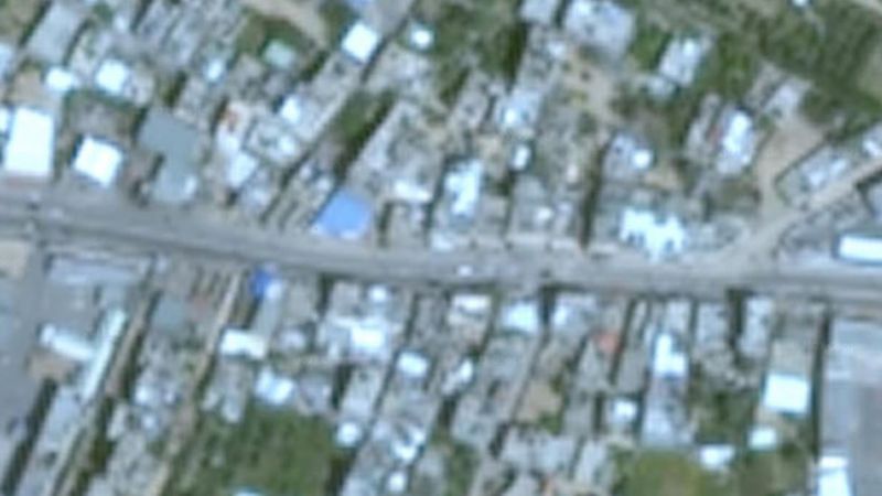
In fact, much of both Israel and the Palestinian territories appear on Google Earth as low-resolution satellite imagery, even though higher-quality images are available from satellite companies.
It’s barely possible to see the cars in Gaza City.
Compare that with Pyongyang, the secretive capital of North Korea, where the cars are sharply defined and it’s possible to make out individual people.
Why is satellite imagery important?
The use of satellite images has become a vital element in the reporting of conflict.
But the availability of detailed images can also compromise military security.
In the latest Middle East confrontation, investigators are looking to corroborate the locations of missile fire and targeted buildings in Gaza and Israel, using satellites.
However, on Google Earth, the most widely used image platform, the most recent imagery for Gaza is of low resolution and therefore blurry.
“The most recent Google Earth image is from 2016 and looks like trash. I zoomed in on some random rural area of Syria and it has had 20+ images taken since that time, in very high resolution,” tweeted Aric Toler, a journalist for Bellingcat.
Google says its aim is to “keep densely populated places refreshed on a regular basis” but this hasn’t been the case with Gaza.
Are high-resolution images available?
Until last year, the US government had placed a restriction on the quality of satellite images of Israel and the Palestinian territories that American companies were permitted to provide on a commercial basis.
This restriction was written into the Kyl-Bingaman Amendment (KBA) - US legislation dating back to 1997 - in support of Israeli security concerns.
“We would always prefer to be photographed at the lowest resolution possible. It’s always preferable to be seen blurred, rather than precisely,” said Amnon Harari, head of space programmes at Israel’s Defence Ministry last year, reported by Reuters.
Under the KBA, US satellite image providers were allowed to offer lower-resolution pictures with a pixel size of no less than 2m (6ft 6in, making an object the size of a car just about visible, but no smaller).
It’s not uncommon that sites such as military bases have been blurred - but the KBA was the only case of an entire country being subject to such a restriction.
The law mentioned only Israel, but it was also applied to the Palestinian territories.
However, once non-US providers, such as French company Airbus, were able to supply these images at a higher resolution, the US came under increasing pressure to end its restrictions.
In July 2020, the KBA was dropped, and now the US government allows American companies to provide far higher-quality images of the region (each pixel can now be as small as 40cm, so that objects the size of a person could be readily picked out).
The initial motivation was scientific," says Michael Fradley, an archaeologist at the University of Oxford and one of the academics who successfully campaigned for the amendment to be changed.
“We wanted to have a consistent data source to work with in our project, so we needed access to high resolution over the Occupied Palestinian Territories comparable to what we use over other parts of the region.”
So why is Gaza still blurry?
The BBC spoke to Google and Apple (whose mapping apps also show satellite images).
Apple said it was working to update its maps soon to a higher resolution of 40cm.
Google told us that its images come from a range of providers and it considers “opportunities to refresh [its] satellite imagery as higher-resolution imagery becomes available”. But it added that it had “no plans to share at this time”.