
Identifying the drivers of Amazon deforestation through high-tech maps and stories
▻https://wildtech.mongabay.com/2016/08/identifying-drivers-amazon-deforestation-high-tech-maps-stories
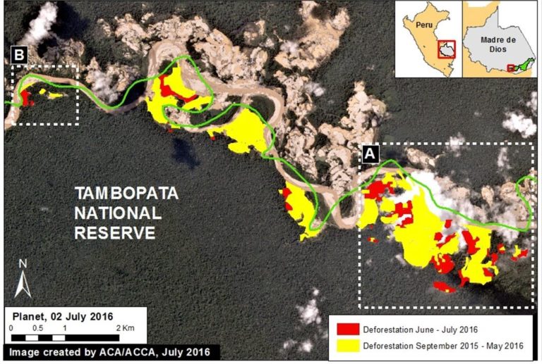
The Monitoring of the Andean Amazon Project (MAAP), launched in 2015 by the Amazon Conservation Association (ACA) and its Peruvian counterpart, Asociación para la Conservación Amazónica (ACCA), creates and presents maps from a near-real-time, high-resolution deforestation monitoring system. Matt Finer, who leads the project, initially came to ACA to help quantify threats to the Amazon—“instead of just saying oil drilling or dams are bad, quantifying impacts to see if and how they are bad”.
As Finer puts it, the MAAP team scours remote sensing data, primarily satellite images of varying resolutions, for new areas of deforestation and revisits known deforestation hotspots. Having seen the power of the timeliness of both monitoring and showing deforestation, the project focuses on high-resolution, high-frequency forest monitoring.
We spoke with Finer about the MAAP project and his team’s capacity to combine several new remote sensing technologies to monitor forest change in Peru. In a second part of this interview, we’ll highlight Finer’s thoughts on the rapid advance of technology in the remote sensing sector and its application to monitoring Amazon forests.
#Amazonie #forêt #déforestation #image_satellite #cartographie