

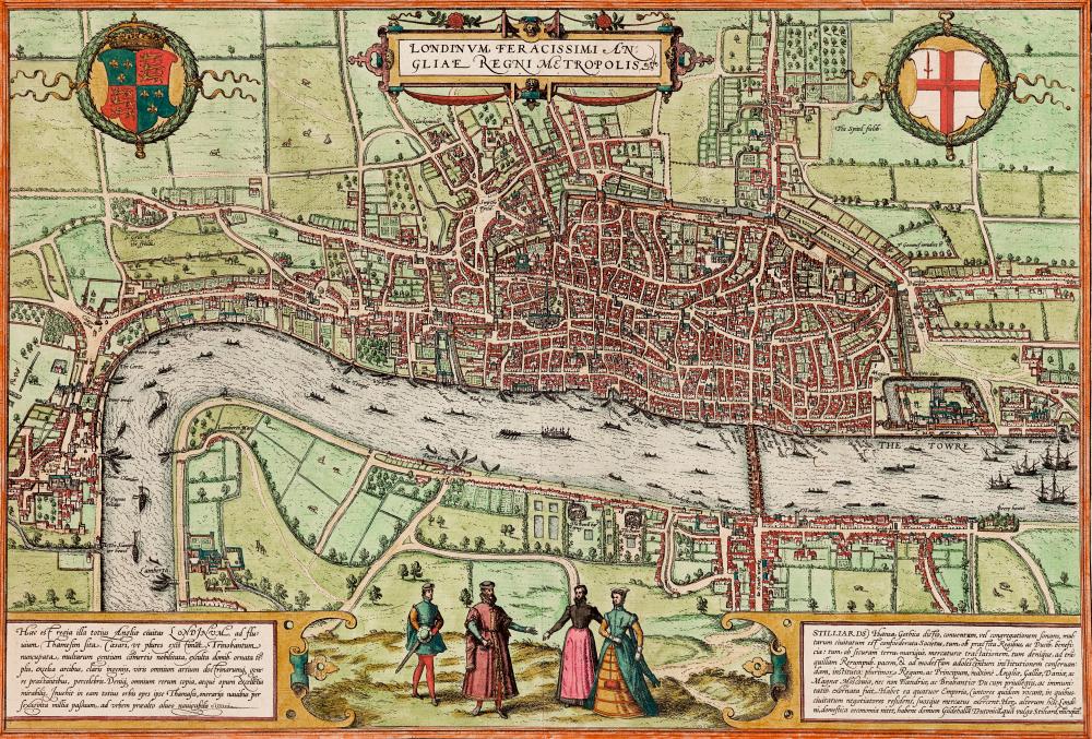
The Forbidden City to Convict’s Landing: rare early city maps – in pictures
From London when it had only one bridge, to a pictorial rendition of Sir Francis Drake’s invasion of Santo Domingo, these global city maps date back to the 1500s and are taken from Great City Maps, published by DK
 https://i.guim.co.uk/img/media/1adbc781b65e22959e6ce0b6f57fa7aa601f18e6/728_445_9516_6442/master/9516.jpg?w=720&q=20&auto=format&usm=12&fit=max&dpr=2&s=9e5f8b26ef2abb303c101d2ba3aff579
  https://i.guim.co.uk/img/media/b02701b0ef27d2189b8e613a1265003fb4e85099/0_426_2244_1346/master/2244.jpg?w=720&q=20&auto=format&usm=12&fit=max&dpr=2&s=9a5636a86e36e3d6b0a7469a09275958
 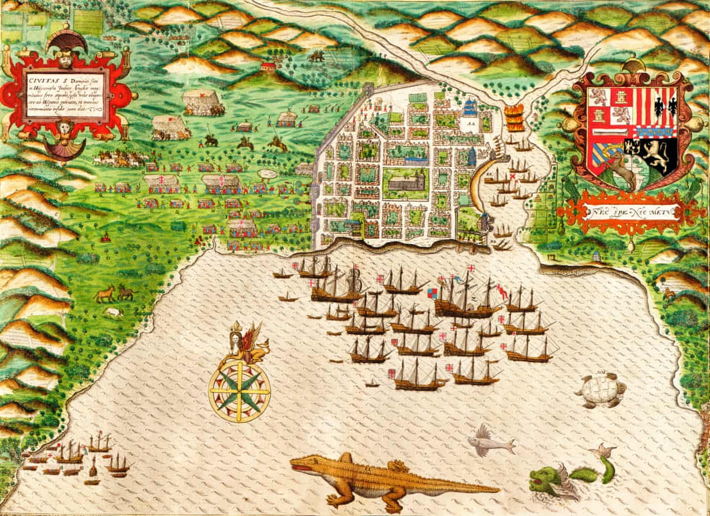 https://i.guim.co.uk/img/media/2663a3153e487686fb96b7ab02796c9718866e8d/197_218_6285_4578/master/6285.jpg?w=720&q=20&auto=format&usm=12&fit=max&dpr=2&s=f006671032a2a1cd193e55e9f238eb66
 ▻https://www.theguardian.com/cities/gallery/2016/sep/01/ancient-rare-early-city-maps-in-pictures
#Londres #cartographie #visualisation #cartographie_historique
via @ville_en