


How indigenous nomadic pastoralists in Iran are using GIS maps to defend and conserve their territories
▻https://intercontinentalcry.org/indigenous-nomadic-pastoralists-iran-gis-maps-conserve
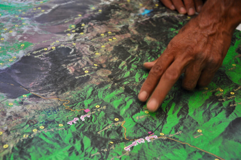
These days, GIS digital maps are proving a really useful tool for Indigenous Peoples to delineate their own customary territories, which are often different from official maps. Many local communities are learning how to use the technology and working with experts in participatory mapping activities. Participatory GIS has turned into a sort of “counter mapping” enabling local communities to make their own maps and models, and using these for their own research, analysis, assertion of rights and resolution of conflicts over land. Such mapping exercises also motivate community members to keep on defending and conserving nature and their territories as they have done for thousands of years, in spite of the difficulties they encounter.
The Centre for Sustainable Development (CENESTA), a Civil Society Organization working in Iran and a founding member of IUCN, has been advocating for ICCAs for decades. This photo-essay captures CENESTA’s experience supporting Iranian Indigenous communities in mapping out their territories.
