Traces of war and laser scanning.
▻http://www.greatwar.ugent.be/en/case-studies/traces

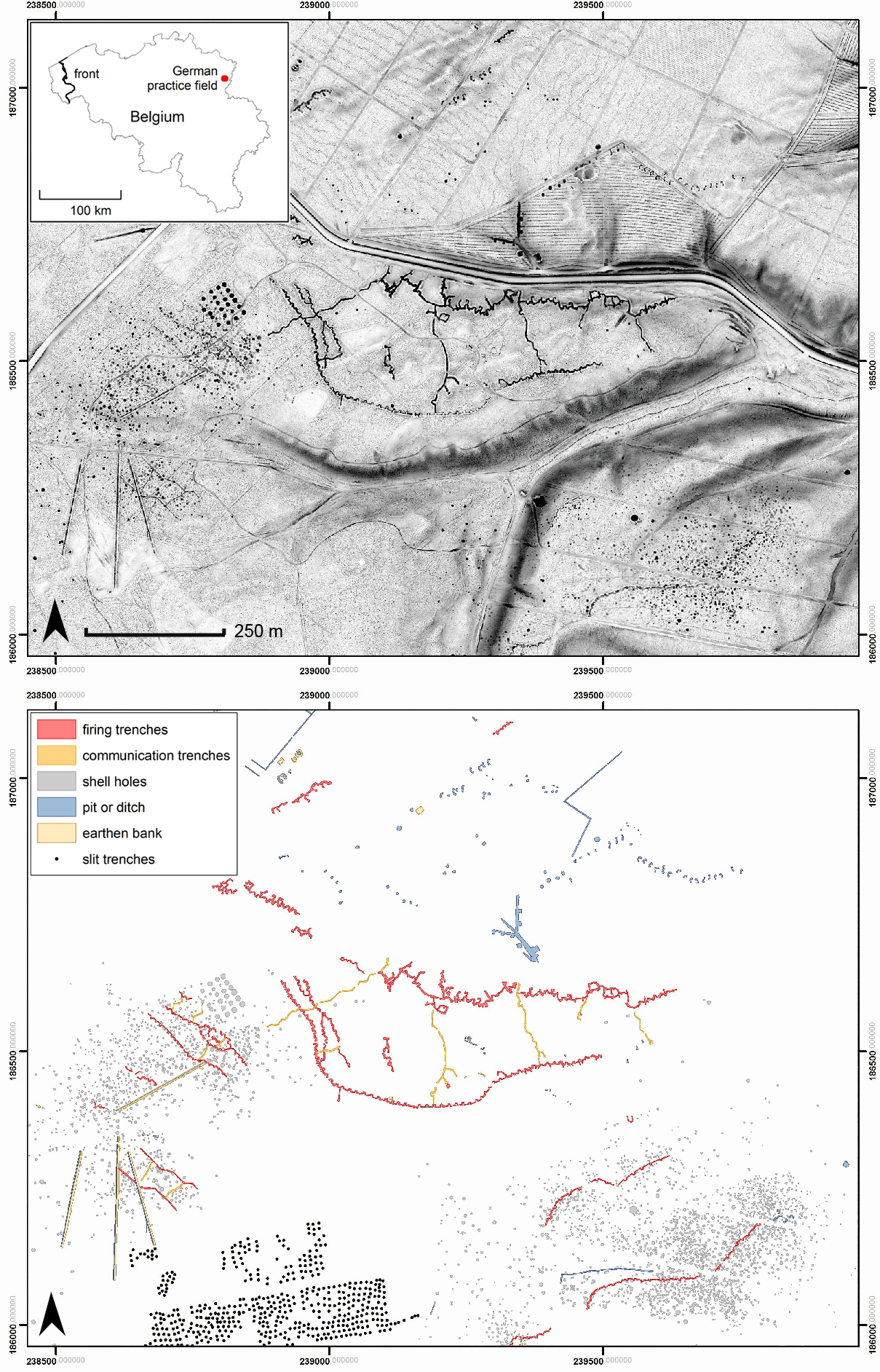
The Belgian front zone, from Newport at the coast to the French border at Comines-Warneton, is actually one large, continuous archaeological site, with thousands of war features preserved in the ground. At the surface today, we see only graveyards, commemoration monuments and pillboxes. At first sight, that is, because the landscape is literally covered with scars of the war: remains of trenches, mine craters, and vast areas that still remind of the massive destruction caused by four years of intense artillery shelling, where millions of explosions converted the woods, fields and pastures of Flanders into a lunar landscape by the end of the war. Many of these shell holes and craters are still preserved today; you only have to know how and where to look. Next to this preserverd landscape of destruction, there are numerous remains of Great War trenches, narrow-gauge railways, practice fields and campments, all over Flanders.
These sometimes subtle traces form a large part of the war heritage in Flanders, although they are mostly unknown. The recent Digital Elevation Models of Flanders (DHMV II, AGIV) and of Wallonia (MNT 2013-1024), made by Airborne Laser Scanning (ALS or LiDAR) can be used to trace all these remains: the detailed elevation models show all subtle relief differences in the forested areas (as it can filter out tree cover and other vegetation), but also in pastures and arable lands. Different visualisation techniques help to highlight even the smallest features preserved in the microtopography. Our team is now analysing the entire study area, and a first estimation is that about 14% of the area still has these surface features, much more than previously known.
Applied Geography | Scratching the surface with Lidar.
▻http://www.greatwar.ugent.be/applied-geography-scratching-the-surface-with-lidar