Mapping Mars with Open Planetary Data | MapBox
cc @fil
►http://mapbox.com/blog/2012-08-26-mapping-mars
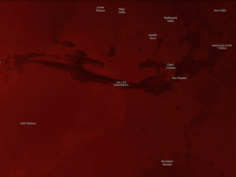
Inspired by the Mars Curiosity rover, I set out to map Mars using all open source tools (like QGIS and TileMill) and open data. The results of these tools and awesome data are stunning. The first shows Mars as “the red planet,” and the second map uses a more divergent color ramp to show Mars’ topographical variation.
The Red Planet
You can explore Mars for yourself on the Mars open data mapping website I created. I’ll be updating it as I create new maps using awesome planetary open data.
Mapping Mars
My first step along the way was to install the USGS’s Integrated Software for Imagers and Spectrometers ISIS, a software library that makes it pretty convenient to obtain planetary DEM data in the ISIS 3 cube format, which GDAL supports. Thanks to USGS’ great documentation, it was easy to get started with ISIS.
My next step was to use GDAL to generate the hillshades, color relief, and slope shading. I took advantage of the great guides we have for working with terrain data that we have in our Tilemill Docs section. To get a better idea about what my process looked like, check out the scripts here.
The last step was to take the finished GeoTiffs into Tilemill to style them using the great new compositing features that Mapnik has.
#espace #cartographie #mars #planètes #open-data #visualisation