
An X reveals a Diamond : locating Israeli Patriot batteries using radar interference – Federation Of American Scientists
▻https://fas.org/blogs/security/2018/11/an-x-reveals-a-diamond-locating-israeli-patriot-batteries-using-radar-interfere
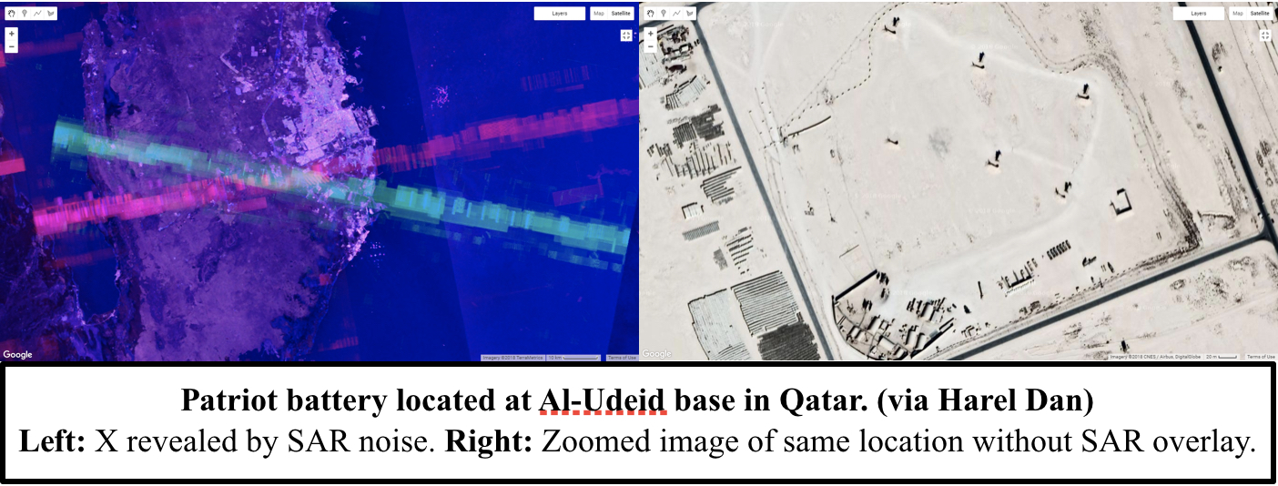
Amid a busy few weeks of nuclear-related news, an Israeli researcher made a very surprising OSINT discovery that flew somewhat under the radar. As explained in a Medium article, Israeli GIS analyst Harel Dan noticed that when he accidentally adjusted the noise levels of the imagery produced from the SENTINEL-1 satellite constellation, a bunch of colored Xs suddenly appeared all over the globe.
SENTINEL-1’s C-band Synthetic Aperture Radar (SAR) operates at a centre frequency of 5.405 GHz, which conveniently sits within the range of the military frequency used for land, airborne, and naval radar systems (5.250-5.850 GHz)—including the AN/MPQ-53/65 phased array radars that form the backbone of a Patriot battery’s command and control system. Therefore, Harel correctly hypothesized that some of the Xs that appeared in the SENTINEL-1 images could be triggered by interference from Patriot radar systems.
Using this logic, he was able to use the Xs to pinpoint the locations of Patriot batteries in several Middle Eastern countries, including Qatar, Bahrain, Jordan, Kuwait, and Saudi Arabia.
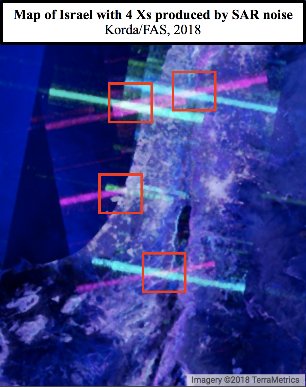
This blog post partially fills that gap, while acknowledging that there are some known Patriot sites—both in Israel and elsewhere around the globe—that interestingly don’t produce an X via the SAR imagery.
All of these sites were already known to Israel-watchers and many have appeared in news articles, making Harel’s redaction somewhat unnecessary—especially since the images reveal nothing about operational status or system capabilities.
Avec analyse détaillée des 4 sites israéliens de batteries de missiles Patriot identifiés, dont l’un (Palmachim, cf. ►https://seenthis.net/messages/740257 ) figure d’ailleurs sur la liste des cibles du Hezbollah…
The proximity of the Negev air defense battery to an Israeli nuclear facility is not unique. In fact, the 2002 SIPRI Yearbook suggests that several of the Yahalom batteries identified through SENTINEL-1 SAR imagery are either co-located with or located close to facilities related to Israel’s nuclear weapons program. The Palmachim site is near the Soreq Centre, which is responsible for nuclear weapons research and design, and the Mount Carmel site is near the Yodefat Rafael facility in Haifa—which is associated with the production of Jericho missiles and the assembly of nuclear weapons—and near the base for Israel’s Dolphin-class submarines, which are rumored to be nuclear-capable.
Google Earth’s images of Israel have been intentionally blurred since 1997, due to a US law known as the Kyl-Bingaman Amendment which prohibits US satellite imagery companies from selling pictures that are “no more detailed or precise than satellite imagery of Israel that is available from commercial sources.” As a result, it is not easy to locate the exact position of the Yahalom batteries; for example, given the number of facilities and the quality of the imagery, the site at Palmachim is particularly challenging to spot.
However, this law is actually being revisited this year and could soon be overturned, which would be a massive boon for Israel-watchers. Until that happens though, Israel will remain blurry and difficult to analyze, making creative OSINT techniques like Harel’s all the more useful.