
Americas Collections Blog
http://britishlibrary.typepad.co.uk
-
-

-

#seenthis, les réponses aux questions que vous ignoriez
-
-

Help Us Decipher This Inscription
▻http://britishlibrary.typepad.co.uk/digitisedmanuscripts/2015/08/help-us-decipher-this-inscription.htmlAn intriguing feature of this sword is an as yet indecipherable inscription, found along one of its edges and inlaid in gold wire. It has been speculated that this is a religious invocation, since the language is unknown. Here’s what the inscription seems to read:
+NDXOXCHWDRGHDXORVI+
▻http://julianharrison.typepad.com/.a/6a013488b55a86970c01b7c7b9356c970b-pi
-

Intelligence Mapping of British East Africa - digitisation begins - Maps and views blog
▻http://britishlibrary.typepad.co.uk/magnificentmaps/2015/02/intelligence-mapping-of-british-east-africa-digitisation-b
With generous funding from the Indigo Trust, the British Library has started to catalogue and digitise a unique archive of military intelligence maps of British East Africa - a region encompassing modern-day Kenya, Uganda and neighbouring parts of South Sudan, Ethiopia and Somalia. The maps are held in the War Office Archive and were created by British intelligence officers, surveyors and cartographers between the years 1890-1940.
▻http://britishlibrary.typepad.co.uk/.a/6a00d8341c464853ef01b8d0d05241970c-800wi
During this period the requirement to administer newly-created British protectorates in Africa brought with it the need for mapping of a new order in terms of volume, scale and subject matter. As a result, the archive represents both a milestone in the history of the cartography of Africa and a goldmine of historical information for the modern-day researcher.
The example below is finely executed in watercolours and coloured inks, and shows a region to the north and east of the Nile River in north-western Uganda. It was drawn in 1901, at a time when the area was under British administration within the Uganda Protectorate, and represents the first systematic survey of the area.
#cartographie_historiques #cartes_anciennes #british_library
-
A song in praise of music : Schubert’s ‘An die Musik’ - Music blog
▻http://britishlibrary.typepad.co.uk/music/2014/01/schubert-an-die-musik.html
Allez, je ne le dénonce pas : il y a 18 ans, alors que je venais juste de m’installer en Norvège et que j’avais enfin le temps de lire, j’expliquais par email à un ex-collègue et ami du Diplo que j’étais en train de déguster la biographie de Schubert par Brigitte Massin (un vrai monument de 1 000 pages), laquelle vous transporte deux siècles en arrière (il suffit de s’arrêter et de fermer les yeux après deux ou trois pages. Vous vous retrouvez dans une Schubertiade dans un quartier malfamé de Vienne en compagnie des fidèles copains du musicien).
Réponse de mon ex-collègue et néanmoins ami : « on devrait fusiller tous ceux qui ont le temps de lire des biographies de Schubert qui font 1 000 pages ».
A song in praise of music: Schubert’s ‘An die Musik’
This is the first in a new series of blog posts highlighting some of the British Library’s music treasures. We’ll be focusing in each post on a particular item or collection and looking at the story behind it. In the spotlight today are Franz Schubert, born on this day in 1797, and his exquisite song ‘An die Musik’ (‘To Music’).
https://dl.dropbox.com/s/l0kvpxzfqwz2tde/6a01676773d098970b01a5115f0219970c-320wi.png
Schubert composed more than 600 songs in his short life, the first at the age of 14 and the last shortly before his death, aged 31, in November 1828. ‘An die Musik’, which Schubert wrote in 1817, is one of his most famous songs, popular both for its beautiful melody and its lyrics - penned by Schubert’s near namesake, Franz von Schober - about the power of music to “kindle the heart to warm love” and carry us into a better world.
https://dl.dropbox.com/s/f067iws04owonzc/6a01676773d098970b01a73d6a8933970d-500wi.png
-
J’ajoute que pour ceux qui aime la musique classique, ce blog est simplement génial. Comme « The Djac Bawer Attitude » d’ailleurs ▻http://djac.baweur.over-blog.com même s’il n’est pas très actif depuis deux ans
-

Peut-être la plus belle scène (la plus poignante, en tous cas) du Maître de Musique
▻http://www.youtube.com/watch?v=0yyIqN-E96Q
-
-

‘For the Sake of Freedom’: British World War II Propaganda Posters in Arabic
▻http://britishlibrary.typepad.co.uk/untoldlives/2014/02/for-the-sake-of-freedom-british-world-war-ii-propaganda-po▻http://britishlibrary.typepad.co.uk/.a/6a00d8341c464853ef01a3fcb33212970b-pi
The use of this slogan is ironic to say the least given that at this time Britain still ruled over a vast global empire that robbed millions of people around the world of the very freedom that they were ostensibly fighting for. Indeed, many of the individuals at whom these Arabic-language posters were targeted were living in areas that were under the imperial domination of the British.
(...)
During World War II, the Middle East was the site of a propaganda struggle between Great Britain and its allies, and Nazi Germany and the other axis powers. As my earlier blog post demonstrated, propaganda produced by the German Government – in this case radio broadcasts in Arabic – found a receptive ear in some areas of the Persian Gulf. The British made efforts to counter this German propaganda by radio broadcasts of their own and through the production of printed materials such as these posters. -
-
A million first steps
▻http://britishlibrary.typepad.co.uk/digital-scholarship/2013/12/a-million-first-steps.htmlWe have released over a million images onto Flickr Commons for anyone to use, remix and repurpose. These images were taken from the pages of 17th, 18th and 19th century books digitised by Microsoft who then generously gifted the scanned images to us, allowing us to release them back into the Public Domain.
Merci MS ;-)
Which brings me to the point of this release. We are looking for new, inventive ways to navigate, find and display these ’unseen illustrations’.
-

-
The British Library Just Made One Million Images Public Domain, and It’s a Big Deal
▻http://theappendix.net/blog/2013/12/the-british-library-just-made-one-million-images-public-domainOur intention is to use this data to train automated classifiers that will run against the whole of the content. The data from this will be as openly licensed as is sensible (given the nature of crowdsourcing) and the code, as always, will be under an open license.
-
fabuleux, #data_mining
an early #data_visualization of historical information, but I have no idea what.
R. Quinton, The Chromatographic Chronicle of English History, illustrated by ... coloured charts (London, 1864) -

@fil
Effectivement, c’est particulièrement alléchant !
Apparemment, il y a, au moins, 4 dimensions représentées. Et contrairement à ce que dit le début de la légende — que tu as tronqué —A good example of how the metadata sometimes isn’t sufficient - this is clearly an early data visualization of historical information, but I have no idea what.
ce qui manque ici ce sont justement les #métadonnées.
À force de se gaver des #metadata de la NSA, on finit par oublier que métadonnées veut juste dire description des données…
PS : apparemment, cette image n’a été reprise nulle part bien que le bouquin dont elle est issue soit réédité.
-
Knight v Snail
▻http://britishlibrary.typepad.co.uk/digitisedmanuscripts/2013/09/knight-v-snail.html
▻http://britishlibrary.typepad.co.uk/.a/6a00d8341c464853ef019aff95ab29970c-800wi
Knight v Snail II: Battle in the Margins (from the Gorleston Psalter, England (Suffolk), 1310-1324 -
De la généalogie ?
Mais alors, pourquoi la division en quatre ? Deux générations ?
-
-


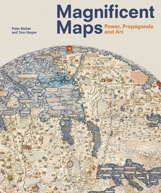
Magnificent Maps: Cartography as Power, Propaganda, and Art | Brain Pickings
►http://www.brainpickings.org/index.php/2012/04/17/magnificent-maps-cartography-as-power-propaganda-and-artThree of my great fascinations — cartography as art, propaganda design, and antique maps — converge in Magnificent Maps: Power, Propaganda and Art. The lavish tome collects cartographic curiosities from the golden age of display maps — the period between 1450 and 1800, when maps were as much a practical tool for navigation as they were works of art and affirmations of cultural hegemony or social status — culled from the formidable collection of the British Library.
Complementing Magnificent Maps is an interactive site from the British Library that lets you explore some of the maps with curatorial context.
►http://britishlibrary.typepad.co.uk/magnificentmaps
cc @reka-
L’âge d’or des cartes marines - Quand l’Europe découvrait le monde
Parmi les trésors de la Bibliothèque nationale de France, figurent des documents scientifiques d’exception dont la contemplation renvoie spontanément aux légendaires Grandes découvertes.
Il s’agit des cartes marines enluminées sur parchemin, souvent rehaussées d’or, appelées couramment « cartes portulans », de l’italien portolano (livre d’instructions nautiques).►http://www.bnf.fr/fr/evenements_et_culture/anx_expositions/f.age_dor_cartes_marines.html
(arf ... avec le soutien de Total ... désolé ...) -

euh ? de quoi tu parle @grommeleur ??? je vois pas le rapport !
-

@odilon
le rapport : les cartes ... heu, rien de plus que de mentionner cette expo à la BnF.
Mais en allant sur le site, je vois cette mention sur Total, alors je grommelle, mais ça ne préjuge pas de l’intérêt de l’expo (que je n’ai pas vu). -
ahhh ! l’expo que tu vise a déjà l’objet d’un seen par reka
-
Merci merci, j’ai vu cette expo à Londres il y a deux ans, j’ai même fait un entretien avec le conservateur en chef du département des cartes. Il est à la retraite, maintenant, c’était un géographe brillantissime. j’ai l’enregistrement, il faudrait que je décrypte et mette à la disposition de tous, c’était vraiment très intéressant.
C’est aussi lors de cette expo qu’on pouvait voir la carte époustouflante de l’Europe des points noirs :
https://dl.dropbox.com/s/orr46zug69qu4al/europe%20carte%20des%20points%20noirs.jpg?m
Carte qui devait servir de base à un billet il y a deux ans, je suis un peu en retard...
-


.jpg)
