
What’s driving tropical deforestation? Scientists map 45 years of satellite images
▻https://phys.org/news/2019-10-tropical-deforestation-scientists-years-satellite.html
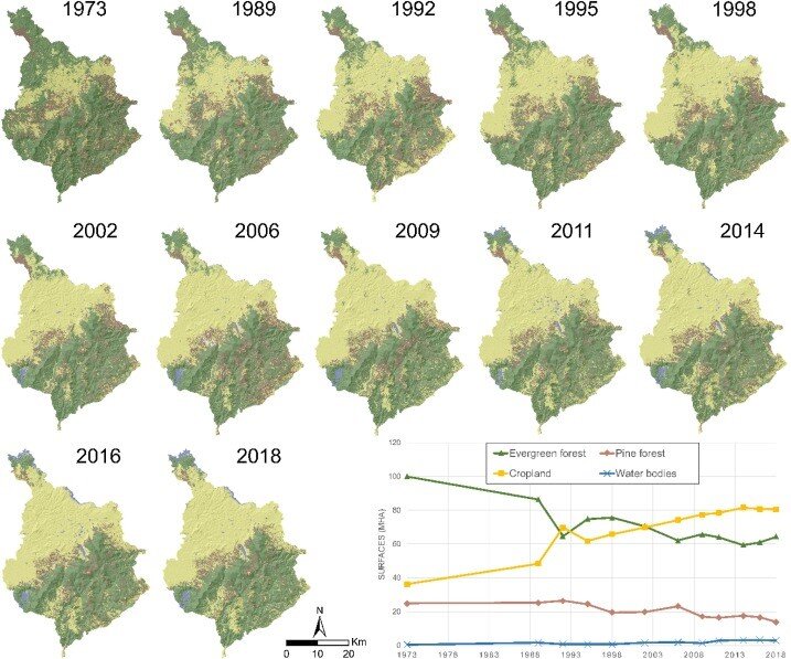
ropical forests are under increasing pressure from human activity such as agriculture. However, in order to put effective conservation measures in place, local decision-makers must be able to precisely identify which areas of forest are most vulnerable.
A new analysis method spearheaded by researchers from the French Agricultural Research Centre for International Development (CIRAD), the International Center for Tropical Agriculture (CIAT) and the University of Rennes-2 could hold the key.
A paradigm shift
The method focuses on the concept of forest vulnerability, meaning a forest’s exposure to threats and its capacity to recover from them. Previously this concept of vulnerability, as defined by the Intergovernmental Panel on Climate Change (IPCC), was only used in relation to the effects of climate change on forests.