Census Dotmap What’s all this?
►http://bmander.com/dotmap/index.html
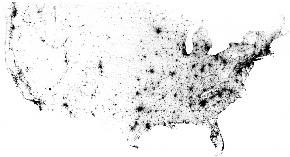
This is a map of every person counted by the 2010 US and 2011 Canadian censuses. The map has 341,817,095 dots - one for each person.
Why?
I wanted an image of human settlement patterns unmediated by proxies like city boundaries, arterial roads, state lines, &c. Also, it was an interesting challenge.