Cartographie chronospatiale... Time of travel in the 1800s
Voilà pourquoi j’aime beaucoup suivre FlowingData
►http://flowingdata.com/2013/01/04/time-of-travel-in-the-1800s
January 4, 2013 to Mapping by Nathan Yau
Time of travel in the 1800s
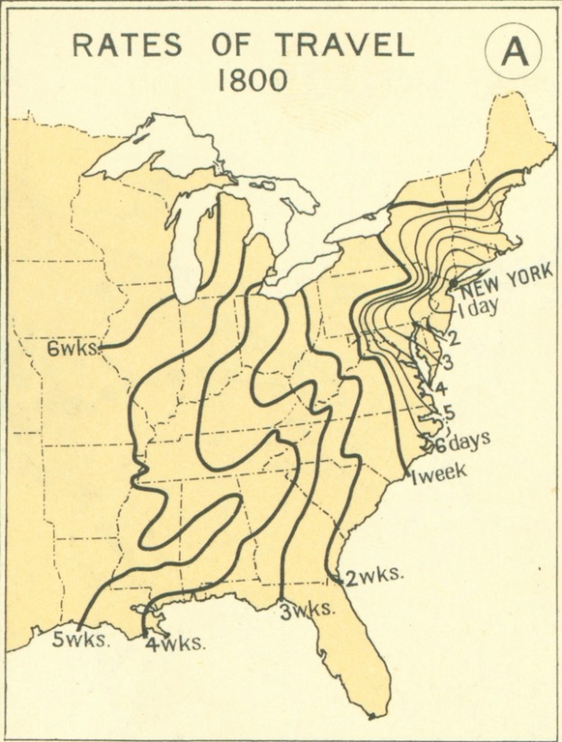
From the 1932 Atlas of the Historical Geography of the United States, these maps paint the picture of transportation in the 1800s. Each line represents how far one could travel in some amount of time, starting from New York. For example, it took about a month to get to Louisiana.
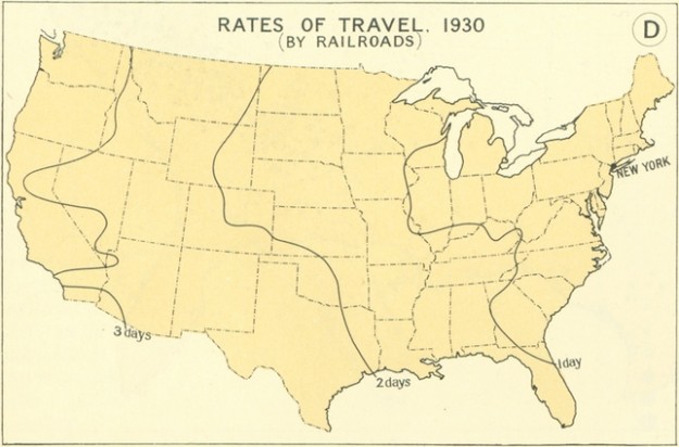
In contrast, here’s what travel by railroad in 1930 looked like:
Travel in 1930
#etats-unis #cartographie #transport #voyage #conquête-de-l-ouest