Poverty maps of London (Charles Booth Online Archive)
▻http://booth.lse.ac.uk/static/a/4.html
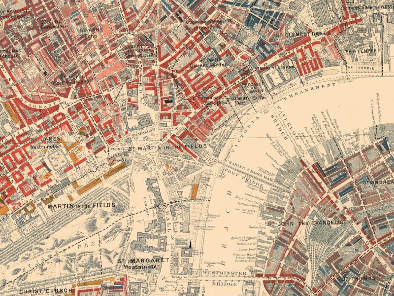
The Maps Descriptive of London Poverty are perhaps the most distinctive product of Charles Booth’s Inquiry into Life and Labour in London (1886-1903). An early example of social cartography, each street is coloured to indicate the income and social class of its inhabitants.
#cartographie-radicale #pauvreté #londres #royaume-uni #santé