


Atlantropa
►http://www.cabinetmagazine.org/issues/10/atlantropa.php
a project called “Atlantropa,” devised by a German architect and engineer named Herman Sörgel (1885–1952).
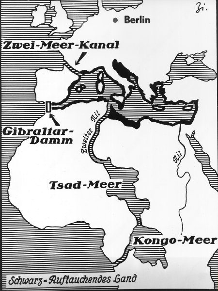
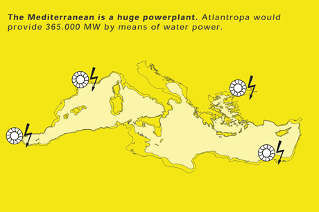
From 1927 until his death twenty-five years later, Sörgel worked on plans for a gigantic project that was initially named “Panropa” and later “Atlantropa.” With the help of a 35 km-long dam in the Straits of Gibraltar, he wanted to cut off the water supply from the Atlantic to the Mediterranean, letting the sea gradually dry up until its water level was reduced by some 200 meters. This was supposed to open up 600,000 square kilometers of new land and enable marvellous new capacities for power generation.
Voir aussi :
J’avais évoqué ce projet en 2008 dans cet article paru sur l’ancien blog visions cartographiques (aujourd’hui devenu ►http://visionscarto.net)
Le delta du Nil menacé par les eaux
Petite histoire d’une étude cartographique
►http://blog.mondediplo.net/2008-01-22-Le-delta-du-Nil-menace-par-les-eaux


