Manual Shaded Relief of the World
▻http://shadedrelief.com/manual_relief
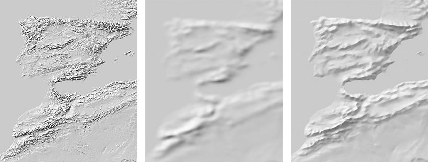
This page describes a generalized shaded relief that I drew, intended for making small-scale maps of the world and continents. The relief image registers with Natural Earth vector data. It is available as a grayscale GeoTIFF (10,800 x 5,400 pixels) in the Geographic projection. The shaded relief is without the blue drainages and water bodies shown in the examples above.
Where to get it
Go to the Natural Earth website.
Why manual shaded relief?
Automated relief shading methods do not produce acceptable shaded relief at very small map scales. The problem is generalization. High-resolution elevation data when rendered yield shaded relief with excessive detail—at small scales mountain ranges look like gritty “sandpaper” textures
#cartographie #relief #visualmisation #cartographie_manuelle :)