

Where is the border? - Architecture - e-flux
▻https://www.e-flux.com/architecture/at-the-border/325748/where-is-the-border
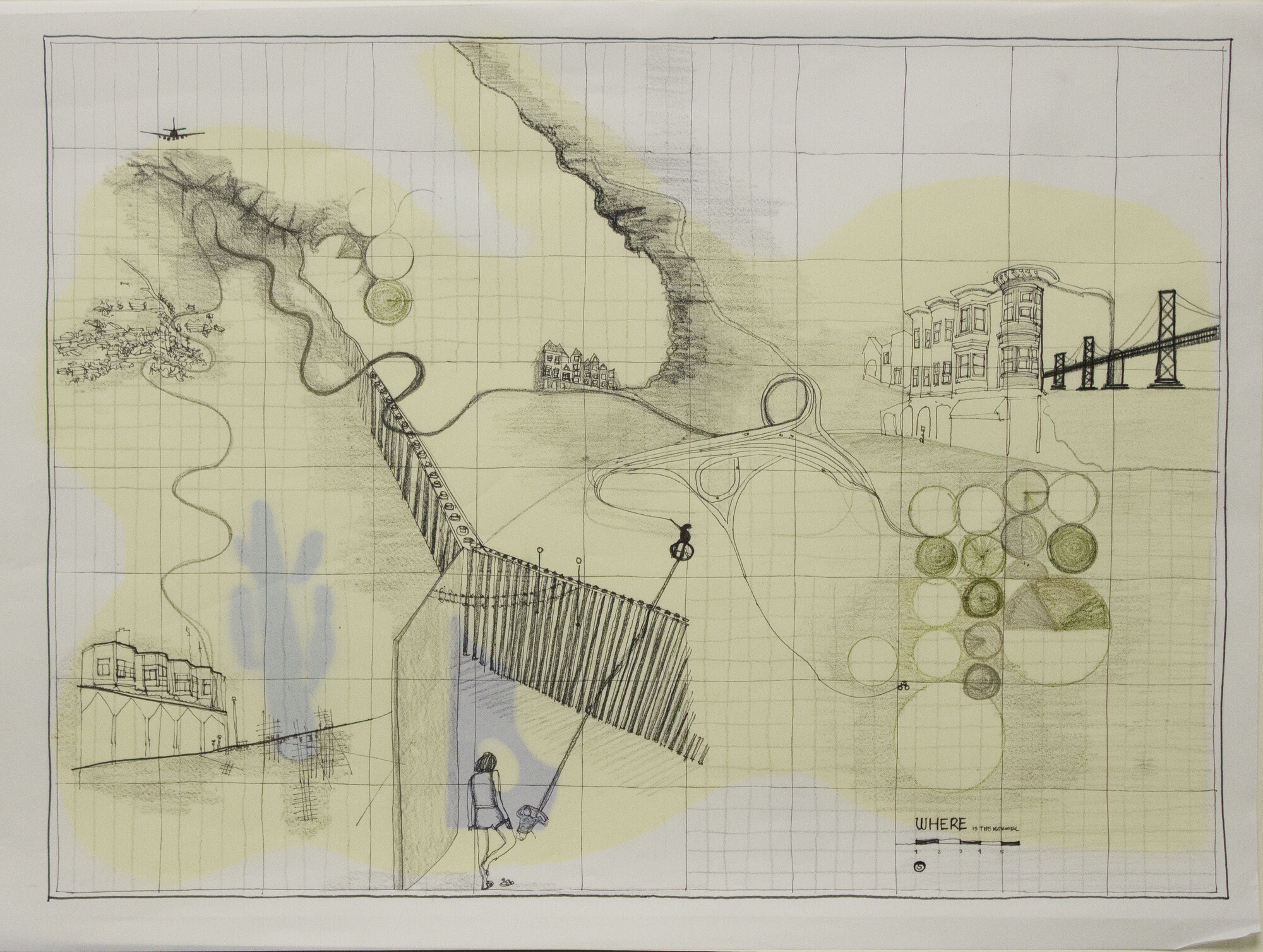
The border as a line that separates nations from each other is a signifier. It is an imaginary vector in space, materialized by pen on paper. Thinking about the word “border” produces a collective eidetic memory, removed from the scale of the body; an aerial view of landscapes divided by a thick black line. The border line is what separates two places, demonstrating a difference. It is a mechanism of othering that creates a reality of here and there; of us and them. If seen as a symbol of separation, the border starts to become diffuse, lifted from its geospatial location on a map to become enacted within the experiences and memories of people throughout entire regions. The Mexico-US border divides a region that has long been interconnected through economic, political, and social ties. While we acknowledge that there is a reality in which the border separates California from Baja California, Arizona from Sonora, Texas from Chihuahua, and so on, there exists another reality in which the experiential weight of the border is perpetuated in the mentality of people living in places such as Ulysses, Kansas or Pachuca, Hidalgo. The border is not just a line. It is a psycho-spatial experience carried within people.
Seeing borders
Contemporary conceptions of borders are rooted in cartography. Early maps were developed for navigation and to delineate political territories. In North America, survey maps were critical in the colonial endeavors of the French, British, and Spanish empires. These survey maps served to authorize the carving up and dividing of a territory that had previously been made up of much more diffuse edges between native inhabitants. After the 1848 Treaty of Guadalupe, for instance, a binational joint survey commission took six years to draw the first detailed border between Mexico and the US. Over the next few decades, the border line solidified through disputes as rivers moved and cities on the border grew. These political maps became the root for a collective image of Mexico-US relations, always refocusing attention to the band between the countries. In the meantime, trade agreements and migration were connecting places far beyond the border region.
For some immigrants, the border is always close by, as they imagine their adopted land as a neighbor of their homeland. For others, the border is distant as the journey to cross it is filled with danger and their families are unreachable. For many people, the border seems far away, as their own personal experiences don’t engage with transnational issues in a conscious way. The imagination of borders is relative. The stories we tell of borders not only connect faraway places, typically considered as separate. They show how important transborder connections are to sustain each other. Without one side, the other would become pockmarked with voids; a place with character unable to be real.
Drawing borders
By visualizing the importance of transborder networks in building the lived reality, we can alter the eidetic memory of borders. Cartography is a tool to redraw how we envision the territory. Maps are a form of representation, and while we consider them scientific and infallible, the way we draw and retrace them involves subjective representational decisions. The colors that underlay each territory, the thicknesses of lines, and the amount of information included all involve careful decision.


