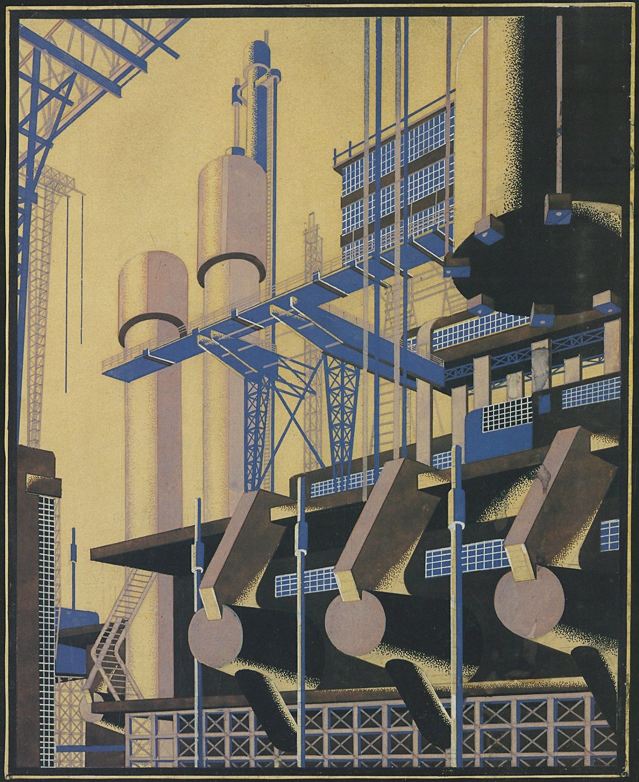
the track east
▻http://furtho.tumblr.com/post/181391654369/hans-poelzigs-messehaus-hamburg-1925-via-here
Signalé par ▻https://twitter.com/Reading_Design readingdesign.org

Hans Poelzig’s Messehaus, Hamburg, 1925
the track east
▻http://furtho.tumblr.com/post/181391654369/hans-poelzigs-messehaus-hamburg-1925-via-here
Signalé par ▻https://twitter.com/Reading_Design readingdesign.org
Hans Poelzig’s Messehaus, Hamburg, 1925
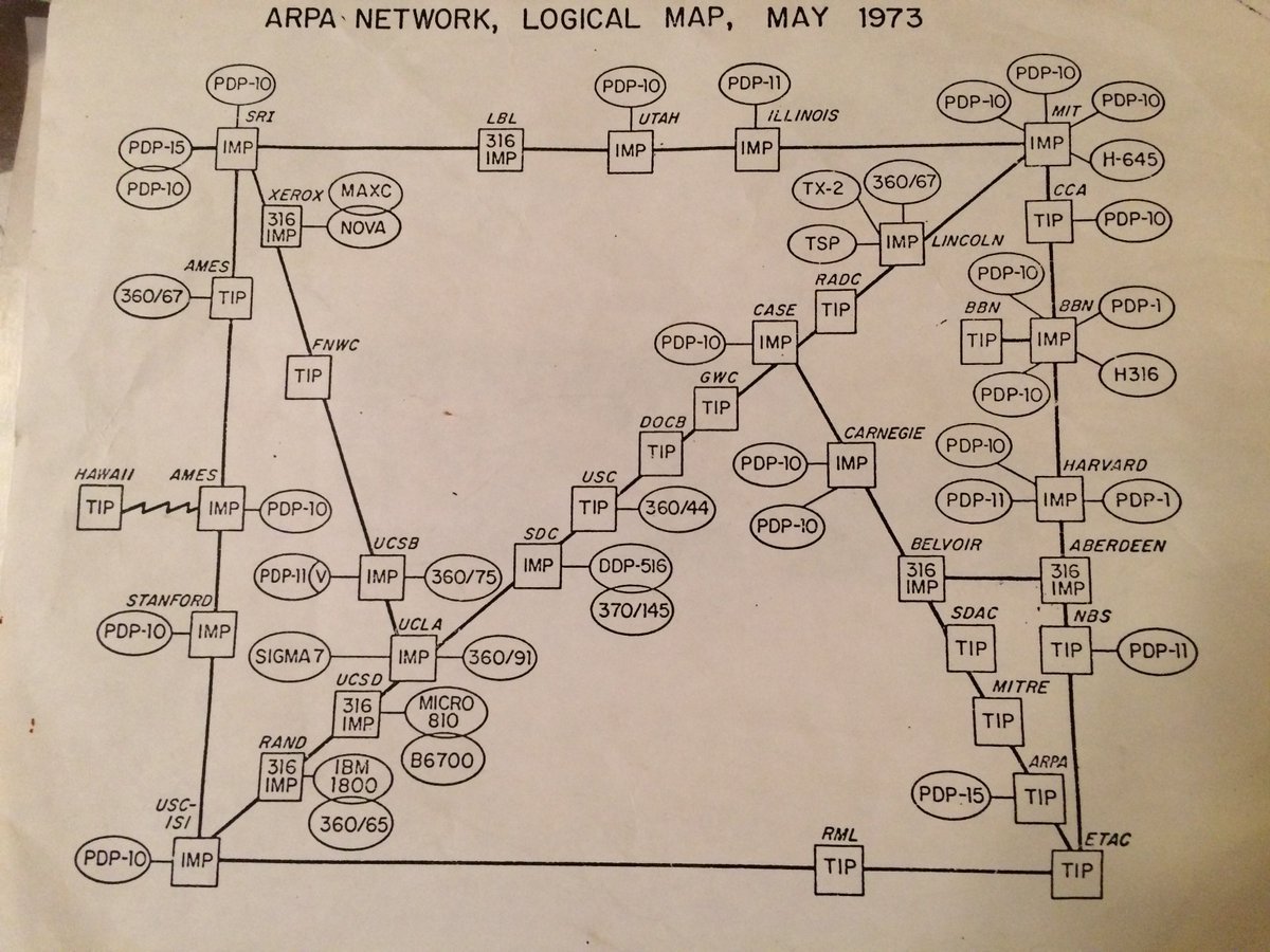
« the track east » ou #Internet en 1973
▻http://furtho.tumblr.com/post/169339518046/paul-newburys-map-of-the-entire-internet-1973
Paul Newbury’s map of the entire internet, 1973

Le « trou des Halles » vers 1974 avec une vue pour le moins surprenante du square des Innocents et de sa fontaine, en face de la rue Berger...
#trou_des_halles #rues_de_paris
▻http://www.parisrues.com/rues01/paris-avant-01-rue-berger.html
source : ►http://furtho.tumblr.com
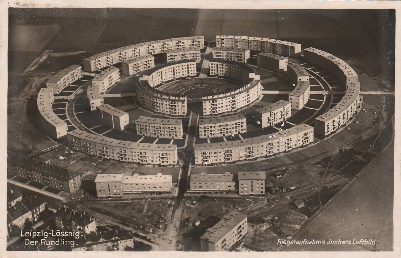
Aerial photograph of Hubert Ritter’s Siedlung Rundling, Leipzig, 1930
▻http://furtho.tumblr.com/post/165610902999/aerial-photograph-of-hubert-ritters-siedlung
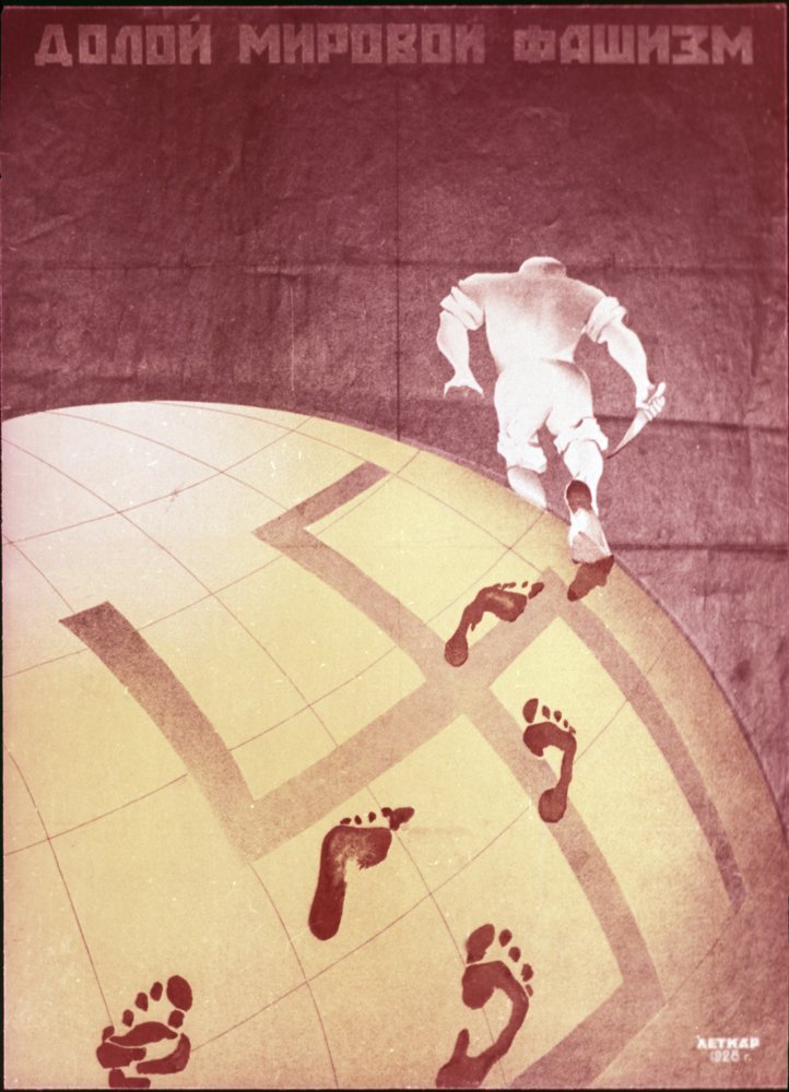
Down With World Fascism, USSR, 1928
▻http://furtho.tumblr.com/post/165064878559/poster-proclaiming-down-with-world-fascism-ussr
Étonnante affiche des débuts de l’URSS
Image d’un jour
From Devin Lunsford’s series All The Place You’ve Got
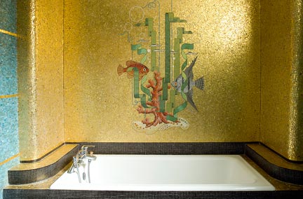
▻http://www.tourisme-rennes.com/fr/les-focus/odorico-mosaique
Originalité du patrimoine rennais, l’art de la mosaïque a laissé son empreinte dans la capitale de la Bretagne et même au-delà, dans tout le Grand Ouest. L’œuvre de la famille #Odorico, installée à #Rennes en 1882. Le début d’une saga pour deux générations d’artistes-artisans italiens qui ont décoré de nombreux bâtiments de la ville.
▻http://www.odorico.musee-bretagne.fr/accueil.htm


Map showing social & functional analysis, County of London Plan, 1944
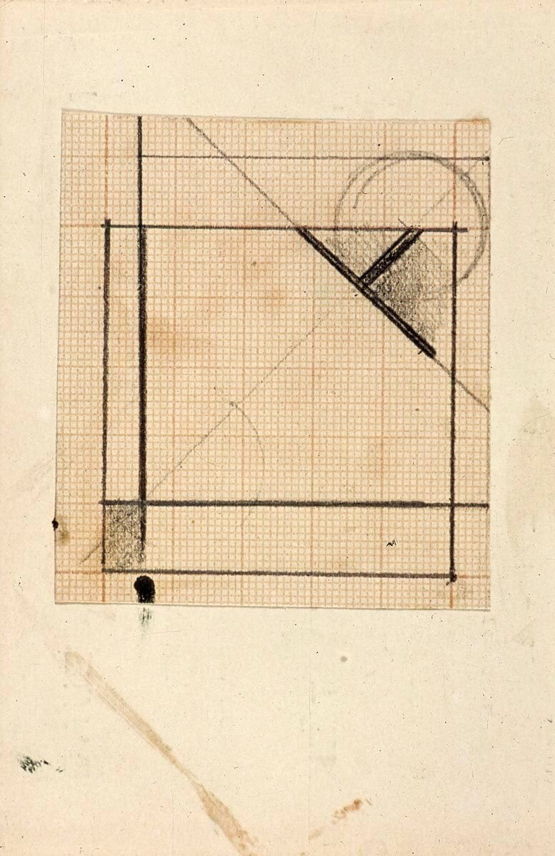
Theo van Doesburg’s Study For Simultaneous Compositions XXII
▻http://furtho.tumblr.com/post/161695410486/theo-van-doesburgs-study-for-simultaneous
Theo_van_Doesburg Study For Simultaneous Compositions XXII, c1929
#art #design #dessin #graphiques
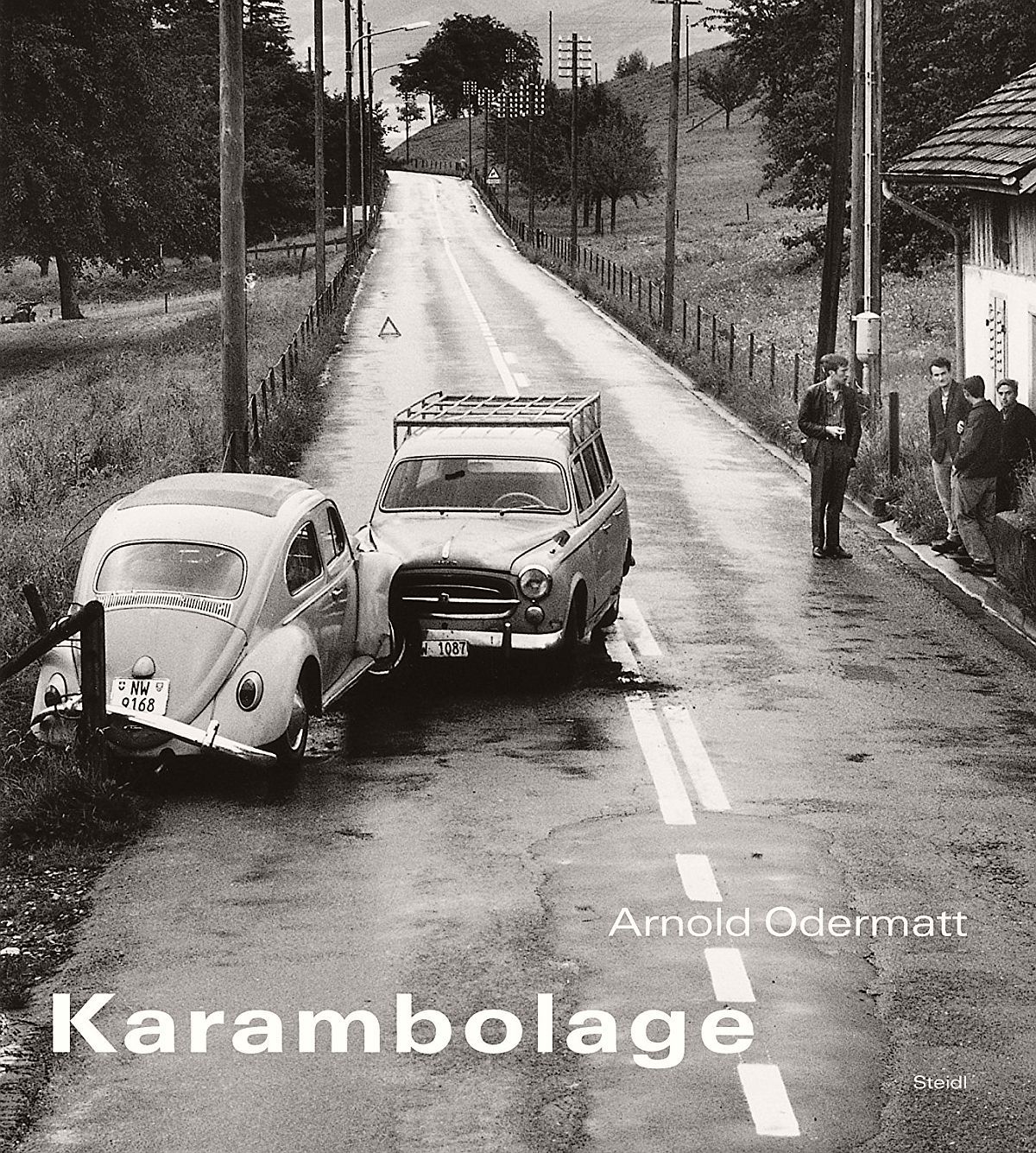
Sécurité routière et photographie du désastre
▻http://furtho.tumblr.com/post/161271854090/cover-of-arnold-odermatts-book-karambolage-via
Cover of Arnold Odermatt’s book Karambolage (via here)

A Arles il y a quelques années, il y avait une exposition très surprenante de ce très surprenant photographe, artiste involontaire, Arnold Odermatt. Un jour il va vraiment falloir que je me prenne par le main pour écrire ce texte à propos de ces photographes remarquables qui ne se seraient jamais pris pour des artistes pourtant, José Branguli, Walker Evans, même.
Fantasy architectural drawing, USSR, c1930
▻http://furtho.tumblr.com/post/160943886374/iakov-chernikhovs-fantasy-architectural-drawing
#Iakov_Chernikhov fantasy architectural drawing, USSR, c1930
#soviétisme #urss #design #architecture #art
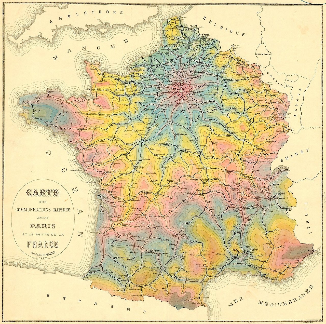
Travel times by rail from Paris, 1882
▻http://furtho.tumblr.com/post/159746803988/map-of-france-showing-travel-times-by-rail-from
Map of France showing travel times by rail from Paris, 1882
#visualisation #cartographie #cartographie_isochrone #trains #transports
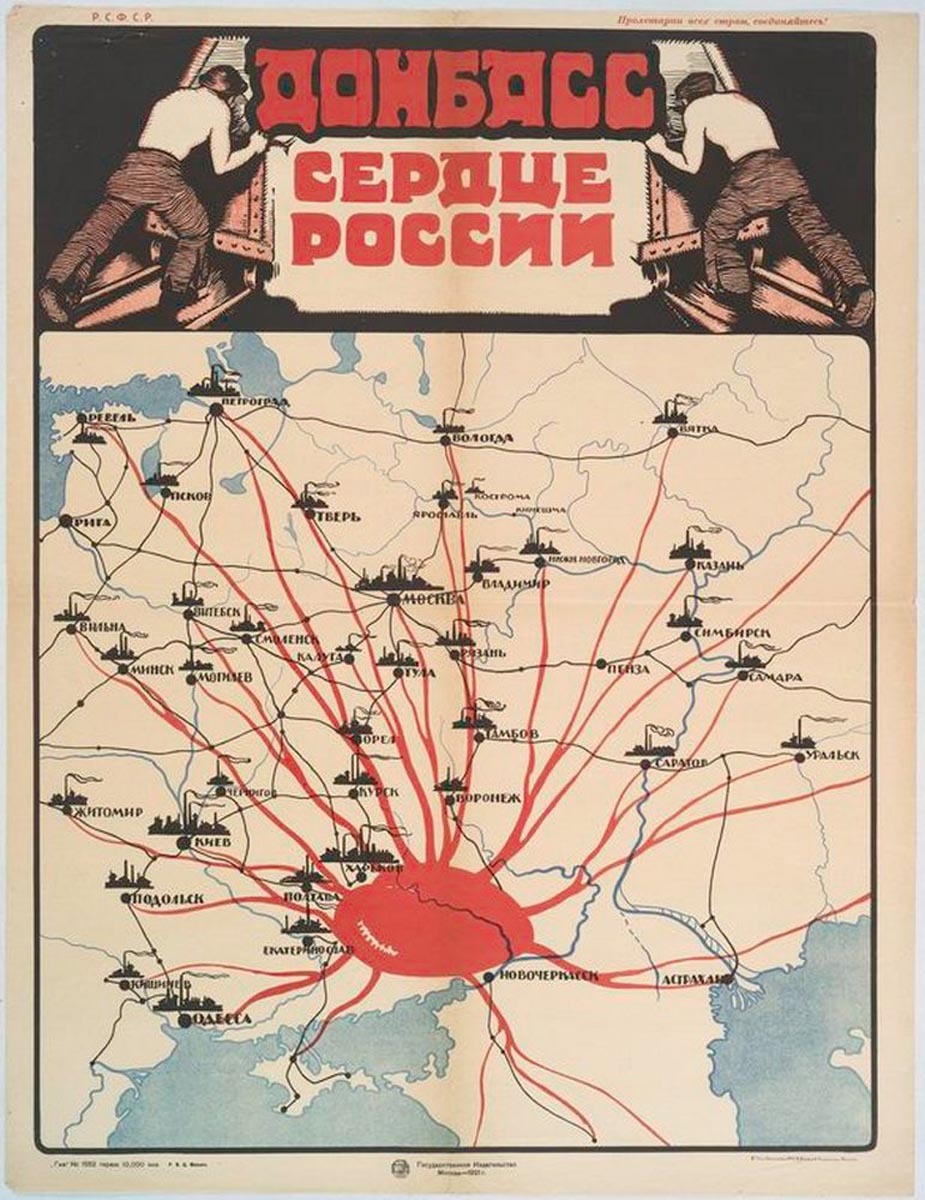
The Donbass is the Heart of Russia...
▻http://furtho.tumblr.com/post/160400913992/map-showing-donbass-as-the-heart-of-russia-via
Map showing Donbass as the Heart of Russia (via here)
May. 7 2017
#visualisation #cartographie #design #Donbass #Ukraine #URSS #Union_soviétique #manipulation #propagande #centralité #périphérie
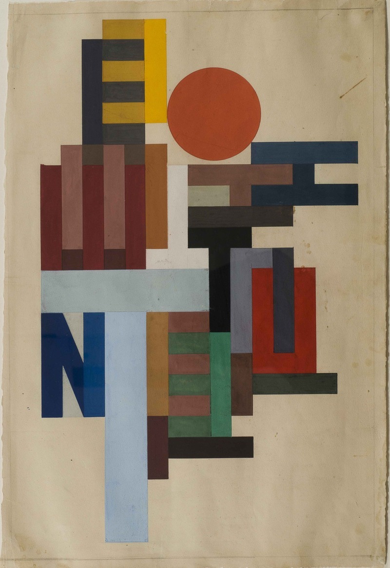
Vasyl Ermilov’s Composition With Letters
▻http://furtho.tumblr.com/post/159441838364/vasyl-ermilovs-composition-with-letters-1915
Vasyl Ermilov’s Composition With Letters, 1915
the track east
►http://furtho.tumblr.com
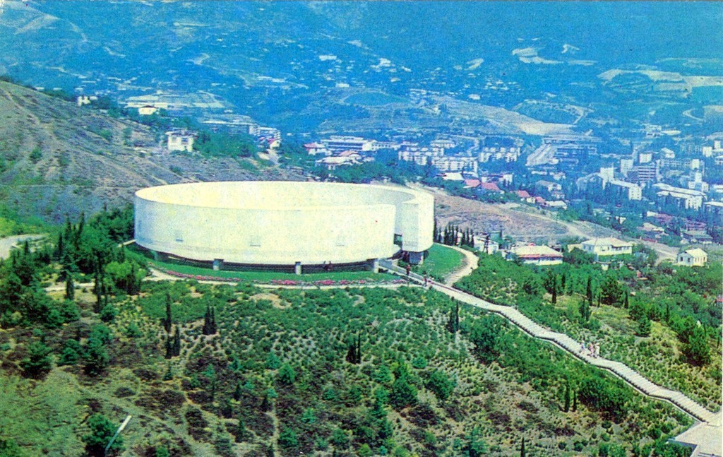
Memorial to those who died in the Civil & Great Patriotic Wars, Yalta, 1978
#spomenik_géant #soviétisme #yalta #image #ex-urss #urss #crimée
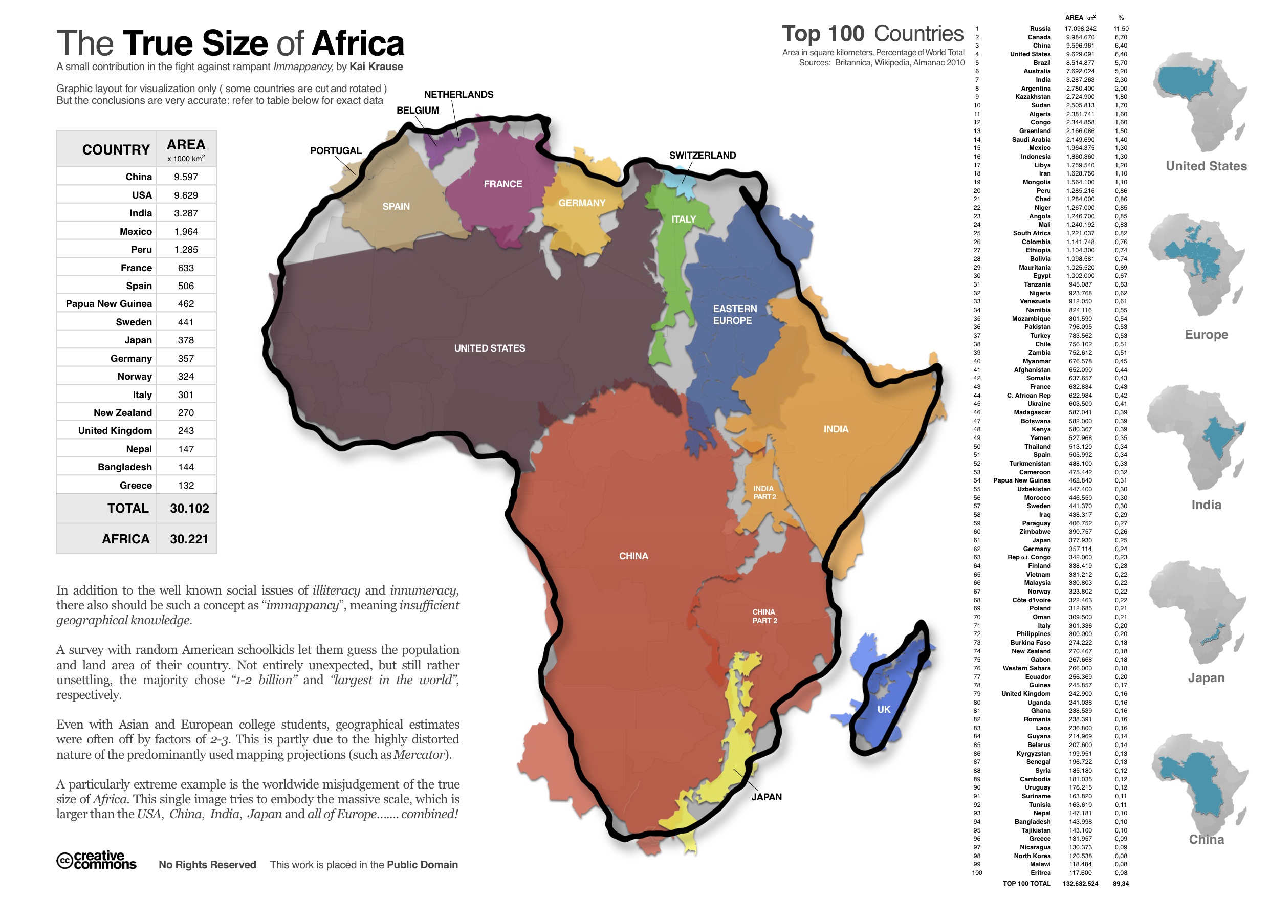
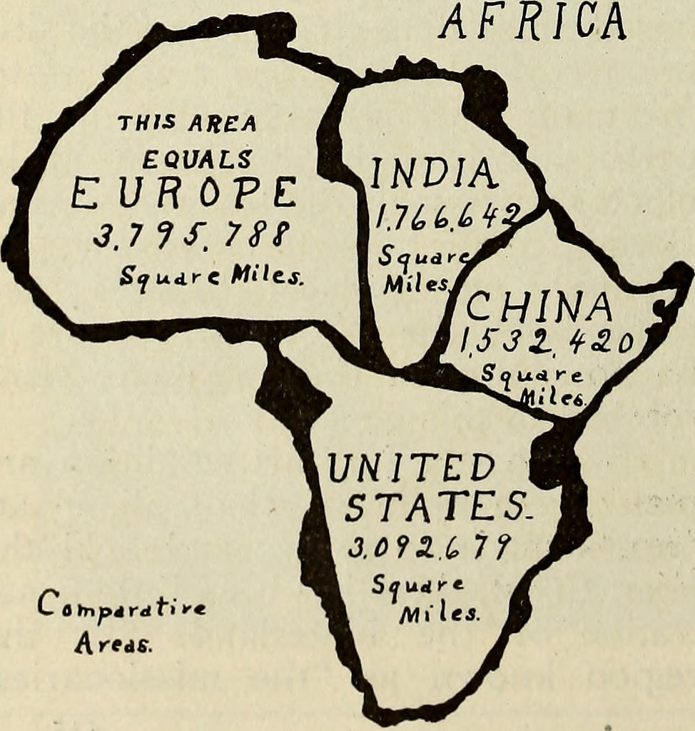
Cartography : The true true size of Africa | The Economist
The Economist a publié cette carte et xpliqué quje ça a été la cartela plus regardée en 2015 de toute leur collection.
►http://www.economist.com/blogs/dailychart/2010/11/cartography
Kai Krause, a computer-graphics guru, caused a stir with a map entitled “The True Size of Africa”, which showed the outlines of other countries crammed into the outline of the African continent.
Il y a exactement 100 ans :
▻http://furtho.tumblr.com/post/134059568035/comparative-map-of-africa-from-the-spirit-of
« Comparative map of Africa from The Spirit Of Missions, 1915 (via internetarchivebookimages)7
@reka
Et démographiquement ? Si une telle chose existe.

@philippe_de_jonckheere je recherche... Et si ça n’existe pas j’essayerai de la faire (en toute simplicité). L’idée est bonne.

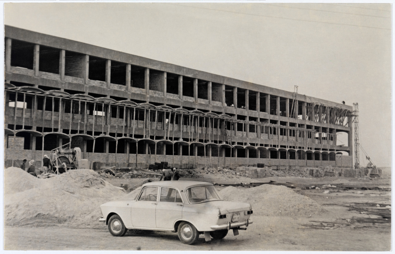
En flanant sur un site d’image intéressant ►http://furtho.tumblr.com ce matin, je tombe sur cette image :
« Construction of the Faculty of Economics at the Gulbenkian Foundation of Iraq (via biblarte) »
Troublant.
En 2007 lors d’une mission en Georgie ex-soviétique, j’avais pris cette photo :
« Ruine industrielle à Roustavi, Géorgie, 2007 »
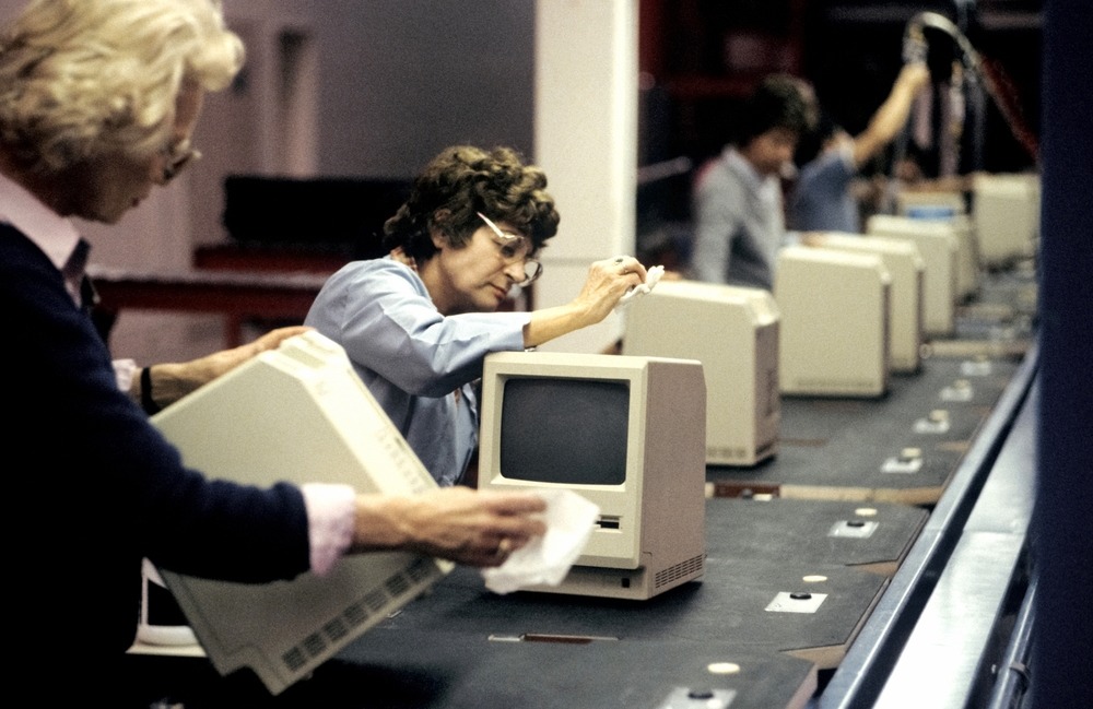
Jean-Pierre Laffont’s photograph of the Apple... — the track east
▻http://furtho.tumblr.com/post/136102498282/jean-pierre-laffonts-photograph-of-the-apple
Vu sur twitter sur le compte de « brutal architecture », et grosse grosse nostalgie quand je repense à cette période et ce que j’ai pu faire avec cette machine...
(soupir)
Jean-Pierre Laffont’s photograph of the Apple Macintosh assembly line, Cupertino, California, 1984 (via zphotojournal.com)