


Mapping #Divided_Cities and Their Separation Walls: Berlin and Jerusalem
This project compares two separation barriers and their urban landscape in two very different socio-cultural and historical contexts: in the cities of Jerusalem and Berlin. The focus is on how different mapmakers from opposite side of the respective divides represent physical divisions, such as walls and barriers, as well as imaginary divides, such as geopolitical or socio-ethnic divisions. Jerusalem and Berlin are particularly powerful symbols of political partition as the Berlin Wall split the city of Berlin for over twenty-six years and Jerusalem remains a divided city to this day. In both cases, their walls have become defining feature of their city’s urban identity. Through much of its recent history, Berlin became synonymous with the wall that split it, and Jerusalem also has become an iconic example of a city divided along physical and imaginary lines.[1]
 http://www.palestine-studies.org/sites/default/files/uploads/images/Christine%201.jpg
  http://www.palestine-studies.org/sites/default/files/uploads/images/Christine%202.jpg
  http://www.palestine-studies.org/sites/default/files/uploads/images/Christine%204.jpg
  http://www.palestine-studies.org/sites/default/files/uploads/images/Christine%206.jpg
  http://www.palestine-studies.org/sites/default/files/uploads/images/Christine%207.jpg
 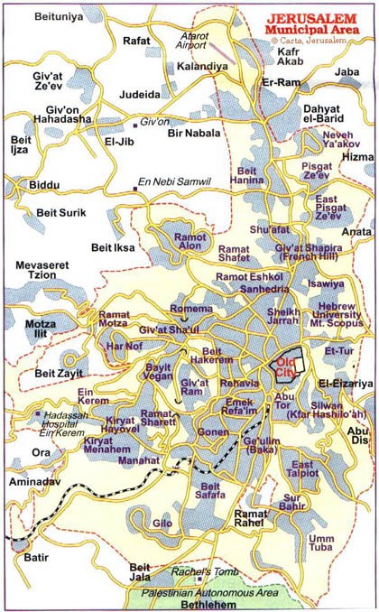 http://www.palestine-studies.org/sites/default/files/uploads/images/Christine%2011.jpg
 ▻http://www.palestine-studies.org/jq/fulltext/198349
#séparation #villes_séparées #murs #barrières_frontalières #urban_matter #Jérusalem #Berlin
cc @reka @albertocampiphoto @clemencel