• Dee Morris & Stephen Voyce | Jacket2

    https://jacket2.org/commentary/dee-morris-stephen-voyce

    Ce site tout à fait original et passionnant propose des exemples de #contre-cartographie #cartographie_radicale #cartographie_critique mais pas seulement ...

    Projet cartographie expérimentale
    Tags généraux : #cartoexperiment #biblioxperiment
    Tags particulier : #visualisation #complexité_visuelle

    Like the term eco-poetics, eco-mapping draws its discursive power from the oikos, whose etymological traces are manifest in both the ecological and the economic. We use it to signify a bio- rather than an anthro-pocentric approach to the complex relationships between cartography and planetary ecosystems. We agree with Donna Haraway that it is the capitalocene, and not the anthropocene, that figures the threat of mass extinction for all biotic and abiotic life. Read more

  • Graphesis — Johanna Drucker | Harvard University Press

    http://www.hup.harvard.edu/catalog.php?isbn=9780674724938

    C’est notre amie Sandra Rengen qui nous signale sur Twitter cet opus que je ne connaissais pas

    In our current screen-saturated culture, we take in more information through visual means than at any point in history. The computers and smart phones that constantly flood us with images do more than simply convey information. They structure our relationship to information through graphical formats. Learning to interpret how visual forms not only present but produce knowledge, says Johanna Drucker, has become an essential contemporary skill.

    Graphesis provides a descriptive critical language for the analysis of graphical knowledge. In an interdisciplinary study fusing digital humanities with media studies and graphic design history, Drucker outlines the principles by which visual formats organize meaningful content. Among the most significant of these formats is the graphical user interface (GUI)—the dominant feature of the screens of nearly all consumer electronic devices. Because so much of our personal and professional lives is mediated through visual interfaces, it is important to start thinking critically about how they shape knowledge, our behavior, and even our identity.

    Information graphics bear tell-tale signs of the disciplines in which they originated: statistics, business, and the empirical sciences. Drucker makes the case for studying visuality from a humanistic perspective, exploring how graphic languages can serve fields where qualitative judgments take priority over quantitative statements of fact. Graphesis offers a new epistemology of the ways we process information, embracing the full potential of visual forms and formats of knowledge production.

    #cartographie #visualisation #cartoexperiment

    Projet cartographie expérimentale
    Tags généraux : #cartoexperiment #biblioxperiment
    Tags particulier : #visualisation #complexité_visuelle

  • Revue « Territory »

    SIgnalé par @fil ce matin

    Issue X - Extremes - Preview — Territory
    http://themapisnot.com/issue-x-extremes-preview

    In theory, extremes are rarities. At any given moment, there can only be one of each superlative—smallest, tallest, fastest, farthest, deepest, darkest, brightest—but, as the saying goes, records are meant to be broken. The indivisible atom was split. Infinity has been proven to come in many sizes and shapes. An extreme is a record of limit, but also a series, a narrative of revision. It is never singular, a datum. As psychonaut Terence McKenna was fond of saying, “the bigger you build the bonfire, the more darkness is revealed.”

    –-----

    Issue 11 - Twins - Preview — Territory
    http://themapisnot.com/issue-11-twins-preview

    Roughly 1 in every 30 births is a pair of twins. Uncommon yet not rare, there’s an ambivalence to twinness, what anthropologist Philip Peek terms the “centrality of liminality.” Twins are both one and two, and this logical ambiguity can be the source of harmony, as with the yin-yang duality, or evidence of a disturbing glitch, as in the uncanny of the doppelgänger.

    –-----

    Issue 12 - Alaska - Preview — Territory
    http://themapisnot.com/issue-12-alaska-preview

    On most maps, Alaska is an outlier. Separated by land and sea from the “lower 48” and skewed by the distortions of the Mercator-derived projections that most popular maps default to, Alaska doesn’t easily fit within the image of the United States. Cartographers seem to be at a loss as to where to put it. On some maps, the state is packed into its own little box and shipped south to warm up next to Hawai’i. On others, it’s not even present at all. Then, when granted its own map, Alaska receives almost compensatory treatment. It is painted pictorially as larger than life, an Arctic Treasureland or The Far North Frontier, a land of opportunity for those rugged enough to brave its harsh conditions, native and colonial alike.

    #cartographie #cartoexperiment #territoire #géographie

    Projet cartographie expérimentale
    Tags généraux : #cartoexperiment #biblioxperiment
    Tags particulier : #visualisation #complexité_visuelle

  • Sur l’imaginaire cartographique dans l’art contemporain | Espace art actuel

    https://espaceartactuel.com/imaginaire-cartographique
    /app/uploads/2016/09/cropped-logo-espace-favicon.png

    Sur l’#imaginaire cartographique dans l’#art_contemporain

    Gilles A. Tiberghien

    L’art et la cartographie ont partie liée depuis bien longtemps, peut-être depuis les origines mêmes de la cartographie. Les cartes médiévales dites T dans l’O étaient souvent richement ornées, tout comme les portulans qui apparaissent dès le XIIIe siècle 2, et les artistes à la Renaissance ont souvent participé à la réalisation de cartes. Aujourd’hui, à une époque où ils sont largement tenus à l’écart de cette activité, et ce depuis plus de deux siècles, l’intérêt pour la cartographie s’est néanmoins beaucoup développé dans le monde de l’art depuis les années soixante, conjointement avec ce que l’on a appelé l’art conceptuel au sens large 3.

    Les artistes en effet réinterrogent les procédures propres à la cartographie. Ils mettent l’accent sur des problèmes que les cartographes dans l’exercice de leur métier finissent par ne plus apercevoir, étant trop occupés à produire des instruments fiables pour se repérer dans l’espace et évaluer les distances entre localités désignées et nommées.

    Pourtant, les géographes depuis une trentaine d’années se sont beaucoup intéressés à l’activité cartographique, à ce que les Anglo-Saxons appellent le mapping, déplaçant pour une part leurs analyses sur les processus plus que sur les objets.Les artistes contemporains ont considéré la carte à la fois pour elle-même, dans sa complexité picturale et sémantique (Jasper Johns, Pierre Alechinsky, etc.), et comme un moyen pour « documenter » des actions éphémères ou pour localiser des réalisations difficiles d’accès, comme l’ont fait certains artistes du Land Art (Robert Smithson, Nancy Holt, Dennis Oppenheim ou Richard Long) mais pour en pervertir et en explorer tous les usages possibles.

    #cartographie
    Projet cartographie expérimentale
    Tags généraux : #cartoexperiment #biblioxperiment
    Tags particulier : #visualisation #complexité_visuelle

  • Clashing Cartographies, Migrating Maps: The Politics of Mobility at the External Borders of E.U.rope | ACME: An International Journal for Critical Geographies

    https://www.acme-journal.org/index.php/acme/article/view/1094

    The generative power of mapping speaks to the material effects produced by maps and their capacity to order particular social and spatial relations. In the case of the EU’s external border, cartography is in fact used both as a practice for the control and government of mobility as well as a tool for advocating, facilitating and even embodying, border crossing. This paper engages a series of border mapping examples showing how cartography works on the ground for both the world of migration management and the struggles for free movement. By focusing on the role that maps and mapping practices play within the politics of migration - the contentious field of actions and relations which determines who can move and in what condition – we point to an on-going “clash of cartographies” in the current flurry of charting borders and flows: while some maps operate at the service of the current border regime, other maps aim at counter governmental practices of control. Examining such tensions between cartographies, and the practices they entail, aids in undermining a fixed understanding and a closed spatial coding of borders.

    Projet cartographie expérimentale
    Tags généraux : #cartoexperiment #biblioxperiment
    Tags particulier : #visualisation #complexité_visuelle #migrations #asile #mourir_en_mer #réfugiés

  • Mappamundi, art et cartographie - Editions Parenthèses

    https://www.editionsparentheses.com/Mappamundi-art-et-cartographie

    Les cartes s’imposent à nous dans les rues, les écrans, les esprits. C’est désormais à travers elles que nous percevons et pensons le monde. Parce que la cartographie est devenue un enjeu majeur, les artistes l’ont reprise d’assaut, bousculant géographes, ingénieurs, militaires et informaticiens. Remettant en cause l’idée même de neutralité cartographique, les plasticiens font et défont les cartes, jouent avec les formes, les couleurs et les mots du monde.
    « Mappamundi » rassemble une trentaine d’artistes qui interrogent la représentation cartographique. Ces visions d’artistes sont regroupées en trois temps : le corps — les cartes renouent avec les sensations et l’expérience physiques du monde ; le combat — des instruments de pouvoir deviennent outils de contestation ; le conte — les cartes utilitaires sont détrônées par l’imaginaire et la fiction.
    Un essai sur les relations entre art et cartographie précède les « portraits du monde » sélectionnés dans « Mappamundi ». Cartes à lire ou à voir ? Miroir tranquille ou distorsion du monde ? Description, évocation, contestation ? Loin d’exprimer des certitudes, ces cartes dessinent à leur façon notre modernité et dressent d’abord notre portrait collectif.
    Œuvres de : Alighiero e Boetti , Céline Boyer, Alexander Chen, Nicolas Desplats, Detanico & Lain, Paola Di Bello, Peter Fend, Jochen Gerner, Luigi Ghirri, Chris Kenny, Bouchra Khalili, Joseph Kosuth, Guillermo Kuitca, Nelson Leirner, Cristina Lucas, Mateo Maté, Vik Muniz, Qin Ga, David Reimondo, Rosana Ricalde, Francesc Ruiz, Stalker, Susan Stockwell, Jessica Vaturi, Jason Wallis-Johnson, Jeremy Wood.
    Textes de : Agathémère / Arendt, Hannah / Baudelaire, Charles / Baudrillard, Jean / Benjamin, Walter / Bergman, Ingmar / Bettencourt, Pierre / Boèce / Borges, Jorge Luis / Boyd, William / Bresson, Robert / Browne, Thomas / Buisson, Ferdinand / Calvino, Italo / Carroll, Lewis / D’Alembert, Jean / Daney, Serge / De Certeau, Michel / De Maistre, Xavier / De Tilbury, Gervais / Deleuze, Gilles, Guattari, Félix / Donne, John / Duval, Pierre / Eco, Umberto / François, Père Jean / Goethe, Johann Wolfgang von / Gracq, Julien / Kafka, Franz / Kleist, Heinrich von / Korzybski, Alfred / La Pérouse, Jean-François de / Latour, Bruno / Locke, John / Long, Richard / Lubin, Père Augustin / Melville, Herman / Michelet, Jules / Montaigne, Michel de / Napoléon / Ortelius, Abraham / Orwell, George / Pascal, Blaise / Perec, Georges / Pétrarque / Picasso, Pablo / Pouchkine, Alexandre / Proust, Marcel / Reclus, Élisée / Schmitt, Carl / Senges, Pierre / Shakespeare, William / Sloterdijk, Peter / Stein, Gertrud / Stevenson, Robert Louis / Thoreau, Henry David / Valéry, Paul / Van Hoogstraten, Samuel / Verne, Jules / Wilde, Oscar / Wittgenstein, Ludwig.

    –—

    Mappamundi, art et cartographie

    https://mappemonde-archive.mgm.fr/num42/librairie/lib14203.html

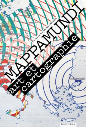
    Cet ouvrage a été édité à l’occasion de l’exposition éponyme, au printemps 2013 à Toulon. Son auteur, G. Monsaingeon, est le commissaire de l’exposition. Mappamundi / Mappemonde : au-delà de la proximité du nom, cette exposition se rapproche des préoccupations de la présente revue par son objet et son contenu.

    En guise de prologue, l’ouvrage rappelle la fascination qu’exercent les cartes et les atlas : elles invitent au voyage et à la rêverie géographique, dès l’enfance. Cette émotion, d’ordre esthétique, est régulièrement mise en œuvre par les artistes plasticiens pour créer des géographies, des dépictions artistiques de notre monde ou d’autres. « Il est aujourd’hui communément admis qu’une carte puisse être dite “belle” » (p. 8).

    L’ouvrage est abondamment illustré et très riche en références, à la fois du monde artistique et esthétique, mais aussi de l’épistémologie cartographique. Il se compose de trois parties qui en font bien plus qu’un simple catalogue d’exposition. Tout d’abord, une première section présente le projet de l’exposition, développe une esthétique de la carte et propose une catégorisation de l’intérêt des artistes pour la carte. La deuxième partie, la plus importante, regroupe de manière thématique les œuvres des vingt-six artistes sélectionnés par l’exposition Mappamundi, selon trois catégories : le corps, le combat et le conte. Enfin, l’ouvrage se termine par une très originale « Table d’orientation », recueil d’une soixantaine de citations d’auteurs plus ou moins célèbres à propos de la carte et de son usage.

    Projet cartographie expérimentale
    Tags généraux : #cartoexperiment #biblioxperiment
    Tags particulier : #visualisation #complexité_visuelle #art #perceptions #représentation

  • An Atlas of Radical Cartography

    http://www.an-atlas.com

    An Atlas of Radical Cartography is a collection of 10 maps and 10 essays about social issues from globalization to garbage; surveillance to extraordinary rendition; statelessness to visibility; deportation to migration. The map is inherently political— and the contributions to this book wear their politics on their sleeves.

    An Atlas of Radical Cartography provides a critical foundation for an area of work that bridges art/design, cartography/geography, and activism. The maps and essays in this book provoke new understandings of networks and representations of power and its effects on people and places. These new perceptions of the world are the prerequisites of social change.

    MAPS | An Architektur | the Center for Urban Pedagogy (CUP) | Ashley Hunt | Institute for Applied Autonomy with Site-R | Pedro Lasch | Lize Mogel | Trevor Paglen & John Emerson | Brooke Singer | Jane Tsong | Unnayan

    ESSAYS | Kolya Abramsky | Maribel Casas-Cortes & Sebastian Cobarrubias | Alejandro De Acosta | Avery F. Gordon | Institute for Applied Autonomy | Sarah Lewison | Jenny Price, Jane Tsong, DJ Waldie, Ellen Sollod, Paul S. Kibel | Heather Rogers | Jai Sen | Visible Collective & Trevor Paglen

    EDITORS | Lize Mogel & Alexis Bhagat

    Projet cartographie expérimentale
    Tags généraux : #cartoexperiment #biblioxperiment
    Tags particulier : #visualisation #complexité_visuelle #art #représentation #résistance #cartographie_engagée

  • GNS : Catalogue de l’exposition sur la cartographie - Palais de Tokyo

    http://archives.palaisdetokyo.com/gns/hors/catalogue.html
    http://archives.palaisdetokyo.com/gns

    http://archives.palaisdetokyo.com/fr/docu/tokyonews/41/tokyonews41.html

    Le livre bilingue (Français / Anglais) GNS est publié par le Palais de Tokyo, site de création contemporaine, aux Editions Cercle d’Art, avec le concours de la CCAS (Caisse centrale d’activités sociales du personnel des Industries électrique et gazière) et, pour le traitement des images, des AGC (Arts Graphiques du Centre).

    Une large partie introductive et théorique regroupe les textes de Nicolas Bourriaud, commissaire de l’exposition, Philippe Rekacewicz, géographe et journaliste au Monde Diplomatique, Antoine Picon, historien et professeur à Harvard et Christophe Kihm, critique d’art et rédacteur en chef de Art Press, qui éclairent et analysent les problématiques de l’exposition selon des axes différents et complémentaires : esthétiques, philosophiques, historiques, géopolitiques, sociologiques...
    Une vingtaine d’illustrations d’oeuvres importantes, parfois inédites, illustrent ou mettent en pespective le propos des auteurs. Chacune est accompagnée d’un commentaire souvent écrit par l’artiste lui-même : Richard Long, Dennis Oppenheim, Bertrand Lavier, Art & Language, Julia Scher, Allighiero Boetti, On Kawara, Peter Halley...

    La deuxième partie est consacrée aux artistes : chacun s’investit directement en commentant son travail, en l’analysant, en expliquant sa démarche et en faisant un choix précis d’illustrations reproduites en couleur pleine page. Ainsi, Bureau d’études a entièrement conçu ses pages, Nathan Carter dialogue avec Liam Gillick, Kisten Pieroth s’approprie un texte...

    Liste des artistes :

    Franz Ackermann / Burean d’études / Nathan Carter / Wim Delvoye /Dominique Gonzalez-Foerster / Thomas Hirschhorn / Laura Horelli / Pierre Huyghe /Pierre Joseph / Jakob Kolding / Matthieu Laurette / Marc Lombardi / Julie Mehretu / John Menick / Aleksandra Mir / Ocean Earth / Henrick Olesen / Kirsten Pieroth / Marjetica Potrc / Matthew Ritchie / Pia Rönicke / Sean Snyder / Stalker / Simon Starling / Le Pavillon, unité pédagogique du Palais de Tokyo

    Projet cartographie expérimentale
    Tags généraux : #cartoexperiment #biblioxperiment
    Tags particulier : #visualisation #art #résistance #cartographie_politique #cartographie_engagée #représentation

  • The Book of Circles: Visualizing Spheres of Knowledge

    by Manuel Lima

    https://www.papress.com/html/product.details.dna?isbn=9781616895280

    In this follow-up to his hugely popular The Book of Trees and Visual Complexity, Manuel Lima takes us on a lively tour through millennia of circular information design. Three hundred detailed and colorful illustrations from around the world cover an encyclopedic array of subjects’architecture, urban planning, fine art, design, fashion, technology, religion, cartography, biology, astronomy, and physics, all based on the circle, the universal symbol of unity, wholeness, infinity, enlightenment, and perfection. Clay tokens used by ancient Sumerians as a system of recording trade are juxtaposed with logos of modern retailers like Target; Venn diagrams are discussed alongside the trefoil biohazard symbol, symbols of the Christian trinity, and the Olympic rings; and a diagram revealing the characteristics of ten thousand porn stars displays structural similarities to early celestial charts placing the earth at the center of the universe. Lima’s introduction provides an authoritative history of the circle, and a preface describes his unique taxonomy of the many varieties of circle diagrams, rounding out this visual feast for infographics enthusiasts.

    Projet cartographie expérimentale
    Tags généraux : #cartoexperiment #biblioxperiment
    Tags particulier : #visualisation #complexité_visuelle