The Map-maker of Gotham City - Life Without Buildings
▻http://lifewithoutbuildings.net/2014/06/the-map-maker-of-gotham-city.html
Gotham City is the perpetually dark comic book metropolis of alleys, asylums, caves, mansions, and of course, Batman. The Dark Knight of DC Comics celebrates his 75th anniversary this year but Gotham didn’t become the hometown of the Caped Crusader until 1940, when Batman co-creator Bill Finger named the city for the first time inBatman No.4. In the early days of comics, cities weren’t much more than rooftop set pieces and vaguely defined skylines, and Batman was ostensibly fighting crime in a generic city with a vague resemblance to New York, but, as Finger has said, “We didn’t call it New York because we wanted anybody in any city to identify with it.” However, since its inception Gotham has gained an identity as complex and unique as any real American metropolis and is now more closely associated with a single character than any other city in comics. Capital-M Metropolis comes close perhaps, but Superman’s city is nowhere near as interesting as Gotham, in part because Gotham has something that makes it more fully realized and more consistent in its representation than any other fictional city in comics or film: a map.
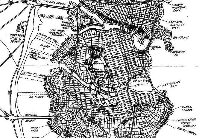
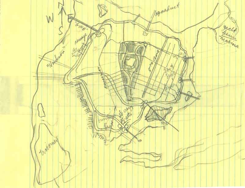
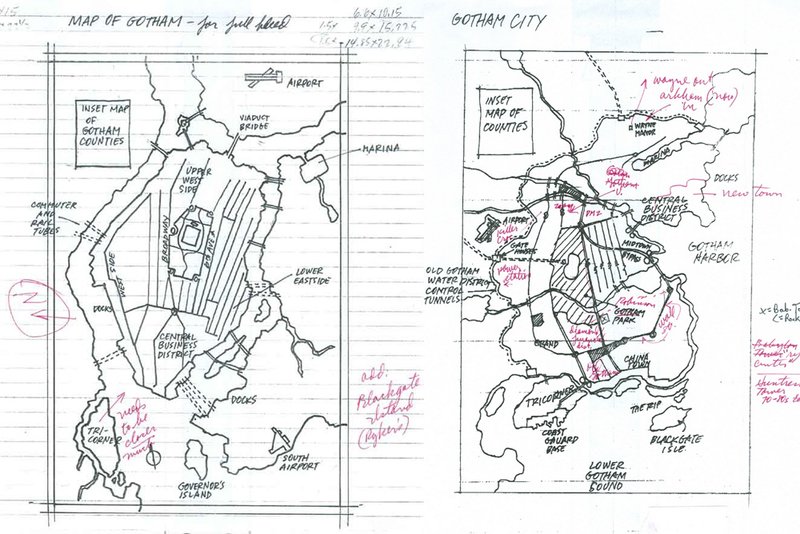
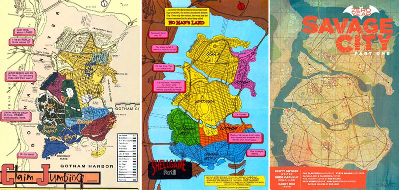
Gotham City limits were defined in 1998 in preparation for the “No Man’s Land Story” story arc, during which the city was cut off from the United States after nearly being destroyed by a cataclysmic earthquake. It was the comic book version of Escape from New York. However, before DC Comics could destroy Gotham City, there had to be a Gotham City to destroy. Enter artist and illustrator Eliot R. Brown, the cartographer of Gotham.
#Gotham_city #carte