• Les mesures de surveillance par géolocalisation doivent être strictement encadrées
    https://lecourrier.ch/2018/02/14/les-mesures-de-surveillance-par-geolocalisation-doivent-etre-strictement-

    Pierre-Yves Bosshard interroge la nécessité de la surveillance par géolocalisation dans une société démocratique. Le 8 février dernier, la Cour européenne des droits de l’homme a dit que la France avait violé l’article 8 de la Convention européenne des droits de l’homme, qui garantit à toute personne le droit au respect de sa vie privée et familiale, pour avoir autorisé l’apposition d’un dispositif technique de localisation (récepteur GPS) sur le véhicule du requérant. Le requérant se trouvait sous (...)

    #GPS #écoutes #géolocalisation #procès #Cour_européenne_des_droits_de_l'Homme

  • [Appli] Strava Global Heatmap
    https://labs.strava.com/heatmap/#11.03/-120.62958/37.32977/hot/all

    #application #GPS #trajectoire #réseaux #geovizu #flowmap #STRAVA #couleurs

    Une cartographie des trajectoires de joggeurs issues de données GPS (smartphones, etc.). Cette jolie représentation repose sur l’utilisation d’un artefact : l’introduction de bruits sur les trajectoires de coureurs.

    Les auteurs ont en effet souligné l’effet négatif des corrections automatiques des positions GPS effectuées par certains capteurs, en cas de perte ou d’imprécision du signal dans certaines zones urbaines.

    Ces corrections impactant le dessin de la trajectoire, les auteurs ont cherché à réduire leur effet, en générant artificiellement du bruit sur les trajectoires. L’idée générale consiste à décaler les positions et à contrôler le niveau de bruit ainsi introduit de manière à empêcher la géovisualisation de ces artefacts, sans affecter celle des autres données.

    Source :
    https://medium.com/strava-engineering/the-global-heatmap-now-6x-hotter-23fc01d301de?_branch_match_id=4583720341732

  • Strava : la Heat Map qui fait froid dans le dos
    https://linc.cnil.fr/fr/strava-la-heat-map-qui-fait-froid-dans-le-dos

    Comme de nombreux autres services d’applications ou de capteurs connectés dédiés aux activités physiques ou plus généralement liés à la mobilité, Strava a récemment publié sur une carte de chaleur l’ensemble de l’activité de ses utilisateurs sur une période allant de 2015 à septembre 2017. Ils offraient déjà ce service aux municipalités. Il s’agit de données agrégées – on ne peut pas suivre un utilisateur en particulier – qui rendent compte des endroits privilégiés par les utilisateurs de la plateforme pour (...)

    #Strava #GPS #sport #surveillance #géolocalisation

  • Fitness Tracker Data Highlights Sprawling U.S. Military Footprint in Africa
    https://theintercept.com/2018/01/29/strava-heat-map-fitness-tracker-us-military-base

    Out in the cocoa-colored wastes of north-central Niger, people have been running around in circles. Exactly who has been jogging or walking around this compound outside the town of Arlit is unclear. But there’s a good chance it has something to do with U.S. Africa Command’s “Analysis Office” there, the existence of which was disclosed in 2016 contracting documents. Not far away, people have been running round and round in a compound near the airfield in Agadez, Niger, where the U.S. military (...)

    #GPS #géolocalisation #sport #Fitbit #Strava

  • U.S. soldiers are revealing sensitive and dangerous information by jogging - The Washington Post
    https://www.washingtonpost.com/world/a-map-showing-the-users-of-fitness-devices-lets-the-world-see-where-us-soldiers-are-and-what-they-are-doing/2018/01/28/86915662-0441-11e8-aa61-f3391373867e_story.html?hpid=hp_hp-top-table

    An interactive map posted on the Internet that shows the whereabouts of people who use fitness devices such as Fitbit also reveals highly sensitive information about the locations and activities of soldiers at U.S. military bases, in what appears to be a major security oversight.

    The Global Heat Map, published by the GPS tracking company Strava, uses satellite information to map the locations and movements of subscribers to the company’s fitness service over a two-year period, by illuminating areas of activity.

    Strava, the social network for athletes, has launched its global heatmap, a striking visualization of over one billion activities from Strava athletes across a wide variety of activities, both on land and in the sea. The activities logged covered nearly 17 billion miles. You can explore and search for your own area here
    https://www.theguardian.com/lifeandstyle/the-running-blog/gallery/2017/nov/02/strava-a-global-heatmap-of-athletic-activity

    The map, released in November 2017, shows every single activity ever uploaded to Strava – more than 3 trillion individual GPS data points, according to the company. The app can be used on various devices including smartphones and fitness trackers like Fitbit to see popular running routes in major cities, or spot individuals in more remote areas who have unusual exercise patterns.

    However, over the weekend military analysts noticed that the map is also detailed enough that it potentially gives away extremely sensitive information about a subset of Strava users: military personnel on active service.

    Nathan Ruser, an analyst with the Institute for United Conflict Analysts, first noted the lapse. The heatmap “looks very pretty” he wrote, but is “not amazing for Op-Sec” – short for operational security. “US Bases are clearly identifiable and mappable.”

    “If soldiers use the app like normal people do, by turning it on tracking when they go to do exercise, it could be especially dangerous,” Ruser added, highlighting one particular track that “looks like it logs a regular jogging route.”

    https://www.theguardian.com/world/2018/jan/28/fitness-tracking-app-gives-away-location-of-secret-us-army-bases

    #applications #bases_militaires_us #cartographie #parcours #jogging

  • Fitness tracking app Strava gives away location of secret US army bases
    https://www.theguardian.com/world/2018/jan/28/fitness-tracking-app-gives-away-location-of-secret-us-army-bases

    Data about exercise routes shared online by soldiers can be used to pinpoint overseas facilities Sensitive information about the location and staffing of military bases and spy outposts around the world has been revealed by a fitness tracking company. The details were released by Strava in a data visualisation map that shows all the activity tracked by users of its app, which allows people to record their exercise and share it with others. The map, released in November 2017, shows every (...)

    #GPS #géolocalisation #sport #Strava

  • Comment une app de course à pied pourrait trahir l’emplacement de bases militaires secrètes
    https://www.numerama.com/tech/325146-comment-une-app-de-course-a-pied-pourrait-trahir-lemplacement-de-ba

    L’application mobile Strava compile sur une carte du monde les trajets de ses utilisateurs adeptes de la course à pied. Or, nombre de ses membres sont des militaires. Dans certaines zones, le tracé de leurs excursions laisse deviner où peuvent se trouver des bases secrètes. Strava est une application mobile destinée aux sportifs qui souhaitent analyser leurs performances et partager leurs exploits avec d’autres athlètes. En novembre dernier, l’entreprise a publié une carte permettant aux (...)

    #GPS #géolocalisation #sport #surveillance

  • En Espagne, des GPS pour traquer les balayeurs provoquent un tollé
    http://www.lefigaro.fr/conjoncture/2018/01/15/20002-20180115ARTFIG00177-en-espagne-des-gps-pour-traquer-les-balayeurs-pro

    La mairie de Gérone impose à ses balayeurs de porter une balise GPS pour être localisés pendant les heures de travail, une mesure polémique très mal vécue par les intéressés. En France, le projet suscite indignation et scepticisme. À Gérone en Espagne, la polémique grandit depuis quelques semaines, autour d’un projet que l’on pourrait facilement qualifier d’orwellien. Comme le rapporte France Bleu, les balayeurs et nettoyeurs ont désormais pour obligation de porter une balise GPS lorsqu’ils travaillent (...)

    #GPS #géolocalisation #travailleurs #surveillance

  • GPS : de la valeur par défaut
    http://www.internetactu.net/a-lire-ailleurs/gps-de-la-valeur-par-defaut

    Sur son blog, Michael Verdi (@michaelverdi), designer pour Firefox, pointe un excellent exemple des ambiguïtés des architectures de choix décidées par-devers nous. Michael possède un véhicule hybride, une Chevrolet Volt. Pour surveiller sa consommation électrique, il dispose d’un tableau de bord précis qui lui montre par exemple que sa batterie se vide bien plus rapidement lorsqu’il roule plus vite, à 120 qu’à 100 km/h. Or, il a remarqué que les GPS qu’il utilise ont toujours tendance à lui proposer (...)

    #GPS #domination #algorithme

  • What if software defaulted to the most efficient route instead of the fastest ?
    https://verdi.space/blog/what-if-software-defaulted-to-the-most-efficient-route-instead-of-the-faste

    As I’ve been driving around in my new Chevy Volt with an instrument panel that is all about efficiency, it’s become really noticeable that the battery drains much faster while driving on the highway at 65 or 70 mph. This is also true for regular combustion engines but it’s basically invisible if all you have is a tiny gas gauge. The other thing I’ve noticed is that both Apple Maps and Google Maps (the car works with both Apple CarPlay and Android Auto) default to the fastest route ; often (...)

    #GPS #algorithme #domination

  • Ten sailors missing after U.S. warship, tanker collide near Singapore
    https://www.reuters.com/article/us-usa-navy-crash-idUSKCN1B100C
    ça devient une habitude…
    mais cette fois à babord, donc, a priori, c’est lui qui a priorité…

    Ten sailors are missing after a U.S. warship collided with an oil tanker east of Singapore before dawn on Monday, tearing a hole beneath the waterline and flooding compartments that include a crew sleeping area, the U.S. Navy said.

    The collision between the guided-missile destroyer USS John S. McCain and the tanker Alnic MC was the second involving U.S. Navy destroyers and merchant vessels in Asian waters in little more than two months.

    The ships collided while the U.S. warship was heading to Singapore for a routine port call, the Navy said in a statement.

    • Ici, il est hors de question d’imaginer une quelconque défaillance de la veille sur l’un ou l’autre navire : ça doit être l’endroit où le trafic est le plus dense au monde et on est aux abords immédiats du port…

      En revanche, le communiqué de la Navy laisse songeur. Le John McCain est abordé à babord (à l’arrière de sa seconde cheminée), vraisemblablement à l’endroit où s’achève la dernière ligne droite de la trajectoire) alors que le pétrolier vient de l’est et se dirige vers le terminal pétrolier (dans l’axe de cette ligne droite). Difficile à imaginer si le John McCain entrait au port ; normalement, il présentait son flanc tribord…

      Au vu des photos, et de l’enfoncement des tôles, il semblerait que le pétrolier venait de l’arrière.

    • Stricken destroyer John S. McCain arrives in Singapore, 10 crew still missing
      http://www.navytimes.com/news/your-navy/2017/08/20/navy-destroyer-john-s-mccain-collides-with-merchant-vessel

      Mounting questions
      The details of how the collisions occurred remain unkown, But incidents such as those with the McCain and Fitzgerald incidents are troubling, said Jan van Tol, a retired commander of three war ships who now serves as an analyst with the Center for Strategic and Budgetary Assessments.

      Navy destroyers are remarkably nimble and responsive, including rapid acceleration ability, thus should certainly be able to get out of the way of almost anything approaching ‘too close,’” van Tol said in an email.

      Such close quarters situations should NEVER be allowed to develop without various watchstanders and watchteams being well aware that they are developing,” he said.

      It is unknown whether McCain had suffered any kind of casualty to its engineering or steering systems ahead of the collision that would have contributed to the disaster.

      The collision was the fourth significant safety incident of 2017 involving a U.S. 7th Fleet ship. In January, the cruiser Antietam ran aground in Tokyo Bay and in May, the cruiser Lake Champlain collided with a Korean fishing boat in the Sea of Japan.

      (outre le Fitzgerald)

    • Complètement dingue !

      La collision a eu lieu nettement plus à l’est, juste à l’entrée du dispositif de séparation de trafic. Dans les derniers instants, on voit l’Alnic NC abattre en grand sur la gauche en ralentissant fortement, indice évident d’une manœuvre en catastrophe, qui ne peut se justifier (on est dans le rail, bon sang !) que par une tentative d’évitement désespérée…

      Mille sabords !, que fabriquait cet amiral de bateau-lavoir de USS John S. McCain à cet endroit là ?
      (NB : le père et le grand-père du sénateur, John S. McCain III, ont tous les deux terminé leur carrière comme amiral et, pour faire simple portaient également le même middle name, Sidney. On fait dans la dynastie ou pas…)

      Comment a-t-il pu couper la route d’un bateau dont la route est absolument rectiligne et prévisible (il est dans le rail) ? Peut-être le McCain n’y était-il pas et a-t-il manœuvré brutalement pour s’y placer ?
      https://www.youtube.com/watch?v=vlrA36GzHNs

      EDIT (24/08)
      pour gCaptain, l’abattée à gauche est le résultat de la collision, ce qui parait tout à fait crédible et explique bien la forme de l’enfoncement sur l’arrière de l’ouverture. Le McCain devait filer vite pour dévier à ce point la trajectore.
      Du coup, on peut élaborer un scénario où le McCain coupe, pour des raisons qu’il reste à préciser, le rail « conformément aux règles internationales » : perpendiculairement et le plus vite possible. Et dans ce cas, il est responsable à 100%…

      Comment, elle a dit déjà l’amirauté ? ah oui, #poor_seamanship

      http://gcaptain.com/uss-john-s-mccain-collision-ais-animation-shows-tankers-track-during-colli

    • The Latest: US Navy vessel arrives to help damaged destroyer - The Washington Post
      https://www.washingtonpost.com/world/asia_pacific/the-latest-us-warship-sailing-on-own-power-after-collision/2017/08/20/9c7ae012-860e-11e7-96a7-d178cf3524eb_story.html

      5:00 p.m.
      The oil tanker involved in a collision with the USS John S. McCain destroyer in busy Southeast Asian waters had four deficiencies including navigation safety violations in its last port inspection.

      An official database for ports in Asia shows the Alnic MC was inspected in the Chinese port of Dongying on July 29 and had one document deficiency, one fire safety deficiency and two safety of navigation problems.

      The database doesn’t go into details and the problems were apparently not serious enough for the Liberian-flagged and Greek-owned vessel to be detained by the port authority.
      […]
      4:10 p.m.
      The chief of Malaysia’s Maritime Enforcement Agency says the collision between an oil tanker and the USS John S. McCain guided missile destroyer early Monday occurred at the start of a designated sea lane for ships sailing into the Singapore Strait, one of the world’s busiest shipping lanes.

      Zulkifli Abu Bakar said the incident occurred 4.5 nautical miles (8.3 kilometers) from Malaysia’s coast. He said a Malaysian warship was in the area monitoring the cleanup of an oil spill from an unrelated collision of two merchant ships and was contacted by the McCain.

      Both Malaysia and Singapore say the accident happened in their waters, likely reflecting a dispute about ownership of some rocky outcrops in the area.

      It happened in Malaysian territorial waters, specifically in Teluk Ramunia waters,” Zulkifli said. “For this moment, we shouldn’t argue about whose waters. Most important thing is we focus on the search and rescue.

    • Frontière entre la Malaisie et Singapour — Wikipédia
      https://fr.wikipedia.org/wiki/Frontière_entre_la_Malaisie_et_Singapour

      La délimitation de cette frontière maritime a fait l’objet d’un recours devant la Cour internationale de justice, effectué conjointement le 24 juillet 2003 par la Malaisie et Singapour. Le différend portait sur l’île de Pedra Branca, les Middle Rocks (deux rochers inhabités) et South Ledge, un haut-fond découvrant. Par un arrêt du 23 mai 2008, la Cour a attribué Pedra Blanca à Singapour, les Middle Rocks à la Malaisie, et South Ledge à l’État dans les eaux territoriales duquel il se trouve (la Cour n’ayant pas reçu mandat des parties pour délimiter leurs eaux territoriales respectives).

      L’arrêt de la CIJ
      Affaire relative à la souveraineté sur Pedra Blanca/Pulau Batu Puteh, Middle Rocks et South Ledge –(Malaisie/Singapour)
      Arrêt du 23 mai 2008
      http://www.icj-cij.org/files/case-related/130/130-20080523-JUD-01-00-FR.pdf

      (il me semblait avoir vu passer ce contentieux ici)


      (extrait de l’arrêt de la CIJ)

    • Serrage de boulons généralisé…

      Admiral to order operational pause in Navy after warship, merchant ship collide - CNN
      http://edition.cnn.com/2017/08/20/asia/us-navy-destroyer-collision-singapore/index.html

      Chief of Naval Operations Adm. John Richardson is expected to order a one-day pause in operations “to ensure we are taking all appropriate immediate measures to enhance the Navy’s safe and effective operation around the world,” according to a US Defense official and an advanced copy of Richardson’s statement obtained by CNN.

      The stand-down will take place over the next couple of weeks, at the discretion of individual commands, the defense official said.

      The order comes after a US Navy guided-missile destroyer collided early Monday with an oil tanker east of Singapore, the fourth accident this year involving a US warship in Asian waters.

      This is the second major collision in the last three months, and is the latest in a series of major incidents, particularly in the Pacific theater. This trend demands more forceful action,” Richardson’s statement says.

      C’est le moment de ressortir la vanne éculée du phare et du porte-avions états-unien… #lighthouse_vs_US_Navy

      https://en.wikipedia.org/wiki/Lighthouse_and_naval_vessel_urban_legend

    • US Navy also considering ’cyber intrusion or sabotage’ as possible causes for USS John McCain collision
      http://www.ibtimes.co.uk/us-navy-also-considering-cyber-intrusion-sabotage-possible-causes-uss-joh

      A steering failure, or maybe even hacked systems – the US Navy is considering all possible reasons after launching a broad investigation into the collision of the US guided-missile destroyer USS John McCain with an oil tanker off the coast of Singapore on Monday (21 August).

      Plusieurs médias reprennent l’hypothèse, apparemment émise par l’US Navy, de panne de l’appareil à gouverner (#avarie_de_barre, un des entrainements les plus fréquents en passerelle dans mon souvenir, presqu’autant que #un_homme_à_la_mer à babord/tribord suivie du Boutakov règlementaire…) Je ne trouve pas le communiqué original. Pas plus que, l’évocation officielle d’une #cyber-attaque qui aurait déjà été plus ou moins éliminée par la marine.

      Apparemment, la source initiale est CNN

      Ships, aircraft search for crashed US destroyer’s 10 missing crew - CNNPolitics
      http://edition.cnn.com/2017/08/21/politics/uss-john-s-mccain-collision/index.html?sr=twCNN082217uss-john-s-mccain-collision0958AMVODtop

      What caused the accident?
      The warship suffered a steering failure as the warship was beginning its approach into the Strait of Malacca, causing it to collide with a commercial tanker Monday, a US Navy official told CNN.
      The official said it was unclear why the crew couldn’t utilize the ship’s backup steering systems to maintain control of ship.
      Earlier, another US Navy official told CNN there were indications the destroyer experienced a loss of steering right before the collision, but steering had been regained after the collision.

      Évidemment, l’option #hacker circule pas mal (déjà pour l’USS Fitzgerald), Popular Mechanics explique de son côté que ça ne peut pas être du #GPS_spoofing, etc.
      No, the USS McCain Wasn’t a Victim of GPS Spoofing
      http://www.popularmechanics.com/military/navy-ships/news/a27854/uss-mccain-collision-gps

    • Ah, ben Les Échos relaient le complotisme, bravo…
      (oubliant au passage l’hypothèse de l’avarie de barre, mise en avant par l’amiral Richardson (CNO : Chief of naval operations)

      Après la collision d’un destroyer américain, des experts agitent la piste de la cyberattaque
      https://www.lesechos.fr/industrie-services/air-defense/010189757977-apres-la-collision-dun-destroyer-americain-des-experts-agitent

      L’amiral n’a pas exclu que la collision ait pu être provoquée par un facteur extérieur ou une cyberattaque. Cet accident n’est pas le premier (voir encadré) et intrigue certains spécialistes de la Défense.

      « Il y a quelque chose de plus que la simple erreur humaine car sinon cela impliquerait énormément de gens », avance par exemple Jeff Stutzman interrogé par le site McClatchyDC.

      Pour cet ancien spécialiste de la guerre de l’information et de la marine, qui travaille désormais chez Wapack Labs, une société de sécurité informatique, tout bâtiment qui s’avance dans le détroit de Singapour aura sur le pont une équipe complète de vigiles et d’opérateurs radars.

      De son côté, interrogé par le site « International Business Times », Todd Humphreys, un professeur à l’Université du Texas et spécialiste en systèmes de navigation par satellite, va plus loin dans la suspicion.

      Pour lui, cet accident semble « statistiquement très suspect ». Et il n’hésite pas à faire un parallèle avec un incident intervenu en juin en Mer noire et au cours duquel des signaux GPS auraient été trafiqués via, selon lui, « un signal qui provenait du continent russe ».

      La piste russe n’est cependant pas la seule à être soulevée. Interrogé par le site australien news.com, Itay Glick, un autre expert de cybersécurité qui a travaillé pour les services de renseignements israéliens, avance que si la Russie a les capacités d’effectuer une telle attaque, la Chine l’a également.

      « Je ne crois pas aux coïncidences », explique-t-il encore en rappelant que « l’erreur humaine » est toujours une solution de facilité pour expliquer un accident.

      À « l’expert » dont les pontifications concluent l’article, on fera remarquer que la Navy a viré tout l’état-major de l’USS Fitzgerald et on rappellera aux Échos que l’amiral Richardson met en avant une deuxième hypothèse « matérielle ».

      Certains font remarquer que les nombreuses gesticulations de la Navy dans un contexte où le nombre de bâtiments baisse pourraient avoir aboutir à une fatigue des équipements et des équipages…

      Enfin, on sourira à la légende de la photo (bizarrement fournie par le SIPA) ouvrant l’article…


      Toutes les pistes sont envisagées y compris celle d’une cyberattaque, a laissé entendre l’amiral John Richardson, chef des opérations de la marine américaine.
      Daniel Chan/AP/SIPA

      … où on a un peu de mal à reconnaître l’amiral Richardson…

      la légende d’AP est la suivante
      Malaysian Maritime Director Indera Abu Bakar points to damage on USS John S. McCain at press conference in Putrajaya on Monday.
      AP Photo/Daniel Chan

    • China Calls U.S. Navy ’Arrogant’ After USS John Mccain Collision Accident
      http://www.newsweek.com/china-us-arrogant-john-mccain-653395

      A Chinese state-run newspaper claimed Monday that the most recent collision of a U.S. Navy destroyer with a merchant ship was an example of the U.S.’s “arrogance” in conducting patrols in and around the South China Sea.

      The nationalist Global Times ran an editorial Monday shortly after the USS John S. McCain was hit by an oil tanker east of Singapore in the Strait of Malacca and 10 sailors were reported missing.

      While stating the collision was an example of the U.S. military’s decline and that Chinese society’s “applause” was tantamount to the nation’s feelings toward the U.S. encroaching on its territory, the opinion piece also claimed that the U.S. is not trying to avoid such collisions.

      U.S. warships are constantly involved in accidents around the South China Sea,” the op-ed, which is often considered direct thoughts from the Chinese government, read. “On the one hand, the U.S. Navy has behaved arrogantly in the Asia-Pacific region. It lacks respect for huge merchant ships and fails to take evasive action in time, thus resulting in serious accidents.

      On n’est pas loin de la blague du phare…
      Blague qu’évoque le deuxième commentateur de l’article du Monde sur le sujet.
      https://seenthis.net/messages/623860

    • CNN sur la même – et évidente – question, mais beaucoup plus terre à terre : quand il y a série, c’est qu’il y a problème de fond…

      Why are so many Navy ships crashing ? - CNNPolitics
      http://edition.cnn.com/2017/08/21/politics/navy-ships-crashing-readiness/index.html

      The US Navy is facing difficult questions about the health of its fleet in the aftermath of the USS John S. McCain’s collision with an oil tanker east of Singapore on Monday, the latest in a series of naval accidents in the Pacific.

      Chief of Naval Operations Adm. John Richardson ordered a rare, one-day operational pause in response to the latest collision. And while the cause of the USS McCain crash is still to be determined, the spate of accidents — four since January — suggests there could be a more systemic issue.
      Lawmakers and defense analysts are warning that the Navy’s readiness problems — which have led to longer deployments for ships and less time and money for maintenance and training — could be playing a role in the uptick in crashes.
      In addition to the Navy’s stand-down, the Marine Corps grounded all of its aircraft for 24 hours earlier this month on the heels of two deadly crashes “to focus on the fundamentals of safe flight operations, standardization, and combat readiness.

      House Armed Services Committee Chairman Mac Thornberry, R-Texas, said it was unprecedented that “two military services have now had to take a knee to review safety and training procedures.
      […]
      Former Virginia Republican Rep. Randy Forbes, who is now a fellow at the Naval War College, said the concern over the recent incidents goes beyond just determining why the collisions occurred, but points to a broader issue if the Navy had to ramp up in a significant conflict.

      When our ships are having this much difficulty sailing in open waters, it gives us a lot of concern about what would happen if we were in a major conflict and how we would operate there,” Forbes said. “The Navy is in desperate need of additional resources so that they can do the kind of training they need, they can do the kind of ship maintenance they need.
      […]
      Thomas Callender, a defense analyst at the Heritage Foundation and former Navy submarine officer, noted that the destroyer collisions occurred in low-light times of day and highly trafficked areas.

      Those are some of the most difficult times, sunset and sunrise, of trying to determine what your contact picture is, what you’re really seeing with this,” Callender said.
      Forbes said traffic congestion would likely be a commonality, too.

      It’s like when you have accidents on roads: Normally it’s going to be where more vehicles are,” he said. “It still doesn’t justify it — we’ve got to operate in those waters.
      But the fact that all four Navy collisions this year occurred in the Pacific could also point to issues with training that are specific to the region, Hendrix said.
      The fact this is so regional ... it strikes me there’s a degradation in training standards and operational procedures,” he said.

    • Déclaration, ce soir à Singapour, de l’amiral Scott Swift, commandant de la Flotte du Pacifique (3è et 7è flotte)
      https://www.youtube.com/watch?v=f4YIXBf03eo


      pas d’info particulière dans la déclaration liminaire (tout bien, tout corporate)

      • toute première question (7:00) (on ne les entend pas bien, mais les réponses permettent de les reconstituer) : cyberattaque ?
      – j’ai entendu cette hypothèse, mais on n’a rien vu qui puisse laisser penser à quelque chose de cette nature, mais nous (il cite le CNO) n’écartons aucune hypothèse

      • des modifications dans la chaîne de commandement
      – c’est trop tôt pour conclure quoi que ce soit, laisser se dérouler l’enquête

      • la flotte n’est-elle pas épuisée ? y a-t-il eu des négligences ?
      – ce n’est pas ce que j’ai vu ce matin lors de ma visite du navire, les équipages sont déterminés et opérationnels, ils ont bien bossé pour le damage control

      • découverte de corps ?
      – la marine malaisienne a récupéré un corps (en mer, donc) et va nous le restituer ; les plongeurs ont trouvé des corps, nous sommes en train de les identifier

    • U.S. Navy to relieve admiral of command after collisions: WSJ
      https://www.reuters.com/article/us-usa-navy-crash-admiral-idUSKCN1B3034

      The U.S. Navy plans to remove from duty the commander of the fleet that has suffered four recent collisions in Asia and the deaths of a number of sailors, the _Wall Street Journal _reported on Tuesday, citing U.S. officials.

      Vice Admiral Joseph Aucoin, the three-star commander of the U.S. Seventh Fleet based in Yokosuka, Japan, will be relieved of command on Wednesday in connection with four collisions since January, including two involving fatalities, two U.S. officials said, according to the Journal. It said Navy officials declined to comment.

    • La Chine remet une couche…

      After U.S. destroyer collision, Chinese paper says U.S. navy a hazard
      https://www.reuters.com/article/us-usa-navy-crash-china-idUSKCN1B20O2

      The state-run China Daily said in an editorial on Tuesday that people will wonder why such a sophisticated navy keeps having these problems.

      The investigations into the latest collision will take time to reach their conclusions, but there is no denying the fact that the increased activities by U.S. warships in Asia-Pacific since Washington initiated its rebalancing to the region are making them a growing risk to commercial shipping,” it said.

      China has been upset at U.S. freedom of navigation operations near Chinese controlled islands in the disputed South China Sea, where China has been reclaiming land, building air bases and increasing its military presence.

      While the U.S. Navy is becoming a dangerous obstacle in Asian waters, China has been making joint efforts with the members of the Association of Southeast Asian Nations to draw up a Code of Conduct for the South China Sea and it has boosted navigational safety by constructing five lighthouses on its islands,” the China Daily said.

      Anyone should be able to tell who is to blame for militarizing the waters and posing a threat to navigation.

    • Ah, quand même, on se décide enfin à demander leur avis à des experts en autre chose que les cyberattaques !

      US Navy 7th Fleet commander dismissed, Navy says - CNNPolitics
      http://edition.cnn.com/2017/08/22/politics/uss-mccain-7th-fleet-commander-dismissal/index.html

      Carl Schuster, a Hawaii Pacific University professor and former director of operations at the US Pacific Command’s Joint Intelligence Center, said that he thought it was unlikely that the ship would have been hacked.

      Navigating a ship in a shipping channel is a manual operation. It comes down to watch attention and awareness. It’s a training procedure issue and a watch qualification issue,” he said.

      He added that even if the steering had been compromised it would be possible for the McCain to outrun the tanker, and that some degree of directionality would be possible by changing the speed of the port and starboard propellers.

      The “traffic situation” in the shipping channel at that time should be the focus of investigation, Ridzwan Rahmat, a senior defense and security analyst at Jane’s suggests.

      The signs were that the merchant ship was in compliance and the damage on the USS John S. McCain suggests that it wasn’t in compliance” of traffic rules at the time, he said.

    • Si vous ne l’avez pas déjà lu, peut-être faites un petit détour sur le fil concernant le Fitzgerald, l’article de gCaptain, Red over red, concernant le rapport préliminaire sur l’abordage d’il y a deux mois est à lire absolument.
      https://seenthis.net/messages/607667#message624112

      Je reprends ici mon commentaire qui concernait plutôt les événements du McCain (je finis par m’y perdre…)
      https://seenthis.net/messages/607667#message624116

      Sur l’incompétence des commentateurs, je remarque qu’aucun n’a fait la remarque que le navire de guerre coupe la route d’un bâtiment de commerce dans un rail…

      L’hypothèse d’une cyberattaque relève du délire. Mais peut-être que les hackers russes ou chinois dont déjà capables aujourd’hui de liquéfier les cervelles d’une équipe de quart en passerelle, après tout de quoi ne sont-ils pas capables ?

      Si le GPS est tombé en rade ou a été piraté, on dispose d’autres moyens de navigation, mille sabords, notamment en vue de terre. Bon sang, l’abordage a eu lieu à 5 miles du principal phare de la région et à 10 miles de la côte ! Si la passerelle a besoin du GPS pour naviguer, il y a lieu de s’interroger sur les compétences requises pour être officier de quart dans l’US Navy.

      Mais, de fait, on en est bien là : couper la route d’un navire dans le rail (je sais je me répète, mais ça ne passe pas !…)

      d’où mon soulagement (enfin, presque…) dans le commentaire précédant immédiatement celui-ci…

    • Search for Missing U.S. Sailors Slowed by Extensive Damage to Vessel - The New York Times
      https://www.nytimes.com/2017/08/24/world/asia/mccain-collision-destroyer-united-states-navy.html

      In the McCain case, the search is taking longer because the damage to the vessel appears to be more extensive. According to one Navy official, who spoke on the condition of anonymity because investigations were underway, the Alnic appears to have hit the McCain nearly head-on, whereas the Fitzgerald suffered more of a glancing blow.

      C’est en effet compatible avec l’enregistrement de la trajectoire de l’Alnic MC (j’ai complété mon commentaire de la vidéo des relevés AIS https://seenthis.net/messages/623510#message623551 )

      Par ailleurs, le corps repêché par la marine malaisienne n’avait pas de lien avec l’abordage.

      A Malaysian Navy vessel found a body at sea on Tuesday, but it turned out to be the decomposed corpse of an elderly man and was unrelated to the collision, the United States Navy said.

    • China suspected after crashes of USS John S McCain and USS Fitzgerald | World | The Times & The Sunday Times
      https://www.thetimes.co.uk/article/0988b8f8-88fa-11e7-a8f3-117a3aea90d9

      The collision on Monday between a Liberian tanker and a US warship, the latest in a series of incidents in Asia, has provoked questions about possible Chinese involvement.

      A former Royal Navy officer said that the movements of the Guang Zhou Wan, a Chinese commercial vessel, could be significant in explaining the fatal crash off Singapore that left at least one sailor dead. A further nine are missing.

      Tracking data indicates that the tanker that collided with U_SS John S McCain_ was followed by the Chinese vessel, which appeared to steer out of the way before the incident.

      “You get the impression that fleet forces command are going to be looking at wider potential problems — hacking, crew training, how they are navigating, validating of ship-watch…

    • With the USS McCain collision, even Navy tech can’t overcome human shortcomings | Ars Technica
      https://arstechnica.com/gadgets/2017/08/with-the-uss-mccain-collision-even-navy-tech-cant-overcome-human-shortc

      Initial reports from the organization suggest that a “steering casualty”—a loss of control over steering from the bridge—contributed to the McCain’s fatal collision. That, and the nature of the ship’s steering and navigation system, has led to speculation that the McCain was “hacked” and that perhaps some sort of malicious electronic attack was also involved in the Fitzgerald’s collision.

      But so far, available evidence suggests something much less sinister—though potentially more threatening to the overall readiness of the service. There was no hacking, no GPS spoofing or jamming, nor any other deliberate enemy electronic attack on the Navy ships involved in this year’s accidents. Instead, much more human factors were at work—and some of them are endemic to the Navy’s current management culture and operational readiness.
      […]
      Watch standers aboard modern warships may have more technology to help them, but they still face a daunting task when they enter high-traffic areas as treacherous as the Strait of Gibraltar—or the Strait of Malacca, the approaches to the Bosporus and Dardanelles, and the approaches to Tokyo Bay. In each, hundreds of other vessels may be visible to the naked eye or on the radar scope. The resulting sea of data points can overwhelm even an experienced bridge crew regardless of how good their technology is.

      Long article, où je finis par perdre le fil de ce qu’il cherche à dire…

    • U.S. Navy Provides Details of Surface Fleet Review In Wake of ’Disturbing Trend’ of Accidents – gCaptain
      http://gcaptain.com/u-s-navy-provides-details-surface-fleet-review-wake-disturbing-trend-accid

      The U.S. Navy has provided details of a comprehensive review of the Navy’s global surface fleet operations after the destroyers USS Fitzgerald and John S. McCain were both involved in major collisions with commercial vessels just two months apart.

      http://navylive.dodlive.mil/files/2017/08/MEMO-FOR-USFF_COMPREHENSIVE-REVIEW-OF-RECENT-SURFACE-FLEET-INCIDEN

      2. You are directed to lead a Comprehensive Review of surface fleet operations and incidents at sea that have occurred over the past decade with emphasis on SEVENTH Fleet operational employment to inform improvements Navy-wide. This review should address the follow areas:

      a. Individual training and professional development, to include seamanship, navigation, voyage planning, leadership development, officer and enlisted tactical training in formal schools and on the job;

      b. Unit level training and operational performance, to including manning, personnel management, watchbill management, bridge (and CIC) team resource management, contact management, contact avoidance, leadership oversight and risk assessment/mitigation at all levels of the chain of command;

      c. Development and certification of deployed operational and mission standards (Force Generation) with particular emphasis on Forward Deployed Naval Force (FDNF), to include validation of required certification standards, gaps between required standards and actual employment practices, effectiveness of leadership and oversight at all levels of administrative and operational chains of command, maintaining and enforcing standards throughout FDNF assignment including self-assessment practices, external inspection reinforcement, remedial action mitigation plans;

      d. Deployed Operational Employment and Risk Management (Force Employment), to include Combatant Commander mission requirements, theater security cooperation requirements, maintenance impacts, other competing priorities (fleet experimentation, concept development), and their corresponding impact to operational tempo (OPTEMPO) and fundamental mariner and seamanship proficiency;

      e. Material Readiness of electronic systems to include navigation equipment (e.g. AIS, radars, ECDIS, VMS, WSNs), propulsion machinery to include steering systems, combat system modernization, and material availability;

      f. Practical Utility of current navigation equipment and combat systems including sensors, tracking systems, displays, and internal communications networks to evaluate their effectiveness at integrating tactical data and providing situational awareness to our people.

    • Fatigue and Training Gaps Spell Disaster at Sea, Sailors Warn - The New York Times
      https://www.nytimes.com/2017/08/27/world/asia/fatigue-and-training-gaps-spell-disaster-at-sea-sailors-warn.html

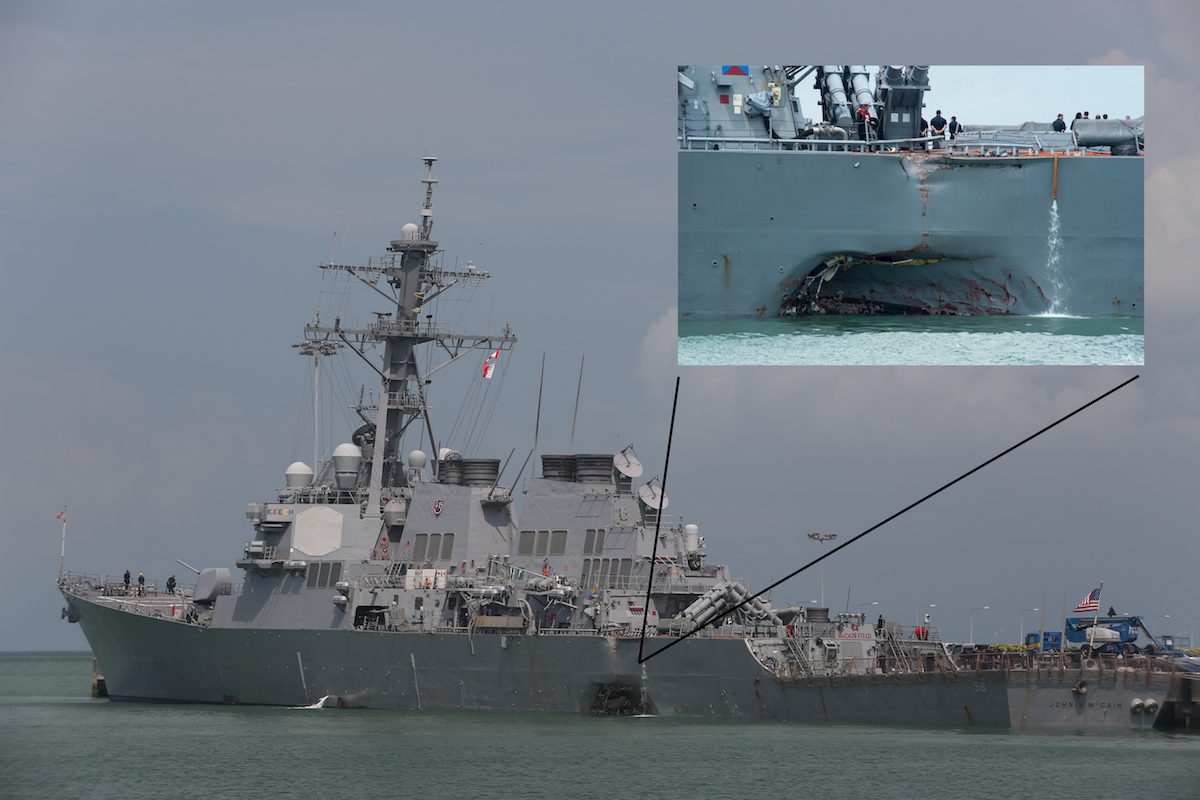
      The bridge of each Navy destroyer is controlled by a round-the-clock shift of young officers, who must pass written and oral exams to qualify for the positions. Still, they typically are under 25 and may have little shipboard experience. Junior officers also move on to other assignments after limited tours.

      Are we shortchanging their basic training, especially as we rotate our junior officers every 18 to 24 months?” asked Admiral Crowder.

      Training for junior ship officers has changed significantly in recent years. In 2003, the Navy dropped what had been an intensive six-month training course on navigation, basic seamanship, engineering and maintenance before new officers were assigned to their first ship.

      Instead, the new officers were sent directly to a ship where they were supposed to learn on the job. Some said they got practical training on deployments, and noted that the Seventh Fleet had a reputation as being the most experienced in the Navy. But, many commanders said, crews were too busy to provide that kind of instruction.

      By last year, the Navy had largely reversed course, sandwiching a junior officer’s first sea tour between 14 weeks of classroom work.
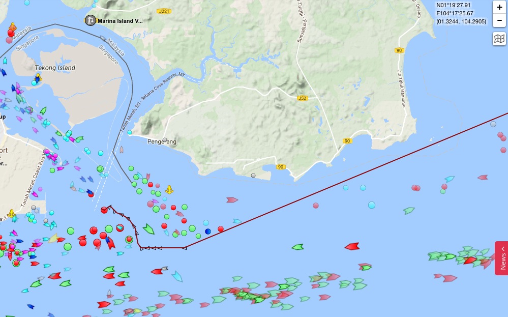
      […]
      Most ships use a traditional “five and dime” watch rotation, in which sailors serve five hours of watch, then have 10 hours off, he said. But during those 10 hours, sailors often have daytime duties.

      The rotation can lead to a watch officer pulling a 20-hour day every three days, Mr. Cordle said, adding that even designated sleep time can be interrupted by drills or refueling operations that can keep sailors up for days at a time. A recent Government Accountability Office report said sailors were on duty up to 108 hours each week.

      I averaged 3 hours of sleep a night,” someone described as a Japan-based Navy officer wrote on Reddit last week. “I have personally gone without sleep for so long that I have seen and heard things that weren’t there. I’ve witnessed accidents that could have been avoided because the person was so tired they had no right to be operating heavy machinery.

      Navy tests of sailors on the five-and-dime schedule found lack of sleep led to blunted decision-making and reflexes that were roughly the same as those of sailors who had downed several beers.

      The Naval Postgraduate School has developed a shorter watch schedule to match circadian rhythms, which uses three hours of watch duty and nine hours off. Recognizing the benefits, submarines were ordered to move to a similar schedule in 2015.

      Mr. Cordle said adopting the schedule could result in greater safety. But the Navy has left scheduling up to individual captains, and three quarters of ships still use the five and dime.

    • Ship Collisions : Address the Underlying Causes, Including Culture | U.S. Naval Institute
      https://www.usni.org/magazines/proceedings/2017-08/ship-collisions-address-underlying-causes-including-culture

      Un think tank naval, grosse institution privée (estd 1873…), entre dans la danse (après plusieurs autres dont gCaptain). Dans le collimateur :
      • l’organisation des tours de quart
      • la non-spécialisation des officiers entre pont et machine
      • la (non-)formation au quart
      (j’ai lu sur un blog que, sur les navires modernes de la Navy (classe Ticonderoga !), il n’y aurait plus de table à carte en passerelle (support traditionnel du point à la main) mais uniquement de l’électronique…, à confirmer)

      In the wake of the USS Fitzgerald (DDG-62) and USS John S. McCain (DDG-56) collisions, the Navy is conducting investigations, relieving commanding officers, conducting safety stand downs (operational pauses), and retraining. This is a similar response to past mishaps, but this time the Navy must include true root cause analysis . Analysis after mishaps invariably uncovers human error and training deficiencies as causal factors. Some people get fired and others retrained. The Navy has begun to dig deeper with the CNO’s mandate for a fleet-wide investigation last week. I predict some of the findings of root causes will include the Navy’s approach to training and career development, surface warfare officer (SWO) culture, and high operational tempo (OpTempo) driving mission over people. 

      When a junior officer (JO) reports to a warship, he or she immediately has three jobs: standing watch under instruction, running a division, and earning qualifications (first as an officer of the deck and then as a SWO). Once qualified to be a watchstander, a JO is on the watch bill and expected to train the next batch of JOs. Depending on the number of qualified watchstanders on board, the watch rotation varies: “port and starboard” (6 hours on watch and 6 hours off); “five and dime” (5 hours on and 10 hours off watch, rotating); three or four section “chow to chow” rotating (based around mealtimes); “3 on/9 off” or “4 on/8 off” with two watches per day that do not change for a given underway. The “off” time is when a JO can accomplish day work, run the division, and work on qualifications—along with a little sleep and maybe squeeze in a run on the treadmill.
      […]
      The U.S. Navy appears to be the only maritime organization in the world that does not have dedicated watchstanders and separate dedicated professional tracks for deck and engineering.
      […]
      Another root cause likely will be the alertness level of those watchstanders. Watch rotations vary greatly in the fleet, partly because of the variability in the number of qualified watchstanders and partly because of SWO culture. Many COs will direct the watches be run the way he or she experienced as a JO. The vast majority of Navy ships still use rotating watches, which is completely against human circadian rhythms. With rotating watches, everyone sleeps when they are off watch because they are in a constant state of exhaustion. Myriad sleep deprivation studies have proven that lack of sleep is cumulative. You can’t “catch up” on sleep, and decision-making is impaired just like being under the influence of alcohol or drugs. Yet the Navy has not addressed watch rotations to maximize crew rest. Instead, it perpetuates a culture where lack of sleep is a rite of passage, and the main risk assessment tool does not account for crew rest.

    • Singapore-led safety investigation underway into USS John S McCain collision - Channel NewsAsia
      http://www.channelnewsasia.com/news/singapore/singapore-led-safety-investigation-underway-into-uss-john-s-9174198

      The Singapore Transport Safety Investigation Bureau (TSIB) launched a marine safety investigation following the collision of the USS John S McCain and Liberian-flagged oil tanker Alnic MC on Aug 21. 

      A TSIB spokesperson said on Thursday (Aug 31) that the investigation was launched immediately after the collision, and the probe was being conducted in accordance with the International Maritime Organization’s Casualty Investigation Code in Singapore’s capacity as a coastal state.

      The US Coast Guard, on behalf of the US National Transportation Safety Board, and the Liberian Maritime Administration are participating in Singapore’s safety investigation as Substantially Interested States,” the spokesperson said. 

      To date, investigators have interviewed the crew members of the Alnic, while TSIB has been coordinating with the US Coast Guard to gather relevant information on the US guided-missile destroyer, including statements of account from its crew. 

      TISB has also obtained shipboard data from the Alnic and other ships in the vicinity at the time of the collision to support the Singapore-led safety investigation, the spokesperson said.

      Si on lit entre les lignes, il semblerait que le TSIB rende public l’ouverture de leur enquête (avec 10 jours de retard) pour faire pression sur la Navy qui, à son habitude, ne semble pas particulièrement coopérative…

      Clairement, il n’est pas prévu qu’ils aient accès directement aux témoignages des marins du McCain

    • U.S. Navy to Haul Damaged Destroyer John S. McCain to Japan for Damage Assessment – gCaptain
      http://gcaptain.com/u-s-navy-to-haul-damaged-destroyer-john-s-mccain-to-japan-for-damage-asses

      The U.S. Navy is planning to haul the damaged guided missile destroyer USS John S. McCain to its ship repair facility in Yokosuka, Japan where damage assessments will continue to take place.

      The Navy said Tuesday it intends to issue a task order on an existing contract, for the salvage patching and transport via heavy lift of USS John S McCain (DDG 56) from Changi Naval Base in Singapore to the U.S. Navy’s Ship Repair Facility-Japan Regional Maintenance Center in Yokosuka, Japan. The Navy did not specify which existing contract it was referring to.

    • Une hypothèse circule depuis quelques jours : l’USS John S McCain aurait été en train de doubler l’Alnic NC, suffisamment près (ie beaucoup trop près…) pour que, vers la fin du dépassement, la perturbation hydrodynamique due à la vague d’étrave de l’Alnic vienne perturber le safran du McCain, provoquant une embardée à gauche, voire mettant en panne l’appareil à gouverner.
      http://forum.gcaptain.com/t/uss-j-mccain-alnic-mc-collision-near-singapore/45819/327

    • Un peu de ménage…
      Pour l’instant, l’état-major du destroyer n’a pas été touché.

      Admiral, Captain Removed in Ongoing Investigations into USS John S. McCain, USS Fitzgerald Collisions
      https://news.usni.org/2017/09/18/admiral-captain-removed-part-investigation-uss-john-s-mccain-uss-fitzgera

      The commander of the Navy’s largest operational battle force and his subordinate in charge of the attached destroyer squadron have been removed from their positions as a result of ongoing investigations into a string of incidents this year that resulted in the death of 17 sailors and hundreds of millions of dollars in damages, USNI News has learned.

      U.S. 7th Fleet Commander Vice Adm. Philip Sawyer removed Rear Adm. Charles Williams, commander of Combined Task Force 70, and Capt. Jeffery Bennett, commodore of Destroyer Squadron 15, from their positions on Monday (Tuesday local time) due to a loss of confidence in their ability to command, two Navy officials told USNI News and later confirmed by a statement from the service.

    • Les réparations auront lieu « localement », à Yokosuka. Localement, parce qu’il faut encore acheminer l’USS John S McCain de Singapour à Yokosuka (transfert prévu dans le courant de ce mois). Contrairement à l’USS Fitzgerald qui lui était à Yokosuka et va être acheminé à Pascagoula dans le Mississippi (probablement en décembre).

      USS John S. McCain to Be Repaired in Japan – gCaptain
      http://gcaptain.com/uss-john-s-mccain-to-be-repaired-in-japan

      The U.S. Navy will repair the guided-missile destroyer USS John S. McCain (DDG 56) at the U.S. Naval Ship Repair Facility-Japan Regional Maintenance Center in Yokosuka, Japan.

      Repairs will begin upon arrival from Singapore aboard a heavy lift vessel in October, the Navy said.

      Accessoirement, on profitera de l’immobilisation pour faire un peu de remise à niveau :

      In addition to supporting repairs, the McCain’s crew will focus on training, readiness, and certifications to prepare the ship for its return to the Seventh Fleet, according to the Navy.
      […]
      On Thursday, the USS John S. McCain departed Changi Naval Base to meet the heavy lift transport vessel MV Treasure, which will transport it to Fleet Activities Yokosuka for repairs.

    • U.S. Navy says deadly McCain collision was #preventable, relieves ship commander
      https://www.reuters.com/article/us-usa-navy-asia/u-s-navy-says-deadly-mccain-collision-was-preventable-relieves-ship-command

      The commanding officer exercised poor judgment, and the executive officer exercised poor leadership of the ship’s training program,” the USS Seventh Fleet said in a statement released in Japan on Wednesday.
      […]
      The McCain’s captain, Commander A. Sanchez, and his executive officer, Commander J. Sanchez, were reassigned to other duties in Japan, where the Seventh Fleet is headquartered, the Navy said.

      On attend le rapport préliminaire d’enquête…

  • Agro-hackeurs du Nebraska
    http://www.lemonde.fr/pixels/visuel/2017/08/08/agro-hackeurs-du-nebraska_5170156_4408996.html

    Ceresco, sud-est du Nebraska, au cœur d’une région agricole vallonnée et verdoyante. Kyle Schwarting, un agriculteur de 36 ans, marié, trois enfants, vit dans une ferme isolée qu’il est en train d’agrandir, et d’équiper de panneaux solaires. Il ne possède pas de terres, mais il exploite à lui seul plus de 800 hectares, qu’il loue à des propriétaires. Il a acheté d’occasion un gros tracteur de marque Case-IH, ainsi qu’une moissonneuse-batteuse et un semoir de marque John Deere. Comme beaucoup de fermiers, (...)

    #algorithme #GPS #copyright #hacking #Apple #JohnDeere

  • Les trajets nocturnes des chats cartographiés grâce à la technologie #GPS !

    Réduire les chats à leur prédisposition à manger et dormir abondamment est une grossière erreur ! Les chats sont capables de couvrir de larges distances pendant la #nuit, un fait démontré par une étude australienne. Si le chien est le meilleur ami de l’homme, le chat est alors le plus grand explorateur !


    http://sciencepost.fr/2016/06/trajets-nocturnes-chats-cartographies-grace-a-technologie-gps
    #cartographie #visualisation #chats #trajets

  • Big Brother s’immisce dans nos voitures, s’inquiète le commissaire à la vie privée
    http://www.journaldemontreal.com/2017/03/28/big-brother-simmisce-dans-nos-voitures-sinquiete-le-commissaire-a

    Big Brother s’immisce peu à peu dans nos voitures et Ottawa a la responsabilité de lui barrer la route en protégeant les données personnelles des Canadiens friands de nouvelles technologies. C’est ce qu’a soutenu, mardi, le Commissaire à la protection de la vie privée, Daniel Therrien, en marge de son témoignage devant le Comité sénatorial des transports et des communications. « Un des risques importants c’est que différents partis - des compagnies, des ministères, des corps policiers - vont pouvoir (...)

    #GPS #automobilistes #surveillance #géolocalisation

  • Chine : la police impose le GPS à des fins de surveillance
    http://www.lesoir.be/1444924/article/actualite/fil-info/fil-info-monde/2017-02-21/chine-police-impose-gps-des-fins-surveillance

    La police chinoise a ordonné à tous les véhicules de porter un système de type GPS afin de surveiller leurs déplacements dans une vaste partie du Xinjiang, une région marquée par des tensions entre les Han (l’ethnie majoritaire en Chine) et les Ouïghours musulmans. Les automobilistes doivent installer le système chinois de navigation satellitaire Beidou « afin de prévenir les vols mais aussi en priorité pour maintenir la stabilité », a déclaré ce jour à l’AFP un responsable de la police des transports (...)

    #GPS #géolocalisation #surveillance #automobilistes

  • Smartphones and the Uncertain Future of ’Spatial Thinking’ - CityLab
    http://www.citylab.com/tech/2014/09/smartphones-and-the-uncertain-future-of-spatial-thinking/379796

    Your brain is indeed relaxing. In a handful of studies conducted over the last decade in the United States, England, Germany and Japan, researchers have shown that GPS navigation has a generally pernicious effect on the user’s ability to remember an environment and reconstruct a route.

    #GPS #devenir_idiot #cartographie_mentale
    #Spatial_Thinking #pensée_spatiale

  • Top départ pour galileo, le service de GPS européen
    http://www.sciencesetavenir.fr/high-tech/transports/galileo-mise-en-service-du-gps-europeen-jeudi-15-decembre-2016_1089

    C’est ce jeudi 15 décembre que le service de #GPS européen #Galileo entre officiellement en service. « Galileo va améliorer par 10 la précision de la #géolocalisation » s’enthousiasme Maroš Šefčovič, vice président de la commission européenne dans un communiqué. [...] [D]ans un premier temps, le maillage des satellite pâtira de « trous » géographiques qui perdureront jusqu’en 2017, voire 2020, le temps que la constellation complète, couvrant l’ensemble du globe terrestre jusqu’au 75e parallèle, soit opérationnelle. La constellation Galileo comporte en effet pour le moment « seulement » 18 #satellites sur l’objectif de 30 visé d’ici quatre ans. Parallèlement, quelques 20 stations sol ont déjà été réparties autour du globe, une infrastructure qui sera encore renforcée d’ici à 2020. En attendant, pour compenser les lacunes, des accords ont donc a été conclus afin d’assurer une continuité de couverture.

    Ainsi, un appareil de réception pourra recevoir un relevé de position fourni par une combinaison de satellites Galileo et GPS, voire Glonass, la constellation russe.

    [...] Imaginé en 1998, Galileo a pour objectif d’affranchir l’Europe du système GPS américain, tout en fournissant un service plus précis (de l’ordre du mètre et non plus de la dizaine de mètres). Le système Galileo est sous la houlette de trois acteurs : la Commission européenne qui décide et supervise, l’ESA qui assure la phase de construction, et le GSA (agence de navigation par satellite européenne) basée à Prague, qui est chargée d’exploiter le système.

    Ariane 5 a battu un record le mois dernier avec son 75e lancement réussi d’affilé en mettant en orbite les satellites 15 à 18. #espace

  • Company town + Internet of Things + Drones = total surveillance of remote mine workers
    http://boingboing.net/2016/12/09/company-town-internet-of-thi.html

    Rio Tinto is a giant UK/Australian mining corporation that operates many facilities in Australia’s remotest reaches, where there is no housing for workers, so the company ends up building “company towns” where their laborers live, closing the loop between home and worklife, and putting them both under control of a corporation ; now the company is flirting with the kind of “smart city” technology that has been tried elsewhere, but generally in places where the residents are citizens, not (...)

    #Rio_Tinto #Sodexo #capteur #drone #géolocalisation #travail #surveillance (...)

    ##GPS

  • Waze accusé de protéger la vie des Israéliens bien mieux que les Palestiniens
    http://www.numerama.com/politique/199525-waze-accuse-de-proteger-la-vie-des-israeliens-bien-mieux-que-les-pa

    Créée en Israël et rachetée par Google en 2013, l’application Waze offre depuis l’an dernier la possibilité d’éviter les « zones dangereuses » de Cisjordanie. Mais les Palestiniens reprochent à Waze de n’y mettre que les zones palestiniennes dangereuses pour les Israéliens, et pas les colonies israéliennes dangereuses pour les Palestiniens. Ou quand l’algorithme d’un GPS devient une question de vie ou de mort. Créer une application de cartographie, c’est parfois devoir plonger dans des conflits (...)

    #Google #Waze #GPS #géolocalisation #discrimination

  • Waze Lets Israelis Avoid Palestinian Areas, but Not the Other Way Around
    http://motherboard.vice.com/read/waze-lets-jewish-israelis-avoid-palestinian-areas-but-not-the-othe

    Jennifer Attallah was using the navigation app Waze to drive from the Palestinian city of Ramallah to West Jerusalem on a recent evening when she noticed the landscape becoming sparser. On the top of several hills were small settlement outposts. She passed a procession of 15 to 20 people, clad all in white, walking by the side of the road. Surely this was not the right way. Attallah, 36, turned on Maps.me, a map app that works offline, and saw that she was not approaching Jerusalem, but (...)

    #Google #Waze #GPS #géolocalisation #discrimination

  • Orange condamné pour surveillance de salariés
    http://www.clubic.com/pro/entreprises/orange-france-telecom/actualite-817691-orange-condamne-surveillance-salaries.html

    Pour avoir placé un boîtier mouchard sur 20 000 de ses véhicules, Orange a été condamné à les retirer. Le syndicat SUD, à l’origine de la plainte, a dénoncé une surveillance disproportionnée. Orange a été condamné par la cour d’appel de Paris à retirer les boîtiers électroniques placés sur 20 000 de ses véhicules d’entreprise, sous peine de devoir verser 2 000 euros d’astreinte par jour de retard, rapporte l’AFP, se basant sur une source syndicale. L’opérateur avait décidé d’un tel équipement entre 2010 et 2012 (...)

    #Orange #GPS #géolocalisation #surveillance

  • Niantic is now permanently banning #Pokémon_Go cheaters | The Verge
    http://www.theverge.com/2016/8/12/12461136/pokemon-go-niantic-permanent-game-ban-cheating-bots

    Game maker Niantic, the developer behind mobile sensation Pokémon Go, is now issuing permanent bans to players who violate its terms of service. Though TOS violations vary, these bans appear to be directed at cheaters who rely on #GPS_spoofing, bots, and other software techniques that allow Pokémon Go to be played beyond the realm of Niantic’s design parameters. For instance, GPS spoofing lets you trick a smartphone into thinking you’re located in a different country, allowing you to catch pokémon that may be more easily located in that area or restricted to certain regions. Bots, on the other hand, let you automate portions of the game.
    […]
    It’s still unclear how Niantic is going about detecting the use of GPS spoofing, emulators, bots, and other hacks. A number of threads on Reddit’s Pokémon Go developer community, where much of the discussion around these techniques takes place, have popped up in the last two days. It seems users cannot seem to lock down what exactly results in a ban and how Niantic’s internal systems may be seeking out #cheating behavior.

    Ou comment favoriser le développement de compétences qui pourront être utiles ultérieurement…

  • MyGPSFiles
    http://www.mygpsfiles.com/app

    Un lecteur de traces #GPS en ligne complet :
    – import de fichiers #GPX
    – profil d’altitude synchronisé avec le parcours sur la carte
    – visualisation sur #IGN 25 000ème
    – possibilité de superposition de plusieurs traces
    – affichage plein écran
    – outils d’édition de traces super pratiques (en particulier le suivi de traces existantes) : voir http://www.mygpsfiles.com/fr/#featuresEdit
    – partage par lien temporaire avec possibilité de cibler une trace ou un point
    – interface conviviale avec choix et dimensionnement des fenètres
    Bref, à peu près tout ce qu’offrait #visuGPX avant de passer en version payante... et plus encore !

    #webapp #trace #vtt

  • Un salarié peut-il refuser d’être géolocalisé ?
    http://rue89.nouvelobs.com/2016/08/01/salarie-peut-refuser-detre-geolocalise-264695

    En 2015, 125 plaintes adressées à la Commission nationale de l’informatique et des libertés (Cnil) concernaient la géolocalisation. Un employeur peut-il installer un dispositif de géolocalisation sur la voiture d’un employé ? Ce dernier peut-il le refuser ? Au cours de l’année 2015, 6 852 dispositifs de géolocalisation ont été déclarés à la Cnil (Commission nationale de l’informatique et des libertés), principalement dans le secteur du transport et de la livraison. Un chiffre en augmentation. En (...)

    #GPS #géolocalisation #CNIL #surveillance

  • Recent imagery in Calais France for Mapfugees
    https://www.mapbox.com/blog/mapfugees

    Mapfugees
    https://mapfugees.wordpress.com

    L’équipe cherche à dresser une carte du camp de réfugiés de Grande-Synthe (proche de Dunkerque), nouvellement installé par Médecins sans frontières. La tâche n’est pas simple d’autant que nous partons de zéro : le camp était, il y a encore quelques semaines, une simple friche, les images satellites ne sont d’aucune utilité. Les résidents du camp participent au travail de cartographie, c’est une condition essentielle à la tenue du projet. Nous rassemblons rapidement le matériel, quelques ordinateurs, des clés 3G, des GPS, des chargeurs, des batteries et une montagne de Field Papers vierges ou déjà annotés.


    #mapbox #cartographie_participative #cartographie_humanitaire #réfugiés #france (#honte_nationale aussi en ce 14 juillet)

    • Connected Refugees

      Je retrouve l’équipe de MapFugees : Katja, Jorieke et Johan. Ils sont là depuis une semaine déjà, éprouvés mais toujours aussi motivés. D’autres m’ont précédé, d’autres nous succéderons. L’équipe cherche à dresser une carte du camp de réfugiés de Grande-Synthe (proche de Dunkerque), nouvellement installé par Médecins sans frontières. La tâche n’est pas simple d’autant que nous partons de zéro : le camp était, il y a encore quelques semaines, une simple friche, les images satellites ne sont d’aucune utilité. Les résidents du camp participent au travail de cartographie, c’est une condition essentielle à la tenue du projet. Nous rassemblons rapidement le matériel, quelques ordinateurs, des clés 3G, des #GPS, des chargeurs, des batteries et une montagne de Field Papers vierges ou déjà annotés. Le territoire occupé par le camp a été préalablement divisé en portions égales, imprimées sur papier en autant de Field Papers qui serviront de support à la récolte d’informations sur place. Chaque Field Paper est unique et porte la marque du binôme qui l’a édité : réfugié + bénévole + numéro du GPS + date, permettant de tracer et de suivre l’évolution du processus de cartographie de chaque zone.


      https://mapfugees.wordpress.com/2016/04/29/connected-refugees-2
      #OSM #open_street_map #smartphone #Calais #Grande-Synthe #campement
      cc @louca @shenriod