


Afternoon Map : Plane Routes
▻http://www.midafternoonmap.com/2013/02/plane-routes.html
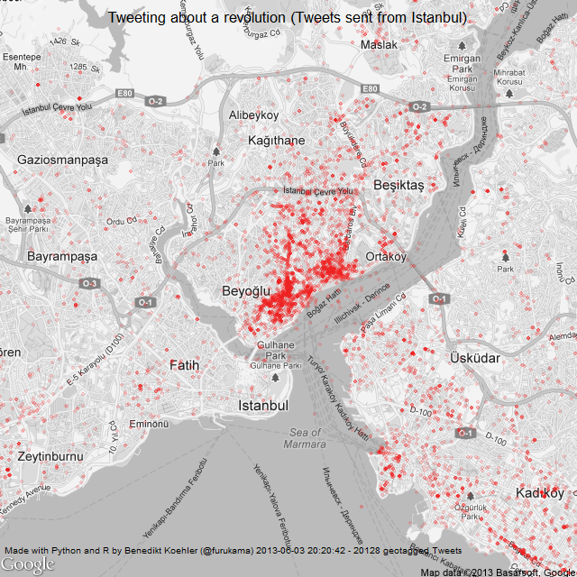
Je suis tombé par hasard sur un blog de cartographie turque, fort intéressant. Ci dessous, en écho à une série de posts de @reka (notamment ►http://seenthis.net/messages/112847), une carte des premières routes aériennes à partir de la Turquie (encore en graphie arabe...). Mais on trouve aussi sur ce blog de très intéressantes des mobilisations de Taksim #OccupyGezi
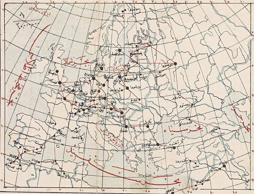
Following up on all our earlier maps on train routes, it’s strange to remember that at one point planes had routes too. They still do, of course, but now the actual flight path seems a little beside the point. In-flight magazine maps show all those looping lines connecting cities with no regard for how the plane actually travels between them. The precise paths of an earlier era are now mostly familiar to us from Indiana Jones movies. Among other things, this map, from an early Republican atlas, also shows some continuing trouble with US geography. They seem to have first placed Chicago somewhere in Nebraska before relocating it and renaming that town Omaha. Other transliterations include Detruvat (MI), Harlston (SC) and Key Vest, on the way to Havana.
Les tweets autour de Taksim
#cartographie

