


The data that underlies Google Earth Engine is not accessible to everybody, but the Landsat data is available to anyone who creates a free account with Earth Explorer ▻http://earthexplorer.usgs.gov . It is not that difficult (but fairly time consuming) to download a set of images and create animations like this:
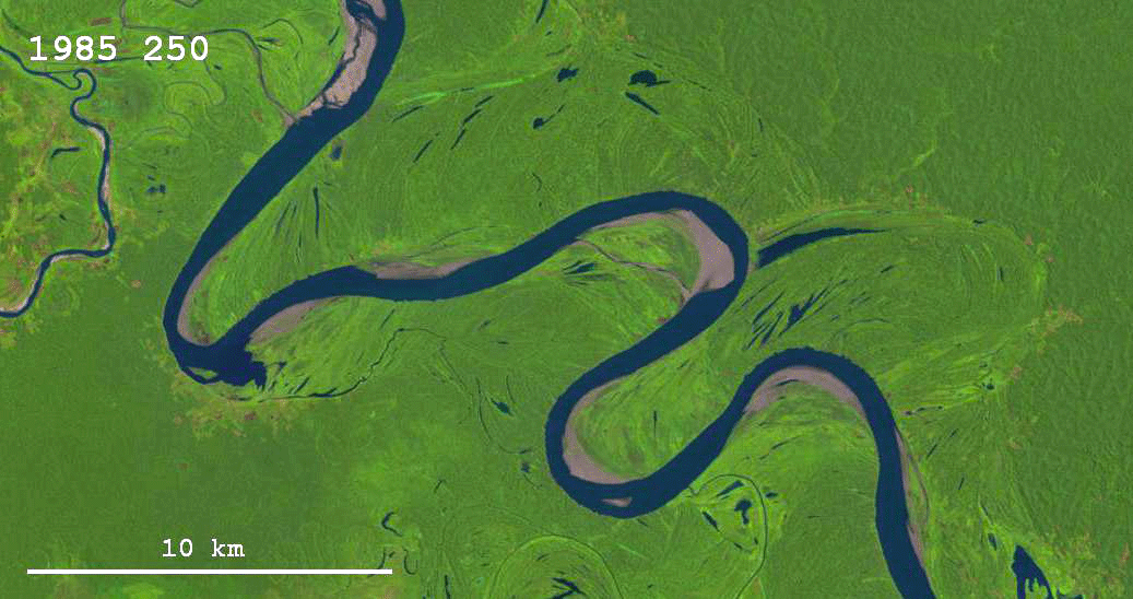
This scene also comes from the Ucayali River (you can view it in Google Earth Engine over ▻https://earthengine.google.org/#timelapse/v=-7.24496,-75.17632,10.567,latLng&t=1.03 ) and it is a nice example of how both neck cutoffs and chute cutoffs form.
▻https://hinderedsettling.com/2014/03/16/rivers-through-time-as-seen-in-landsat-images
#map


