


Atlas for the End of the World
▻http://atlas-for-the-end-of-the-world.com
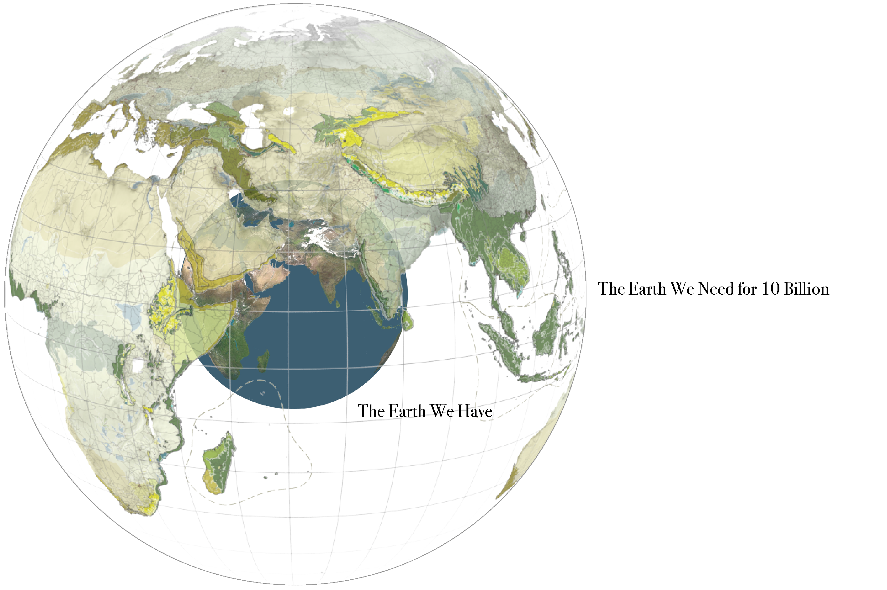
Coming almost 450 years after the world’s first Atlas, this Atlas for the End of the World audits the status of land use and urbanization in the most critically endangered bioregions on Earth. It does so, firstly, by measuring the quantity of protected area across the world’s 36 biodiversity hotspots in comparison to United Nation’s 2020 targets; and secondly, by identifying where future urban growth in these territories is on a collision course with endangered species.
By bringing urbanization and conservation together in the same study, the essays, maps, data, and artwork in this Atlas lay essential groundwork for the future planning and design of hotspot cities and regions as interdependent ecological and economic systems.
Première entrée
On May 20, 1570, Abraham Ortelius, book collector and engraver from Antwerp, published the Theatrum Orbis Terrarum (Epitome of the Theater of the World), the world’s first modern atlas.2 It laid bare a world of healthy ecoregions, ripe for colonization and exploitation. Some 450 years later this Atlas for the End of the World is a survey of what’s left.

#atlas #fin_du_monde #anthropocène #cartographie


