Models of Geo-Information Science and Remote Sensing: HILDA - WUR
▻https://www.wur.nl/en/Research-Results/Chair-groups/Environmental-Sciences/Laboratory-of-Geo-information-Science-and-Remote-Sensing/Models/Hilda.htm

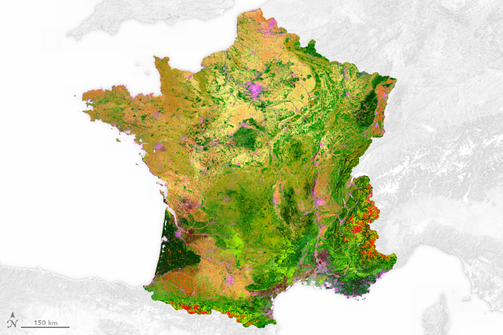
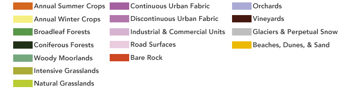
The HIstoric Land Dynamics Assessment (HILDA) is a new concept for the reconstruction of historic land cover/use and its changes.
HILDA combines multiple harmonized and consistent data streams of historic land cover information in one approach, like remote sensing products, national inventories, aerial photographs, land cover statistics, old encyclopaedias and historic land cover maps.