Using Satellite Analysis to Monitor Humanitarian Access | UNITAR
▻http://www.unitar.org/using-satellite-analysis-monitor-humanitarian-access
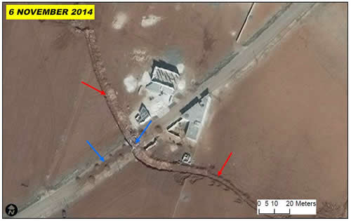
The UNOSAT rapid mapping service has produced hundreds of maps over Syria and neighbouring countries affected by the crisis since 2012, when humanitarian agencies started to plan relief operations for the rapidly increasing population of civilians displaced by the mounting violence. Since then UNHCR has used UNOSAT analysis regularly for refugee camp monitoring, for example. UNOSAT uses satellite imagery to assess camps’ growth and pinpoint the location of spontaneous settlements erected by internally displaced persons.