Interactive Time-Lapse Map Shows How the U.S. Took More Than 1.5 Billion Acres From Native Americans
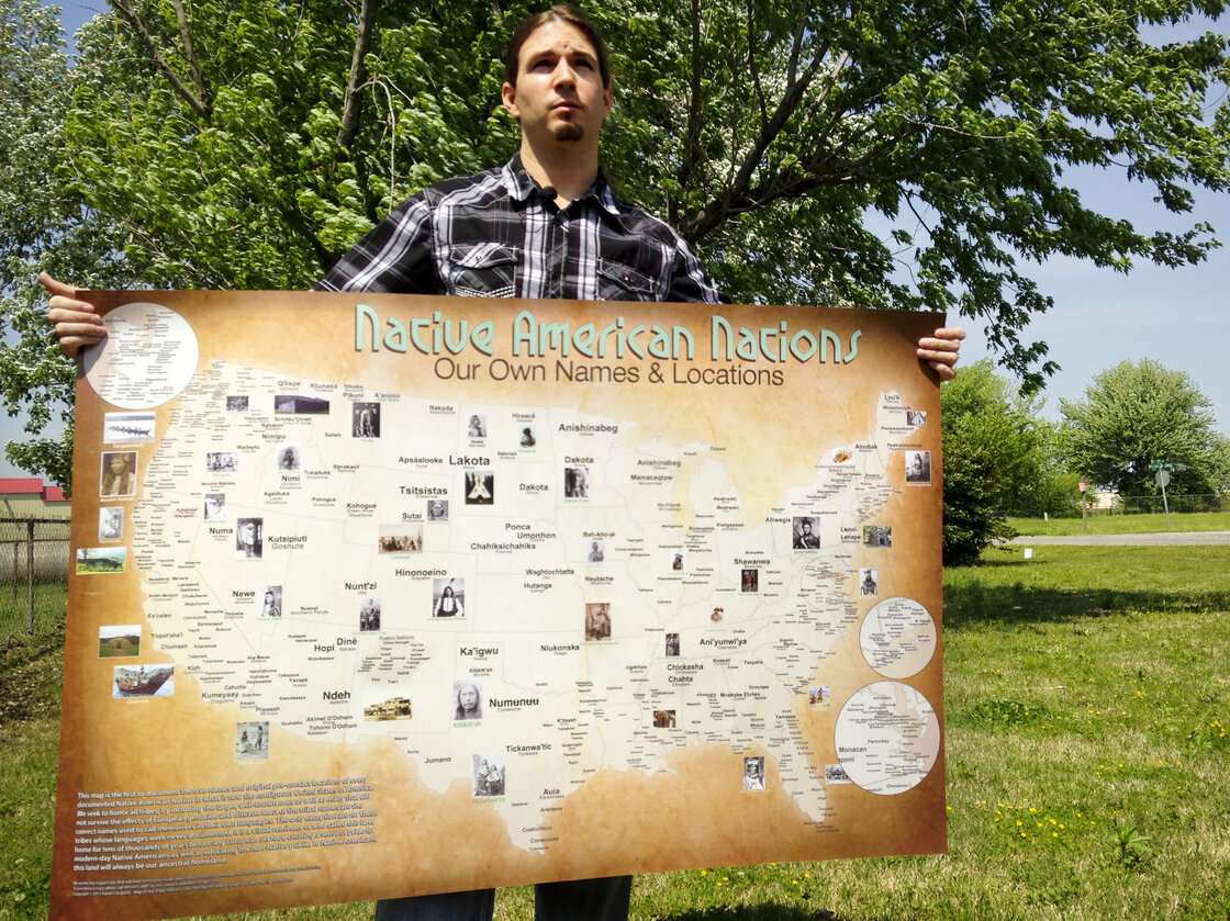
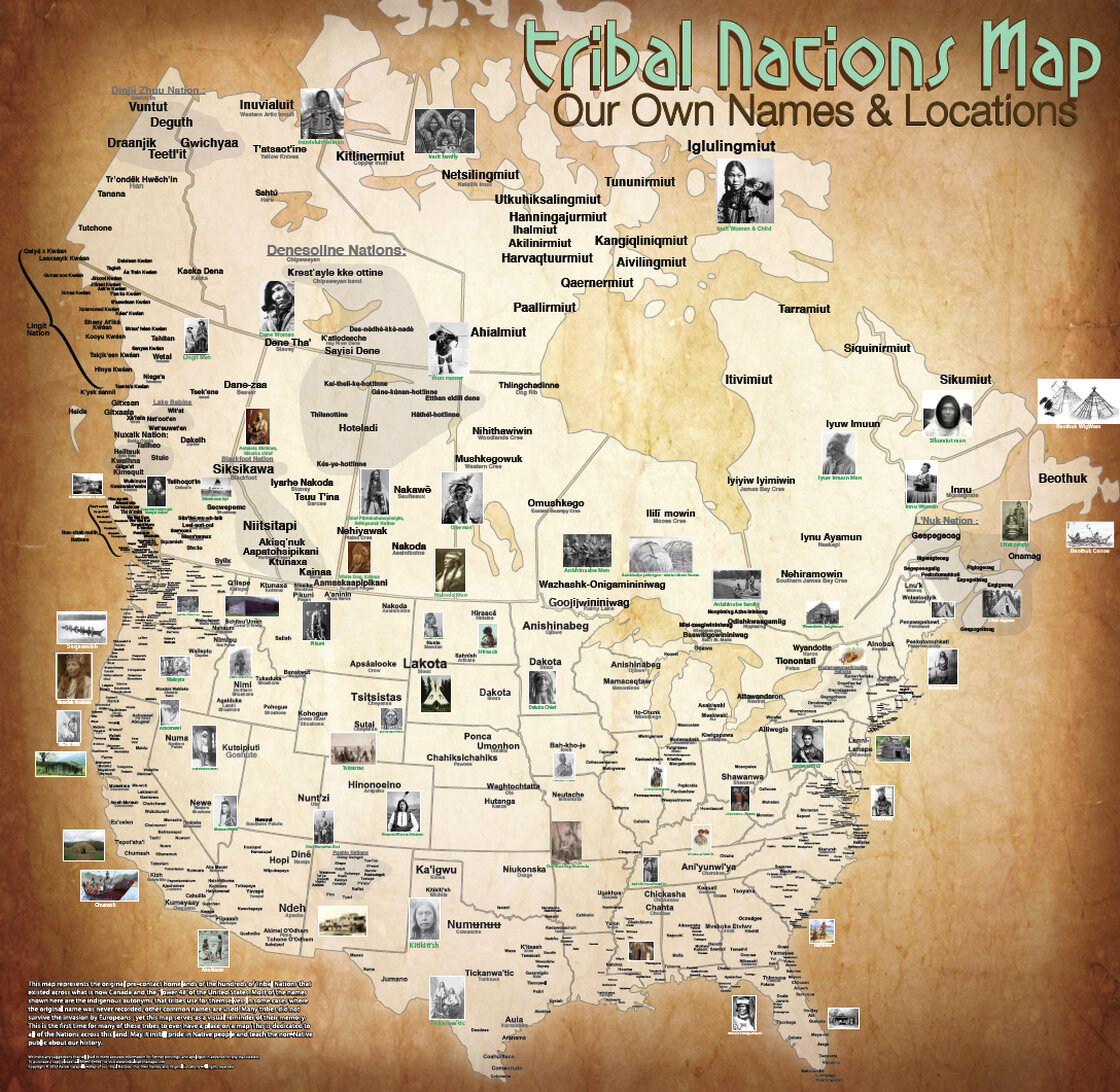
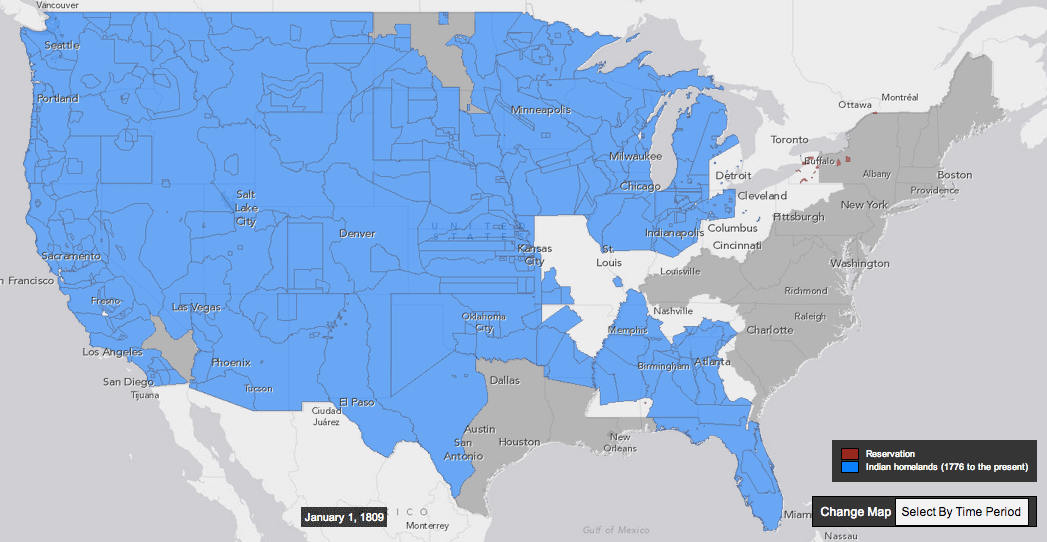
This interactive map, produced by University of Georgia historian #Claudio_Saunt to accompany his new book West of the Revolution: An Uncommon History of 1776, offers a time-lapse vision of the transfer of Indian land between 1776 and 1887. As blue “Indian homelands” disappear, small red areas appear, indicating the establishment of reservations. (Above is a GIF of the map’s time-lapse display; visit the map’s page to play with its features.)
▻http://www.slate.com/blogs/the_vault/2014/06/17/interactive_map_loss_of_indian_land.html?wpsrc=sh_all_dt_tw_top
#carte #cartographie #carte_interactive #timeline #USA #Etats-Unis #visualisation #peuples_autochtones #terres #réserves