• Atlas for the Blind, 1837 | Rumsey | Cartographic Perspectives

    http://cartographicperspectives.org/index.php/journal/article/view/cp80-rumsey/1416

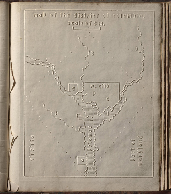
    Samuel Gridley Howe (1801–1876) was the founder and president of the New England Institute (later known as the Perkins Institute) and produced the atlas with the assistance of John C. Cray and Samuel P. Ruggles. Howe was the husband of Julia Ward Howe, the American abolitionist and author of the US Civil War song “The Battle Hymn of the Republic.” He was a champion of people with disabilities and believed that blind youth could be taught geography through maps created with his special paper embossing process. In his introduction to the atlas, Howe notes that crude attempts had been made to create maps for the blind, but they used primitive methods of creating relief and required the assistance of a sighted person. He claimed that his new embossing method was superior in all respects. Today, it is difficult to know how successful the atlas was, although there can be little doubt that these maps helped Howe’s blind students visualize geography. We do know that 50 copies were made and five survive today, including one available in the David Rumsey online map collection. The atlas includes 24 state maps with a page of text describing each state and the symbols used on the maps. In our scans, we have lit the maps and text pages from one side to create shadows that reveal the embossing.

    #cartographie #atlas #aveugles #atlas_pour_aveugles

  • Interview with a Celebrity Cartographer : Dr. Barbara (babs) Buttenfield | Stauffer | Cartographic Perspectives

    http://cartographicperspectives.org/index.php/journal/article/view/cp72-stauffer-buttenfield/320

    Longue interview avec une figure de la carto. Très intéressant surtout pour la démarche et la description d’une certaine approche en carto.

    http://cartographicperspectives.org/index.php/journal/article/viewFile/259/320/1522.jpg

    In previous installments of “Interview with a Celebrity Cartographer,” well established designers have been featured. Yet there are many facets to the field of cartography, and a skilled cartographer requires a working knowledge of all areas to create a memorable design. Cartographers who specialize in a few facets bring unique skills and design tactics to the table when creating a map. To embrace the diversity of knowledge that cartographers need, this interview features someone who specializes in map generalization and the mathematic building blocks behind data processing.

    Dr. Barbara (babs) Buttenfield earned her master of arts in Geography from the University of Kansas in 1979 and her doctorate from the University of Washington in 1984. After professorships at the University of California Santa Barbara, the University of Wisconsin–Madison, and SUNY Buffalo, she is currently a professor at the University of Colorado Boulder, teaching Geographic Information Science (GIS), Computer Cartography, and Information Design and Representation. She is also the Director of the Meridian Lab, a research facility that focuses on visualization and modeling of geographic information. babs’ current research interests focus on cartographic generalization, multi-scale databases, representation of uncertainty, and cartographic information design.

    #cartographie #sémiologie